The Landslide Blog is written by Dave Petley, who is widely recognized as a world leader in the study and management of landslides. In the last few days on November 2025, Cyclone Senyar brought torrential rainfall to parts of Indonesia, and in particular to Sumatra. At the time or writing, at least 1,022 people are […]
hurricanes, typhoons, & cyclones
Posted inThe Landslide Blog
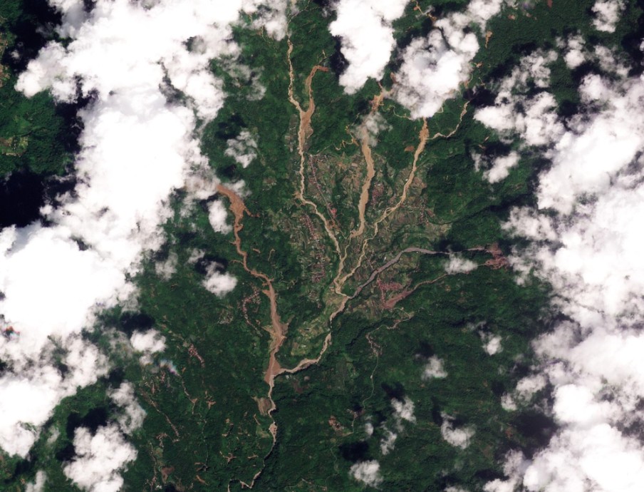
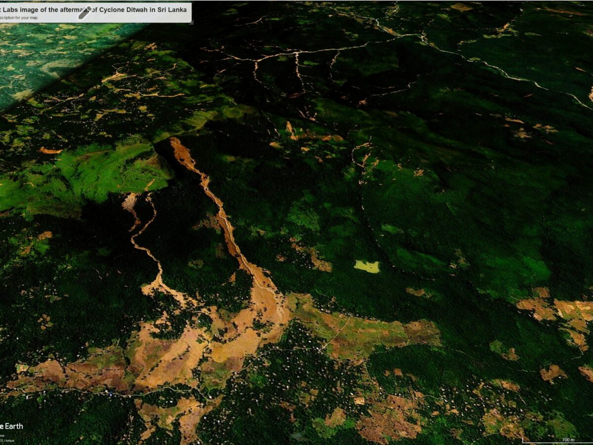
Landslides triggered by Cyclone Ditwah in Sri Lanka
Satellite images are revealing the scale of the destruction in Sri Lanka caused by landslides triggered by Cyclone Ditwah at the end of November 2025. At the end of November 2025, a “weak” tropical cyclone, subsequently named Cyclone Ditwah, formed just offshore from Sri Lanka. Over the following day the storm tracked around the south […]
Posted inThe Landslide Blog
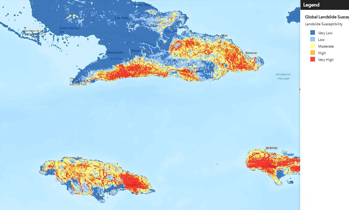
Some useful tools for monitoring the evolution and behaviour of Hurricane Melissa
Various online datasets will allow a detailed understanding of Hurricane Melissa as it impacts Jamaica and then Cuba Hurricane Melissa is now making headlines around the world in anticipation of its landfall today. As always with tropical cyclones, the picture is evolving continuously as the storm evolves. Their behaviour is highly complex. I thought I’d […]
Posted inThe Landslide Blog
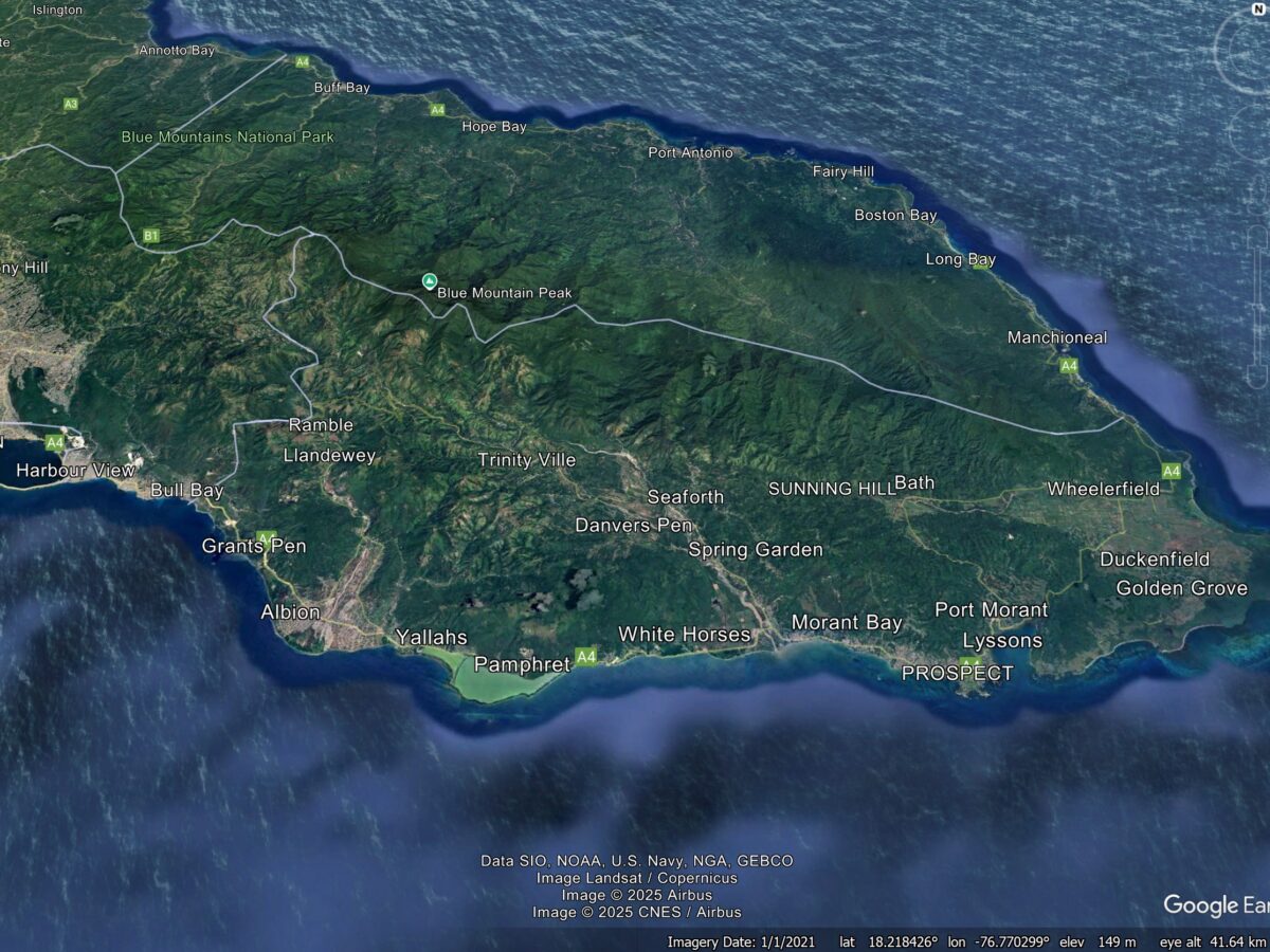
Anticipating the impact of Hurricane Melissa in Jamaica
Hurricane Melissa is bearing down on Jamaica, with many areas likely to see over 500 mm of rainfall. The impacts could be extremely significant. Hurricane Melissa has strengthened substantially over the weekend, and is now on course to track across Jamaica in the next couple of days. Various media agencies have identified the threats that […]

Posted inResearch & Developments
Alaska Awaits Response from FEMA in the Aftermath of Major Floods
Major floods in Alaska have caused the death of at least one person and displaced thousands more over the course of the last two weeks. Many of the displaced may not be able to return home for 18 months or longer, according to Alaska Gov. Mike Dunleavy.
Posted inThe Landslide Blog
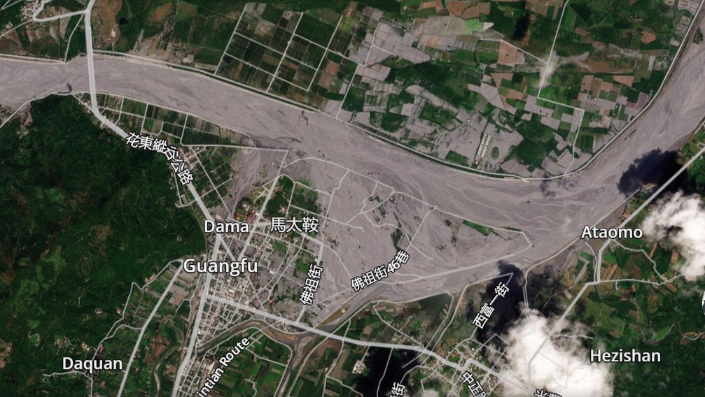
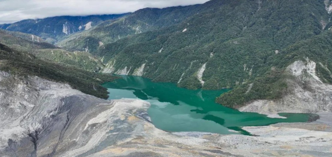
The evolution of the Matai’an landslide dam
Some excellent before and after imagery is now available showing the evolution of the Matai’an landslide dam. The active GIS/spatial analysis community in Taiwan has produced some fascinating analysis of the Matai’an landslide. Much of this has been posted to Facebook (which is not my favourite platform, but sometimes you have to go where the […]
Posted inThe Landslide Blog
The aftermath of the Matai’an landslide in Taiwan
It is likely that the final death toll from the collapse of the Matai’an landslide dam will be 25 people. The dust is literally settling in the aftermath of the breach of the Matai’an landslide dam in Taiwan. The current estimates for the loss are life are 18 fatalities with seven more missing, and a […]

Posted inThe Landslide Blog
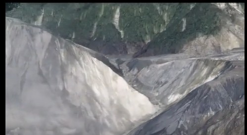
The tragic 23 September 2025 Matai’an landslide dam breach in Taiwan
At least 15 people are known to have been killed by the debris flow and flood from the landslide dam breach that was triggered by typhoon Ragasa. The extremely intense rainfall brought by super typhoon Ragasa triggered the overtopping of the landslide dam at Matai’an in Taiwan on 23 September 2025. This was not a […]
Posted inThe Landslide Blog
Evacuations ordered downstream of the Matai’an landslide dam in Taiwan
Extremely heavy rainfall associated with super typhoon Ragasa could cause the Matai-an landslide dam to overtop in the next two days. In East Asia, super typhoon Ragasa is moving westwards between Taiwan and the Philippines. At the time of writing, Earth Cut TV has a live feed from the Batanes Islands, almost in the path […]

Posted inNews
Cyclones Affect Heart Health for Months After They Subside
In a multicountry study, researchers found that cyclones increase the risk of heart disease–related hospitalizations for up to 6 months.