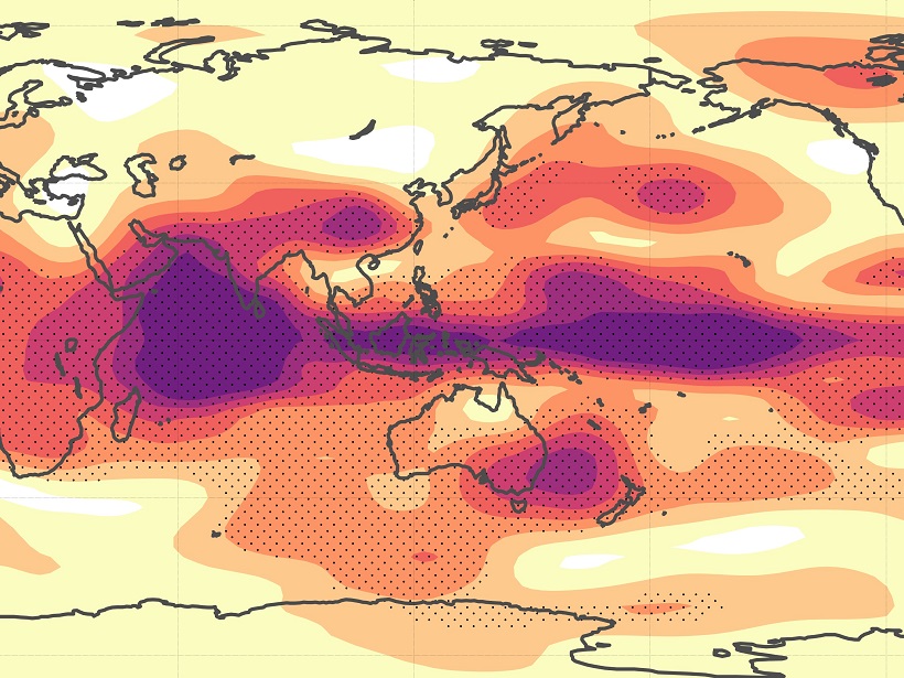
A new index for quantifying regional sensitivities to the influence of periodic events.
data management

Posted inResearch Spotlights
Data Mining Reveals the Dynamics of Auroral Substorms
An analysis of 5 decades of satellite data has pieced together the most comprehensive picture yet of substorms, the magnetic disturbances that cause surges of aurora.
Posted inResearch Spotlights
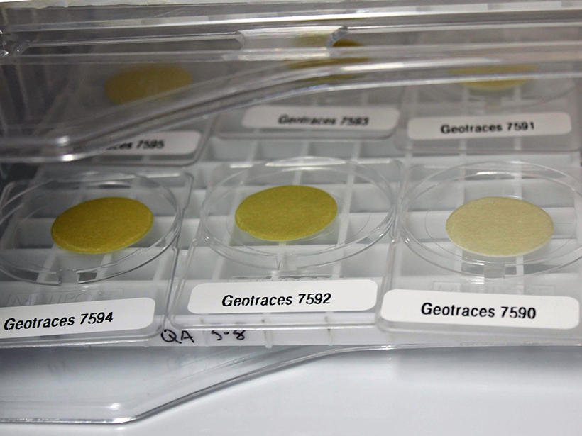
Big Data Help Paint a New Picture of Trace Element Cycling
A new framework for understanding the suite of processes acting on marine particulate trace metals exemplifies how alternative analyses can maximize the information that large data sets provide.
Posted inResearch Spotlights
A Novel Method for Assessing Model Sensitivity
This newly developed approach to assessing the quality of sensitivity analyses can be applied to any method without bootstrapping or additional model runs.
Posted inEditors' Highlights
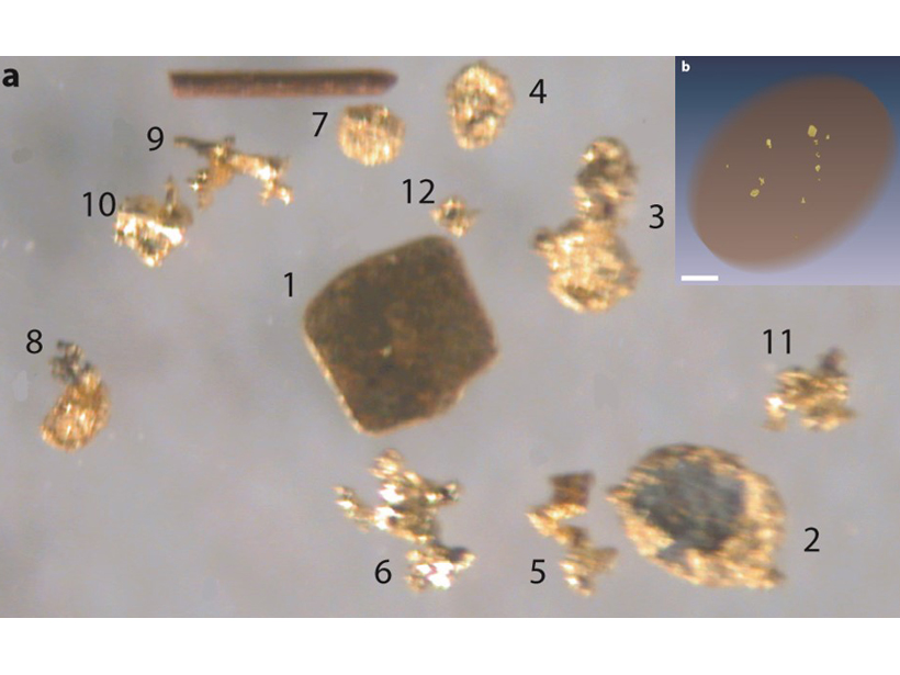
X-Ray Computed Tomography Detects Resolution Scale Gold Grains
A method combining partial-volume and blurring effects can be used to measure small features in computed tomography data volumes.

Posted inScience Updates
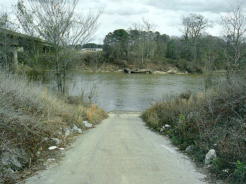
Sharing Data Helps Puerto Ricans Rebound After Hurricane Maria
Recent hurricane seasons left many communities wondering if this is the new normal. Digital infrastructure designed for citizen data collection may help these communities increase resilience.

Posted inScience Updates
Putting the Cloud to Work for Seismology
The cloud infrastructure developed in the business community has made access to cluster computing possible for even the smallest research groups, enabling new kinds of research workflows in geophysics.

Posted inScience Updates
Compiling a Census for SEAFLEAs
Collaboration to Compile Open-Source Sites of Seafloor Fluid Expulsion Anomalies, AGU Fall Meeting 2018; Washington, D.C., 14 December 2018

Posted inScience Updates
Data from Past Eruptions Could Reduce Future Volcano Hazards
Optimizing the Use of Volcano Monitoring Database to Anticipate Unrest; Yogyakarta, Indonesia, 26–29 November 2018

Posted inScience Updates
A Digital Mayfly Swarm Is Emerging
Low-cost, open-source data collectors and a suite of collaborative online tools are making big leaps in the field of watershed monitoring.