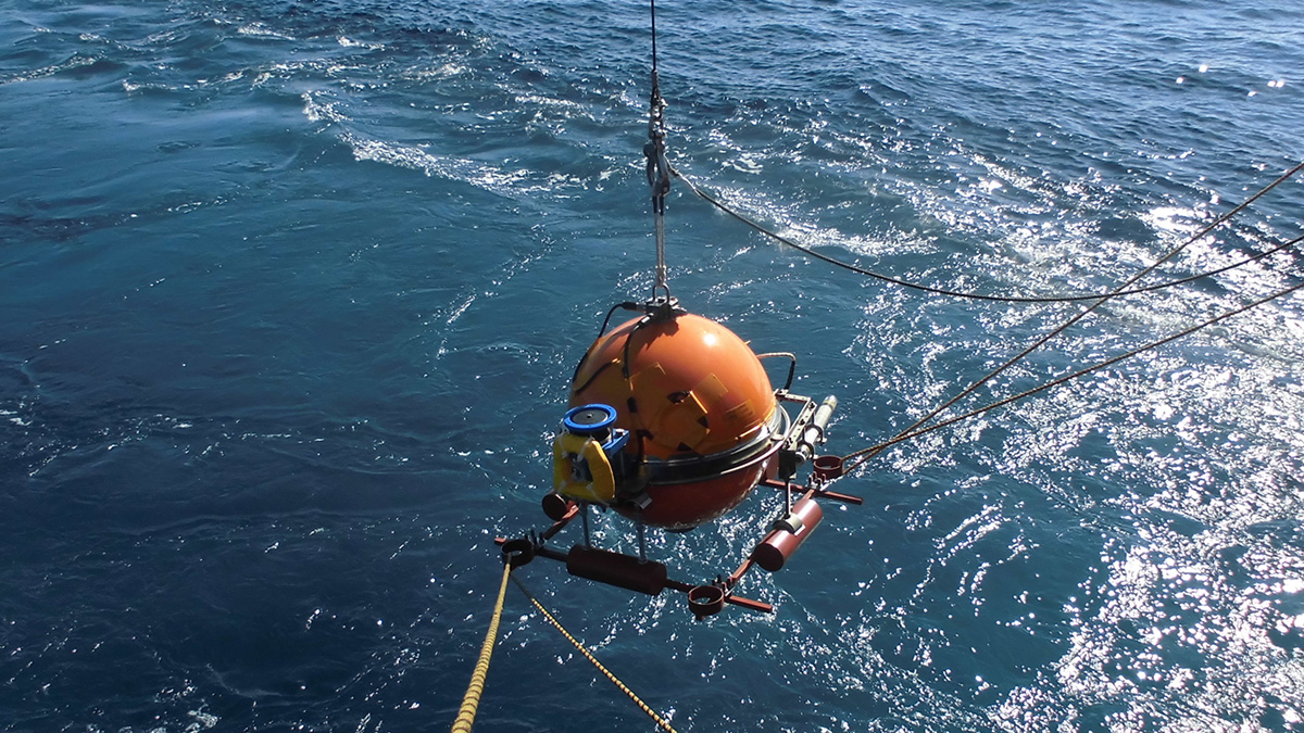
Researchers tease apart the links between slabs and mantle flow near subduction zones, upending some traditional views of subduction-induced mantle flow.
lithosphere

Posted inEditors' Highlights
Law and Order for Friction and Faults: One Law to Rule Them All
Faults are made of complex materials with complex behaviors, and having a single model that can predict these behaviors is an advance in understanding deformation and the earthquake cycle.

Posted inEditors' Highlights
Do Some Cratons Have Soggy Bottoms?
Long-persistent stable cratons bear much of the deep-time geologic record, and a new study combines seismic and petrological data to reveal how interactions with mantle fluids can shape their evolution.
Posted inEditors' Highlights
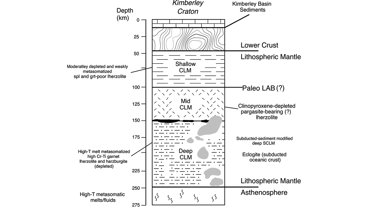
Piecing Together the Roots of the Ancient Australian Continent
Mineral compositions from numerous volcanic rocks that sample the mantle keel beneath Western Australia’s Kimberley Craton reveal the temperature and mineralogy that explain its long-lived stability.

Posted inNews
Shifts in Tectonic Plates Change Biodiversity
A 36-million-year cycle of marine biodiversity booms and busts matches the movements of plate tectonics, linking what happens deep below the ocean to what’s happening in it.
Posted inEditors' Highlights
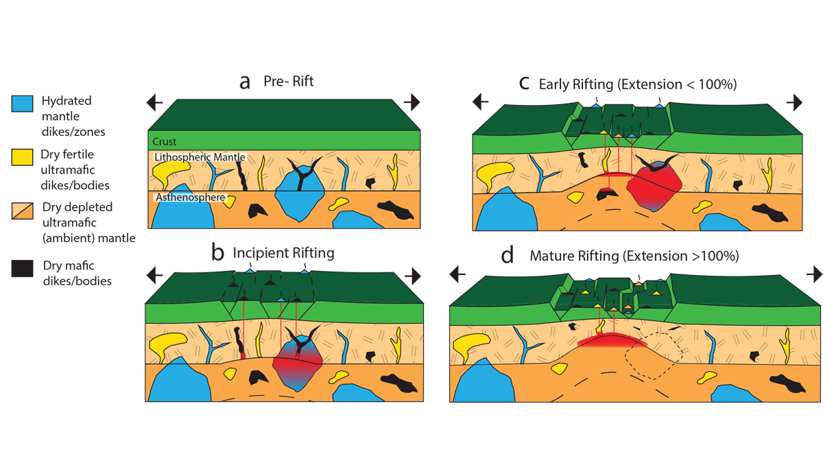
Uncovering Mantle Heterogeneities Beneath Drifting Continents
Computational models of the composition and volumes of magmas during continental rifting evolution provide clues on the heterogeneities of the deep melting mantle.
Posted inNews
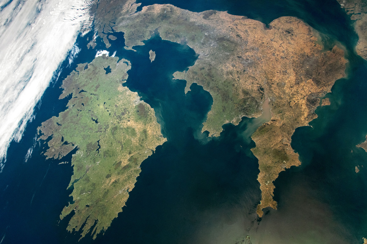
The Mysterious Case of Ireland’s Missing Earthquakes
The Emerald Isle has far fewer earthquakes than neighboring Britain. Now scientists think they know why.

Posted inNews
Mounds of Ancient Ocean Floor May Be Hiding Deep in Earth
A mysterious seismic feature at the bottom of Earth’s mantle is more widespread than previously thought.
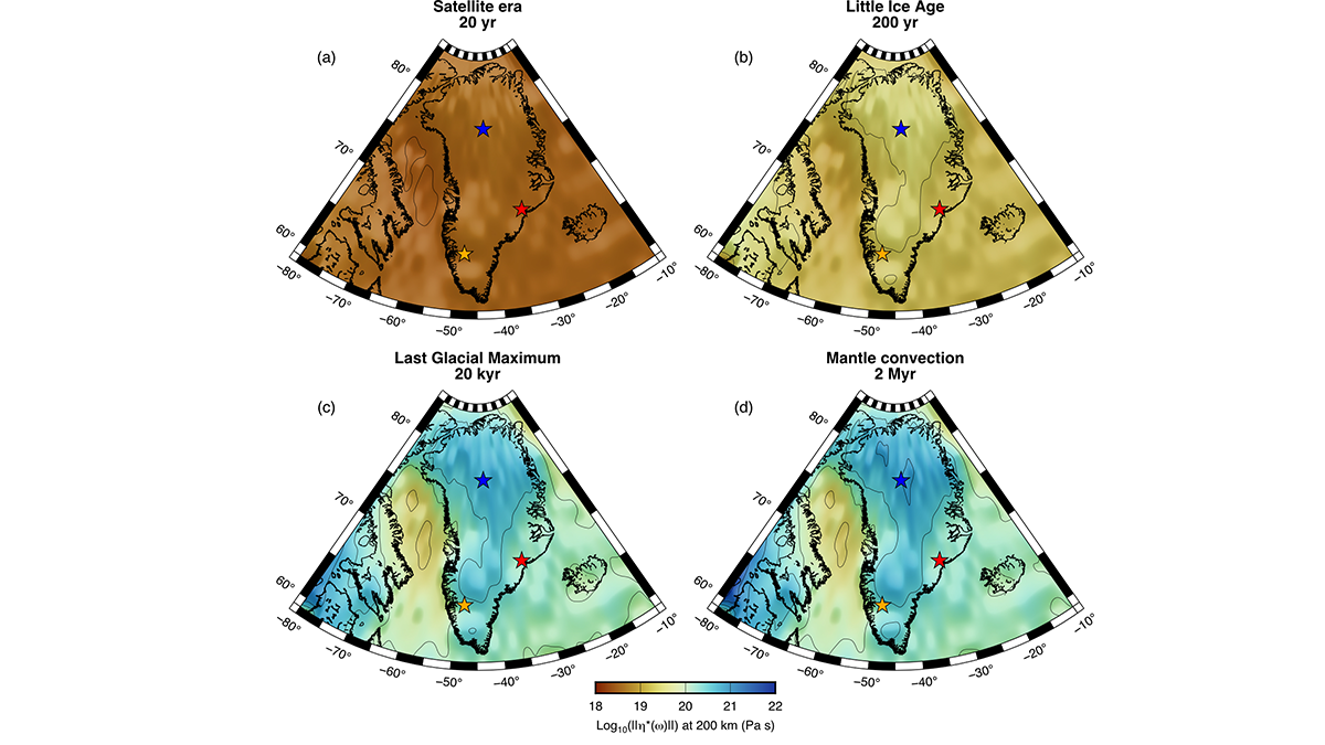
Posted inEditors' Highlights
4D Viscosity Constraints from Greenland
The mantle’s resistance to flow appears different for glacial and plate tectonic timescales but this behavior can be reconciled with new thermo-mechanical models of the asthenosphere.