From its high mountains to its low plains, Nepal faces growing risks from natural hazards. Preparing for these risks requires accurate, locally relevant risk assessments and effective communications.
Nepal
Posted inNews
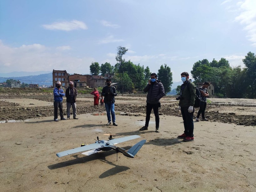
COVID Clears the Skies for Earth-Observing Drones in Nepal
When the pandemic hit Nepal and the country’s main airport drastically cut flights, a group of drone experts, local governments, and scientists saw a once-in-a-lifetime opportunity to gather geodata.
Posted inNews
Trayendo la Educación Sobre Terremotos a las Escuelas de Nepal
El programa de Sismología en la Escuela en Nepal, tiene como objetivo preparar a las comunidades rurales para el próximo gran terremoto.

Posted inENGAGE, News
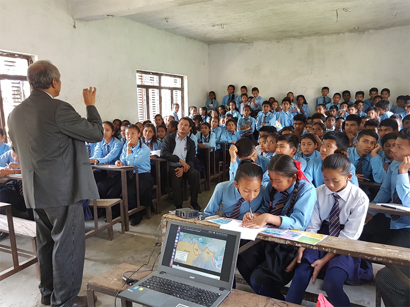
Bringing Earthquake Education to Schools in Nepal
The Seismology at School in Nepal program aims to prepare rural communities for the next big earthquake.
Posted inEditors' Highlights
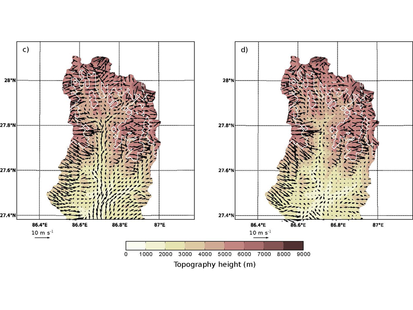
What Drives Surface Winds in a Deep Valley?
Surface winds in a Himalayan valley are found to vary daily and seasonally due to factors including pressure gradient, advection, turbulent vertical mixing, and the presence of glaciers.

Posted inNews
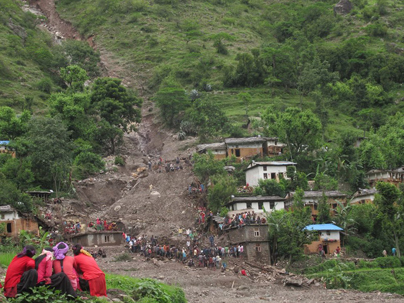
Varying Impact of Earthquake- and Monsoon-Induced Landslides
Using nearly 50 years of satellite data and records stretching back millennia, scientists determine the relative frequency—and the erosional power—of monsoon- and earthquake-induced landslides in Nepal.

Posted inNews
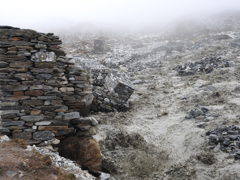
Glacial Lake Outburst Flood Captured in Seismic Recordings
A flood that thundered through eastern Nepal in July 2016 left a telltale seismic signature and caused more erosion than local monsoon rains, new research shows.
Posted inResearch Spotlights
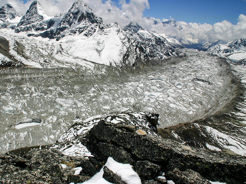
A Novel Way to Map Debris Thickness on Himalayan Glaciers
By combining changes in elevation with other data, scientists have developed a method for estimating the thickness of debris covering glaciers on whose water more than 800 million people depend.
Posted inEditors' Vox
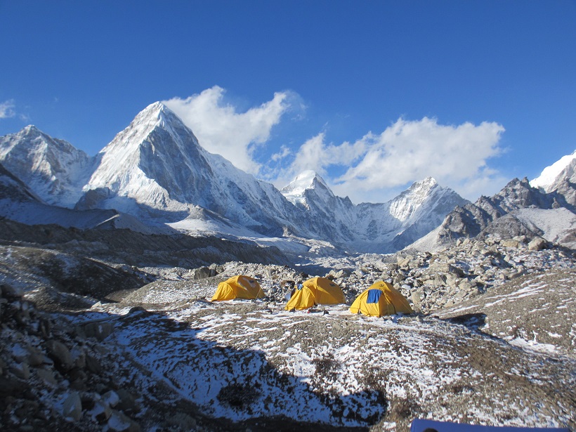
Hot Water, Cold Ice
Despite careful planning, there can be many uncertainties and unknowns about doing field research in remote locations.
Posted inNews
Glacial Outburst Flood near Mount Everest Caught on Video
More than 2 million cubic meters of water, hidden deep within Lhotse Glacier, spilled down toward the village of Chukhung, Nepal, in 2016.