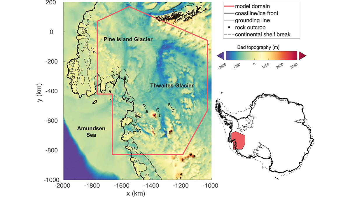
The Antarctic ice sheet behaves like a non-Newtonian fluid and may be more nonlinear than previously thought. This impacts its future stability and requires revisions to predictions of sea level rise.
sea level change
Posted inScience Updates
Unlocking Climate Secrets of Hawai‘i’s Drowned Reefs
Researchers set sail to study sea levels, climate, ecosystem responses, and volcanic histories over the past 500,000 years, using an innovative seabed drill to sample fossilized reefs off Hawai‘i.
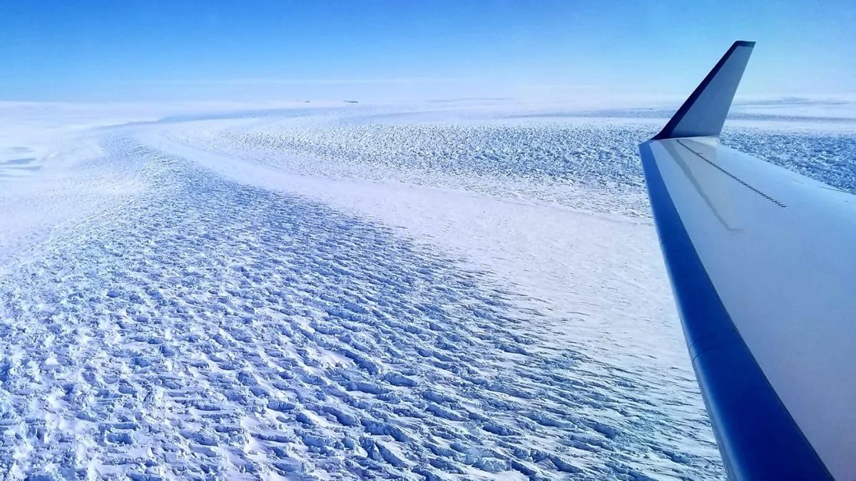
Posted inEditors' Highlights
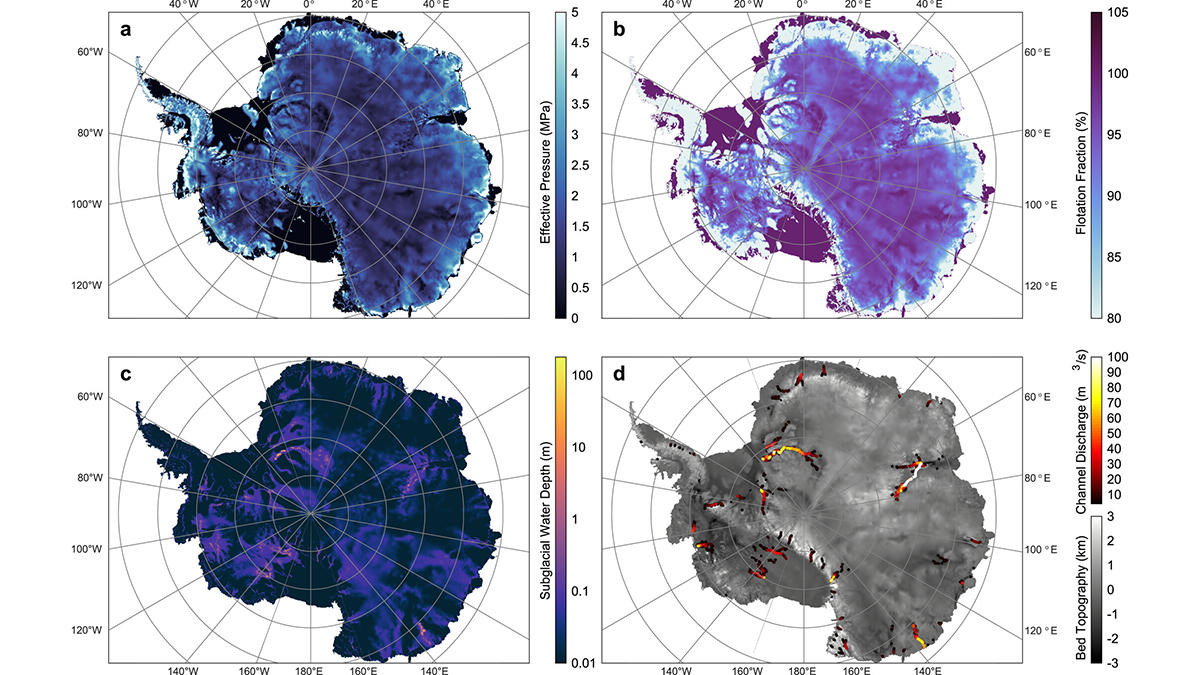
Subglacial Hydrology Under the Antarctic Ice Sheet
Using simulations of subglacial hydrology, a new study shows the volume and movement of meltwater underneath the Antarctic Ice Sheet.
Posted inNews
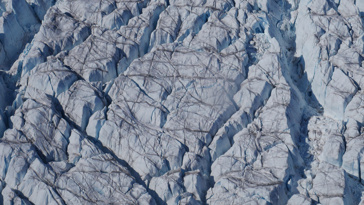
Crevasses on the Greenland Ice Sheet Are Growing
High-resolution 3D maps show crevasse volume is increasing across most of the Greenland Ice Sheet as it accelerates toward the ocean, which could affect future ice loss and sea level rise.

Posted inResearch Spotlights
Flooding from Below: The Unseen Risks of Sea Level Rise
Researchers demonstrate a method for assessing how rising seas could raise groundwater levels, potentially transmitting flood hazards far inland.

Posted inEditors' Vox
Asian Megadeltas: Tackling Coastal Flooding Challenges
Integrating scientific insights into current actions is crucial for steering future research directions and underpinning informed management of coastal flooding in Asian deltas.

Posted inNews
Tiny Icequakes Ripple Through Greenland’s Largest Ice Stream
Seismologists made an accidental discovery on the Northeast Greenland Ice Stream, changing the way glaciologists understand how ice moves.
Posted inResearch Spotlights
A Seafloor Spreading Slowdown May Have Slashed Sea Levels
Between 15 million and 6 million years ago, a drop in ocean crust production may have lowered sea level by 26–32 meters.

Posted inNews
A Seychelles Shoreline Resists the Rising Seas
The geomorphology of a protected atoll likely contributed to its ability to maintain its shoreline over a turbulent half-century.

Posted inOpinions
Glacier Intervention Research Isn’t Just for Glaciologists
Prospects for mitigating sea level rise by slowing flows of glacial ice into the ocean are worthy of research, but this work must involve all rights holders and stakeholders.