
Accounting for the newfound bubble effect could improve estimates of how sea-terminating glaciers melt underwater—and better anticipate their shrinkage as oceans warm.
sea level change

Posted inNews
Shifts in Tectonic Plates Change Biodiversity
A 36-million-year cycle of marine biodiversity booms and busts matches the movements of plate tectonics, linking what happens deep below the ocean to what’s happening in it.
Posted inNews
Greenland Was Much Greener 416,000 Years Ago
A fresh analysis of a historic ice core has revealed evidence of a much smaller ice cap.
Posted inEditors' Highlights
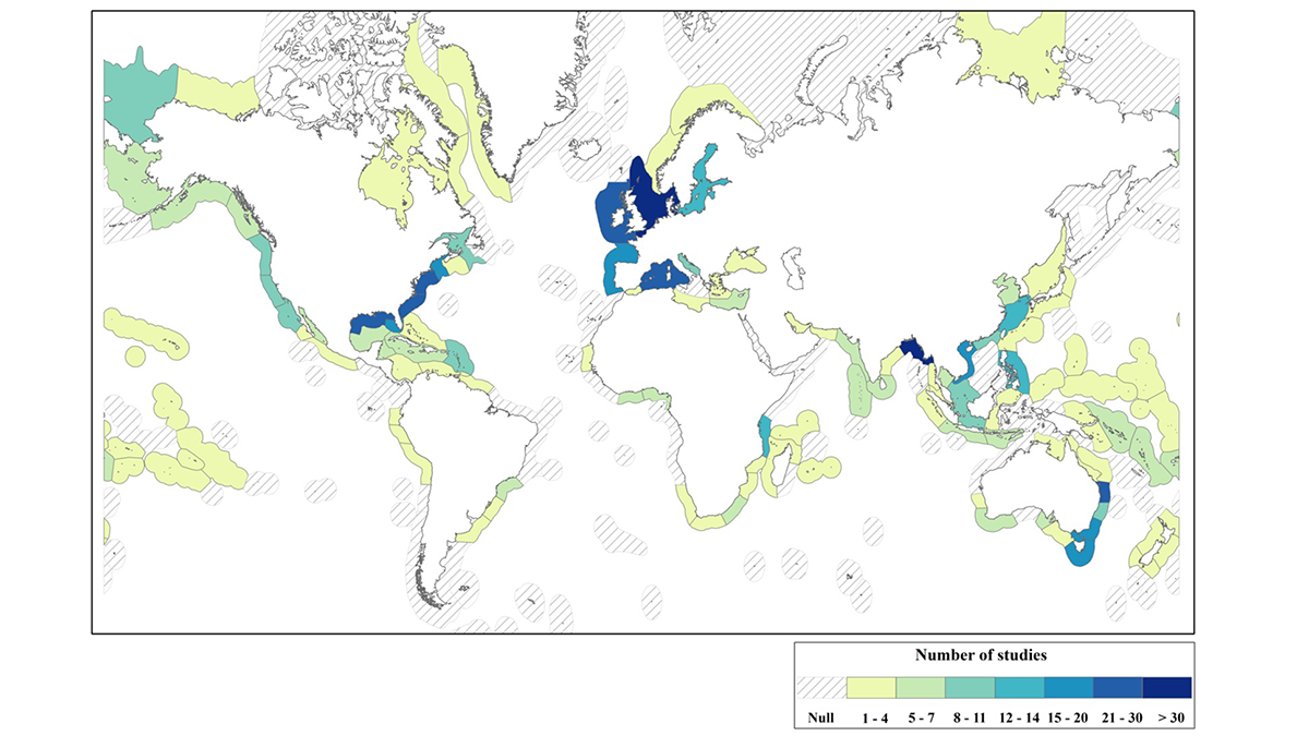
Gaps and Challenges in Coastal Adaptation Research
A new study reviews 650 empirical studies on coastal adaptation, revealing knowledge gaps on its implementation, policy, governance, and economic contexts, especially in the Global South.
Posted inEditors' Highlights
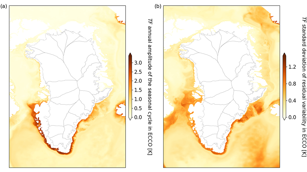
Going with the Flow: New Tool Improves Sea Level Projections
By bringing together multiple data sources a new statistical method aims to improve the accuracy with which we might predict future ice melt in Greenland.
Posted inEditors' Highlights
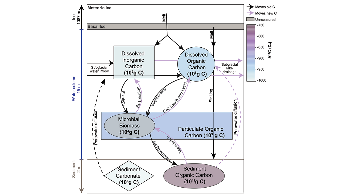
Clues from a Subglacial Lake for Holocene Grounding Line Change
Organic carbon sampled in the lake contained radiocarbon, indicating connection to the ocean in the mid-Holocene, when the grounding line was up to 260 kilometers inland of its current position.

Posted inFeatures
Redefining “Glacial Pace”
As Earth’s climate warms, glaciers and ice sheets are retreating, cracking, and adding to sea level rise at record speeds.
Posted inEditors' Highlights
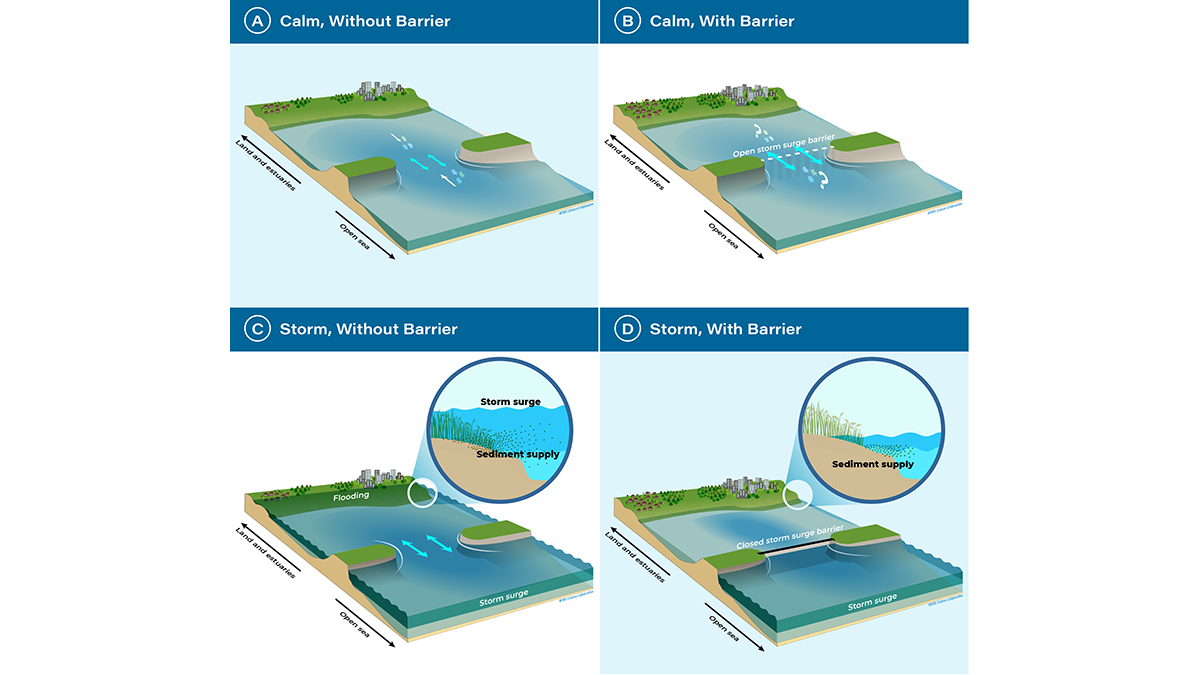
A Turning Point for Estuaries Worldwide
As estuarine barriers are built in response to sea level rise, flooding, and salinization, more research is needed to better understand their implications for human activities and ecosystems.

Posted inNews
Back-to-Back Hurricanes Could Become Common by 2100
New research shows back-to-back hurricanes could strike the United States every few years by 2100.

Posted inENGAGE, News
“Icefin” Investigates a Glacial Underbelly
An instrument-laden submersible reveals where—and how rapidly—the Antarctic glacier is melting.