
Human-made channelization significantly accelerates peat decomposition and drives ground-surface deformation in tropical wetlands.
subsidence
Posted inEditors' Highlights
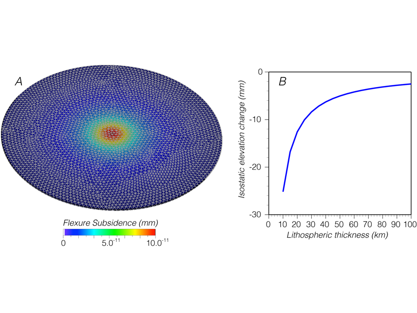
Going Down: How Do Cities Carry That Weight?
Calculations show that the added weight of growing cities can lead to tens of millimeters of subsidence, an effect that needs to be considered for coastal cities under threat by sea-level rise.

Posted inEditors' Highlights
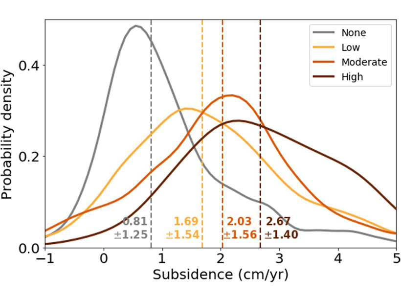
Machine Learning Predicts Subsidence from Groundwater Pumping
Machine learning and data on aquifer type, sediment thickness, and proxies for irrigation water use has been used to produce the most comprehensive map of land subsidence in the western U.S. to date.
Posted inEditors' Highlights
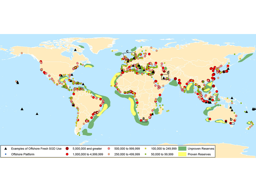
Pumping Offshore Groundwater Resources Has Consequences on Land
While vast volumes of fresh groundwater are located offshore, pumping these reserves can also deplete on-shore aquifers and cause land subsidence.
Posted inEditors' Highlights
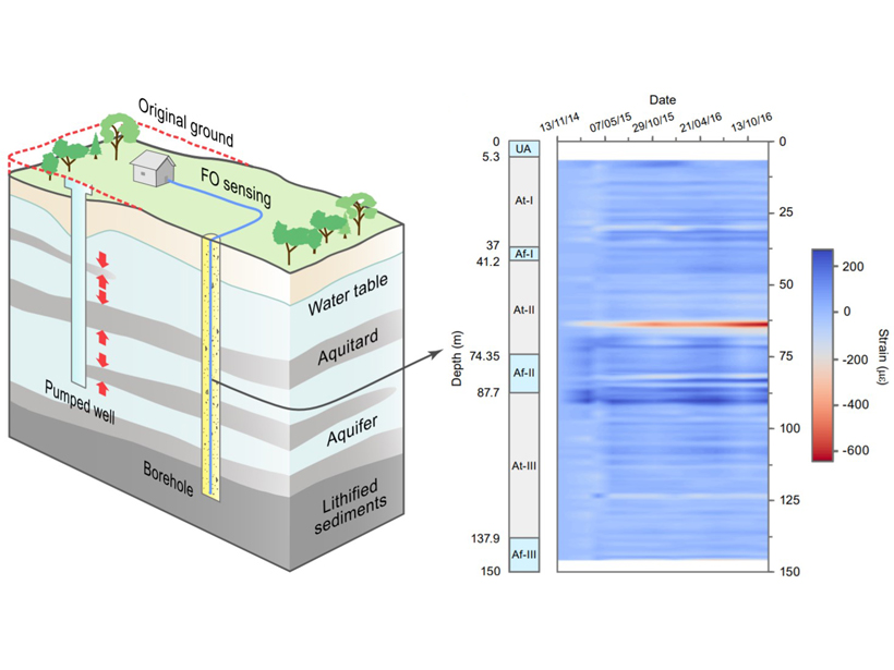
Fiber Optics Opens Window into Subsurface Deformation
The distributed deformation of buried materials is difficult to map, but a new approach is able to resolve vertical deformation over the length of a fiber optic cable.
Posted inEditors' Highlights
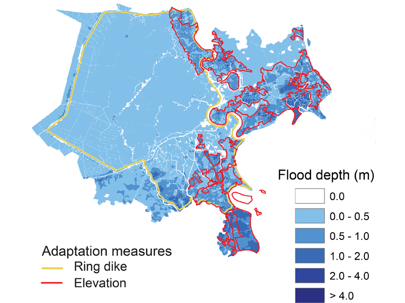
A City’s Challenge of Dealing with Sea Level Rise
A well-developed case study in Ho-Chi Min City, Vietnam, exemplifies how other mega-cities located on deltas could face the major challenge of adapting to rising sea-level.

Posted inNews
Playing with Water: Humans Are Altering Risk of Nuisance Floods

New research suggests that excessive groundwater usage and damming have changed the natural risk of nuisance floods, for better or worse, in eastern U.S. coastal cities.
Posted inFeatures
Global Risks and Research Priorities for Coastal Subsidence
Some of the world's largest cities are sinking faster than the oceans are rising. Humans are part of the problem, but we can also be part of the solution through monitoring and modeling.