The Landslide Blog is written by Dave Petley, who is widely recognized as a world leader in the study and management of landslides.

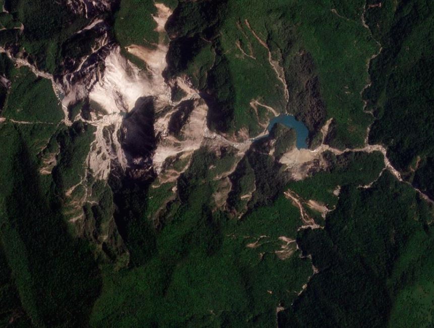
As the analysis of the landslides triggered by the 3 April 2024 Mw=7.4 Hualien earthquake in Taiwan continues, it has emerged that there is at least one valley-blocking landslide. Taiwan News has a good article, which includes this image collected by the Forestry and Nature Conservation Agency in Taiwan:-

I have rotated the landslide so that north is approximately to the north. This landslide is located at [24.008, 121.378]. The river is flowing from the west towards the east, with the landslide moving from the south towards the north. The main landslide scar in the image is about 300 m long from the crown to the lake, but it appears that part of this failure has occurred a little to the west, in a failure with a length of about 200 metres.
Whilst this area is sparsely populated, downstream are two small hydroelectric schemes and then, at a distance of about 15 km, Tongmen village. However, as Tongmen is located 20 above the river level, it is not thought to be threatened.
There is a really good Planet Labs image of this site, captured on 17 April 2024, which captures the situation well. I have draped it onto the Google Earth DEM:-
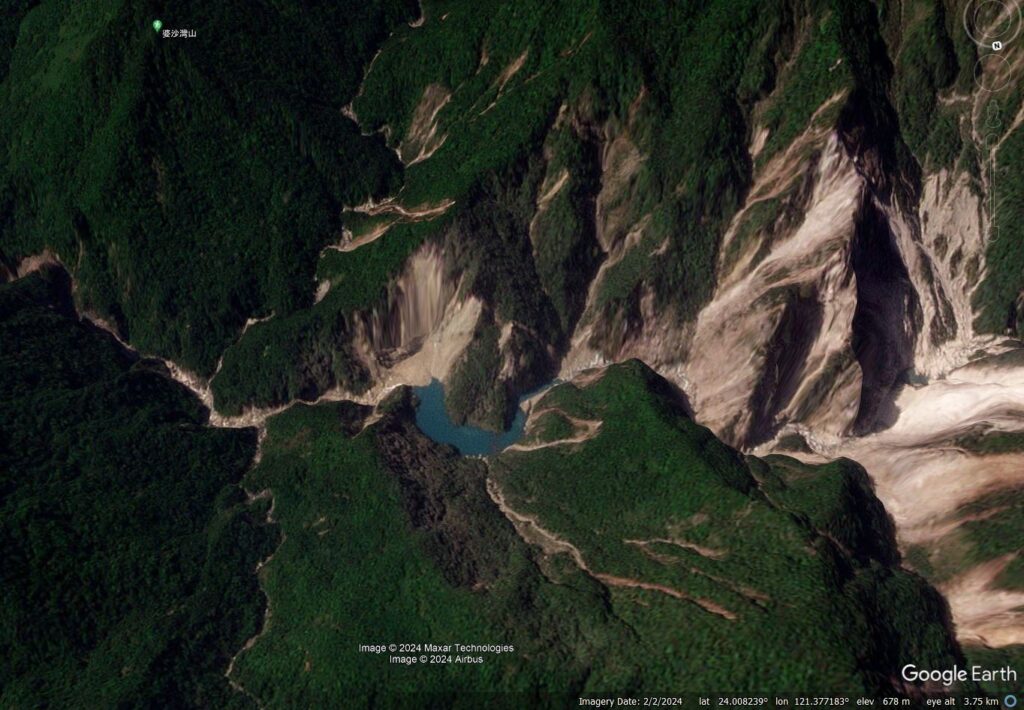
It is clear that the dam has overtopped, with steady water flow. The site will need to be monitored, especially going into the typhoon season, but the overall risk is likely to be quite low.
Reference
Planet Team (2024). Planet Application Program Interface: In Space for Life on Earth. San Francisco, CA. https://www.planet.com/