An unusual failure has occurred on a cut slope adjacent to a key road in Greece.

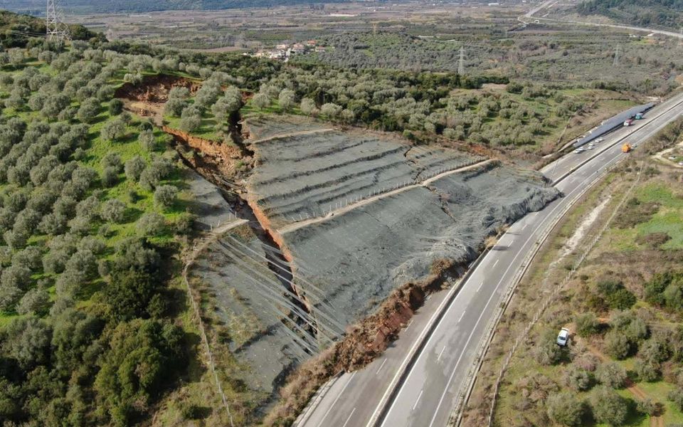
On 2 February 2026 a major, fascinating landslide occurred on the A5 Ionian motorway between Arta and Amfilochia in Greece. The location appears to be [39.07754, 21.09861]. The news site ekathimerini has a story providing the details, which includes this extraordinary image of the aftermath of the landslide:-
I believe that the Google Earth image below shows the configuration of the site in 2023:-
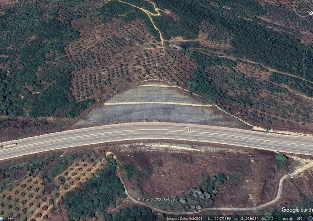
So, this is a large cut slope that appears to have been formed in about 2015 (based on Google Earth imagery). The failure is quite complex, with most of the landslide moving as a large block (which has fractured in the late stage of movement). There is a large displacement on the far side of the landslide (in the photograph view), so there has been some rotation around an approximately vertical axis. The landslide does not appear to have been conventionally rotational.
To me, this suggests failure on an existing plane of weakness in the slope. The news report indicate that the landslide occurred after heavy rainfall.
This is a Google Streetview of the landslide site from September 2023:-
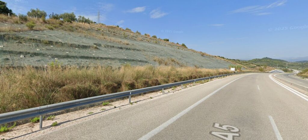
It appears that the slope has rockbolts, which suggests that there was an awareness of the potential for instability. Perhaps they were insufficiently long to prevent this failure? The presence of the rockbolts may explain why the landslide moved as a predominantly intact block, though.
The Ionian motorway is now closed. There are similar slopes along the road, so the investigation of this failure may have wider implications.