
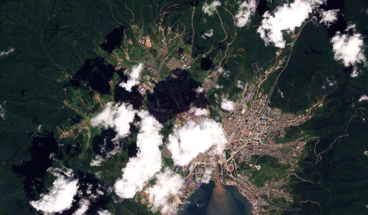
Satellite images have started to reveal the hundreds of shallow landslides and channelised debris flows triggered by a major rainfall event in North Korea at the end of August 2026.

Although North Korea is landslide-prone, there is a paucity of information about the impacts and losses that occur there. Interestingly, NK Pro reported last month that a series of landslides were triggered around Rason, a city on the Russian border on 31 August to 1 September 2026.
The NK Pro report suggests that 266 mm of rainfall fell, triggering landslides and floods that damaged infrastructure, industrial plans and houses.
I have a one month lag to access Planet Labs imagery, so I’m just starting to be able to examine the aftermath of this event. This is starting to reveal what happened, but watch this space as a cloud-free image was acquired on 9 September 2026, which should be very interesting.
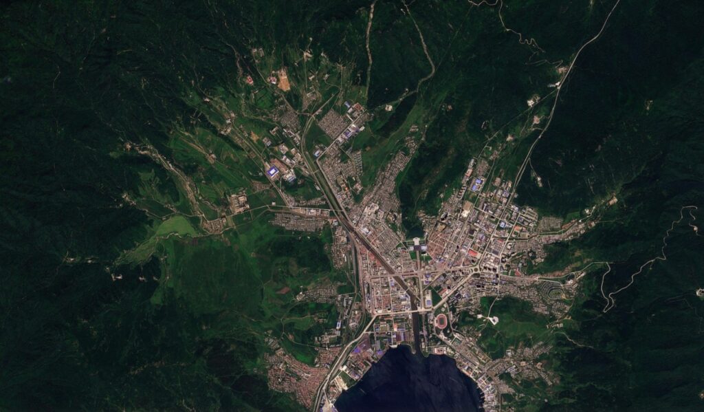
In the meantime, this is an Planet Labs image of the area around Rason, captured on 27 August 2026 (before the event):-
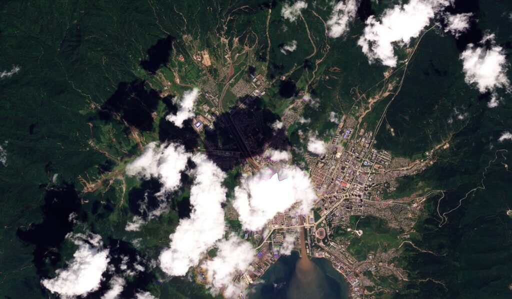
And here is the same area on 3 September 2026, albeit with some slightly irritating cloud:-
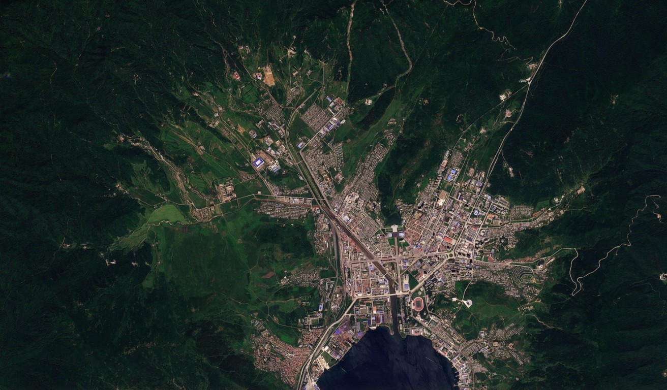
And here is a slider to compare the images:
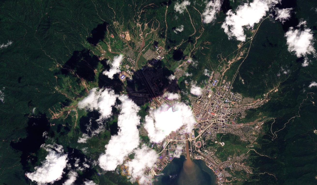
The images show multiple shallow landslides in the hills to the west and north of Rason. These have combined to form channelised debris flows in many locations – see the cluster directly to the west of Rason, for example. The rivers are choked with debris and there is a plume of sediment extending from the river mouth into the bay.
I’ll post a more detailed analysis when better imagery is available, but these landslides around Rason look to be quite significant.
Acknowledgement
Many thanks to the wonderful people at Planet Labs for allowing me to use their imagery.