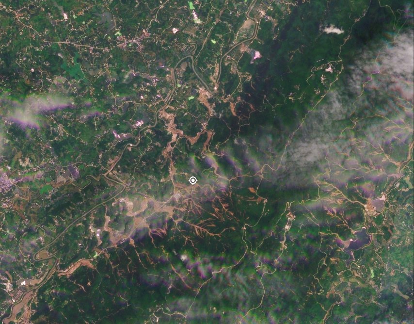
Satellite images show two very large landslides and multiple smaller failures, and channelised debris flows, in Shimen County in China. In China, this year rainy season started with an intense event that covered the provinces of Guizhou, Hubei and Hunan in the period between 17 and 21 May 2026. There were some news reports at […]
landslides
Posted inThe Landslide Blog
Fatal landslides in May 2026
In May 2026 I recorded 51 fatal landslides causing 185 fatalities. 2026 is proving to be atypical in terms of the temporal pattern of fatal landslides. This is my regular update for the number of fatal global landslides, focusing on May 2026. As usual, this data has been collected in line with the methodology described […]

Posted inThe Landslide Blog
Fatal landslides at the Rohingya refugee camps in Bangladesh
Early in the morning of 6 July 2026, three fatal landslides killed eight people in the refugee camps housing the displaced Rohingya people in Bangladesh. There have long been fears of the potential for fatal landslides in the refugee camps Cox’s Bazar in Bangladesh that house the Rohingya people who were ethnically cleansed from Myanmar. […]
Posted inThe Landslide Blog
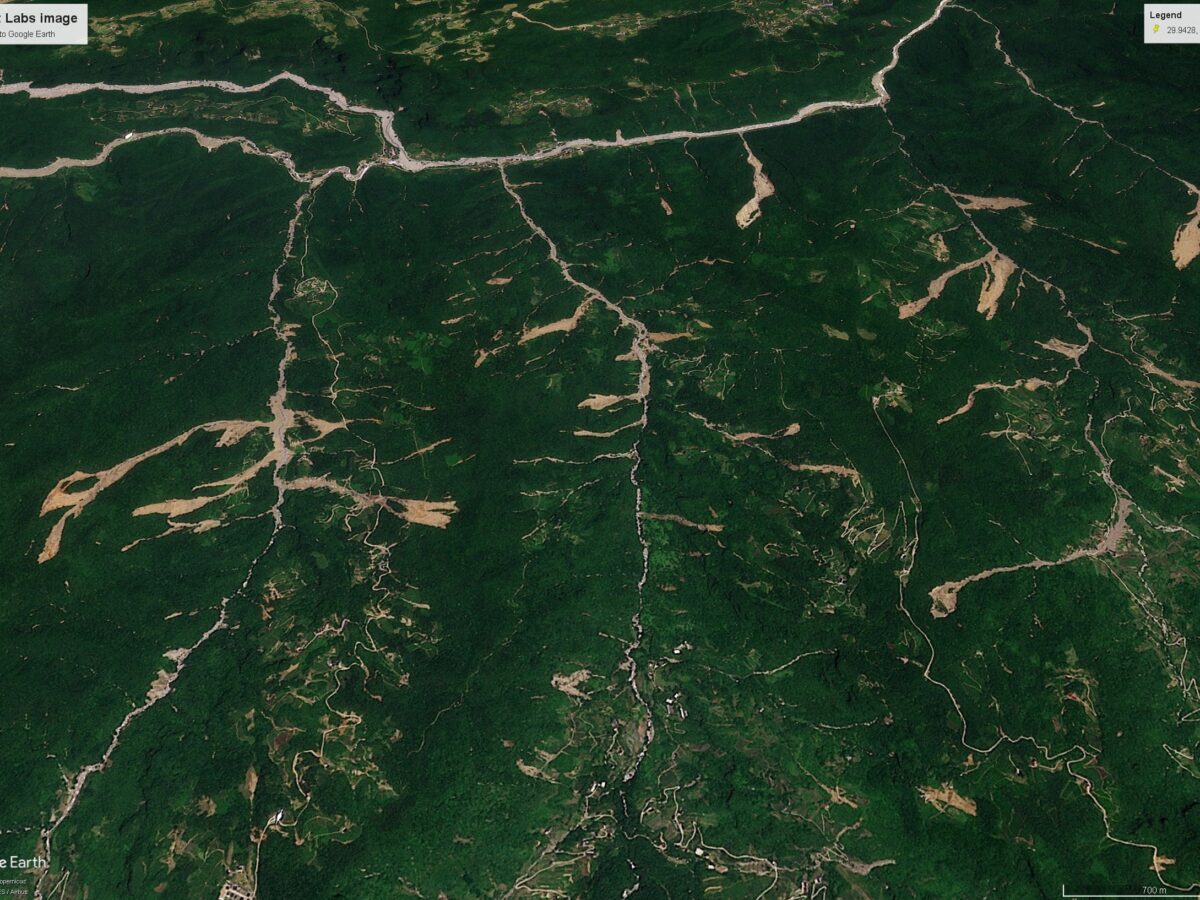
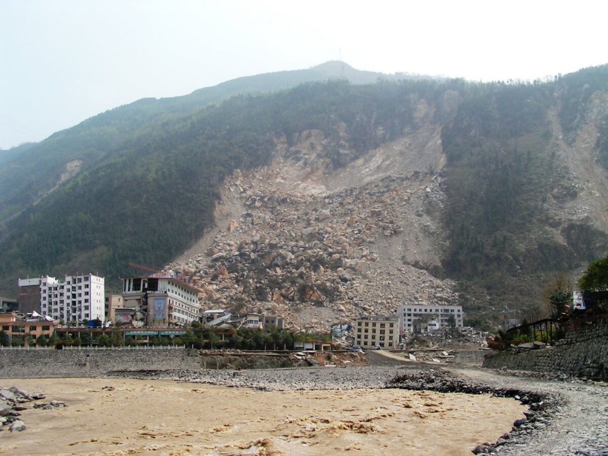
The 24 May 2026 landslide disaster in Yongchuan, Chongqing, China
Planet Labs imagery reveals a cluster of shallow landslides and channelised debris flows triggered by extreme rainfall. Official figures indicate that 20 people were killed. Early in the morning of 24 May 2026, extremely heavy rainfall triggered a significant landslide disaster in Yongchuan District in Chongqing, China. As is so often the case in mainland […]
Posted inThe Landslide Blog
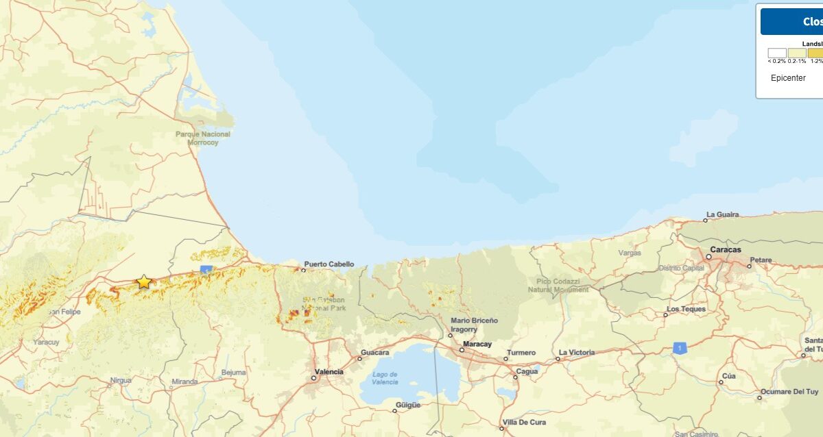
Landslides and liquefaction from the 24 June 2026 “double tap” earthquakes in Venezuela
The Landslide Blog is written by Dave Petley, who is widely recognized as a world leader in the study and management of landslides. The news this morning of the “double tap” M=7.2 and M=7.5 earthquakes in Venezuela late on 24 June 2026 is grim. These are large earthquakes in their own right occurring at a […]

Posted inThe Landslide Blog
The Operation L!STO disaster preparedness manual for landslides
In the Philippines, an incredibly useful manual has been published that guides local government agencies in preparing for and responding to landslides. The Philippines has a long term landslide problem, with most events being triggered by either rainfall associated with typhoons or by earthquakes. However, the Philippines is also proactively trying to manage the losses […]
Posted inThe Landslide Blog
An update on landslides from the 8 June 2026 M=7.8 earthquake offshore Mindanao in the Philippines
It is now clear that more than half the fatalities from last week’s earthquake in the Philippines were caused by landslides. In the areas of the Philippines affected by the 8 June 2026 M=7.8 earthquake offshore Mindanao, operations have shifted from rescue to recovery. Inquirer has an interesting report about information provided by an official […]
Posted inThe Landslide Blog
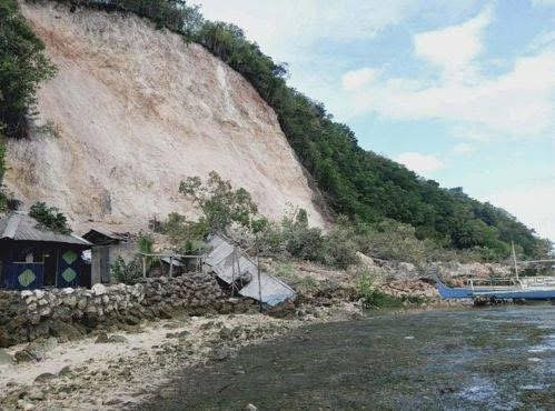
Reports of landslides triggered by the 8 June 2026 M=7.8 earthquake offshore Mindanao in the Philippines
To date news reports suggest two fatal landslides with a combined toll of 17 people. There are various news reports trickling in about the landslides triggered by the 8 June 2026 M=7.8 earthquake offshore Mindanao in the Philippines. As usual, the remote locations of many of the landslides means that the information is a bit […]
Posted inThe Landslide Blog
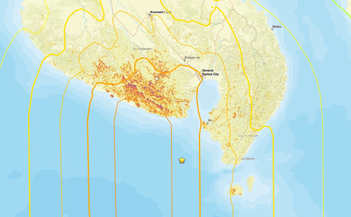
Potential landslides and liquefaction from the 8 June 2026 M=7.8 earthquake offshore Mindanao in the Philippines
Initial analyses suggest that the earthquake this morning has the potential to have triggered significant numbers of landslides and areas of liquefaction. At the time of writing, the impacts of the M=7.8 earthquake that occurred offshore the south coast of Mindanao in the Philippines remain unclear. Initial reports in the local press suggest 15 fatalities […]
Posted inThe Landslide Blog
Fatalities from landslides in earthquakes
A new study (Sun et al. 2026) shows that in six earthquakes in China between 2010 and 2022, landslides and rockfalls were responsible for at least half of the total fatalities. It is well-established that landslides are a major cause of loss of life in earthquakes in mountainous areas. The seismology maxim that “it is […]