A new paper (Kharismalatri, Gomi & Sidle 2025) in the journal Natural Hazards uses the concepts of the inflow angle and the channel gradient to examine the behaviour of large landslides after failure.

Large landslides in areas with steep terrain that either block the valley or turn into a long runout debris flows are an increasing problem globally as the impacts of climate change accelerate. A key question for any large, potentially unstable slope is whether it will block the valley or transition into a long runout flow. Neither is good, clearly, but the risks and management approaches differ.
There is a very interesting paper (Kharismalatri, Gomi & Sidle 2025) in the journal Natural Hazards that uses a database of 188 large landslides from around the world to examine this issue. The paper has been published open access and using a creative commons licence (hurrah!), so please do take a look.
This diagram, from the paper, explains a key and very interesting metric in the study – the inflow angle:-
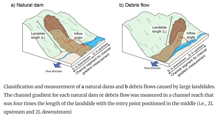
There are two key ideas here – one is the inflow angle, which is the angle between the main axis of the landslide and the main axis of the channel, and the other is the channel gradient – the gradient of the river valley into which the landslide is moving, measured using a consistent distance scaled to the landslide length.
The most important diagram in the paper is this one, which shows the inflow angle plotted against channel gradient:-
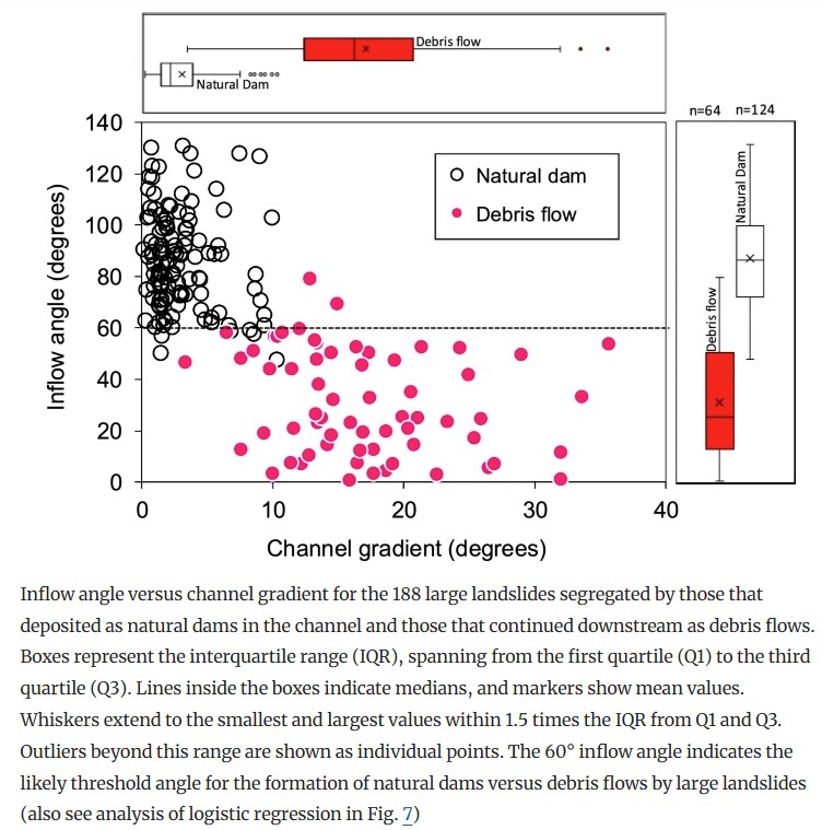
This is quite remarkable. The inflow angle plays a key controlling role in what happens when the landslide reaches the valley. If that angle is greater than about 60o, the landslide nearly always blocks the valley. If it is less, then it generally turns into a debris flow.
Similarly, if the channel gradient is less than about 10o, the landslide almost always blocks the valley. If it is less, it generally turns into a debris flow.
There are some overlaps, but the number of these cases is remarkably low.
It is also very interesting that there are no cases of landslides with both a high inflow angle and a high channel gradient (i.e. where inflow angle is >60o and channel gradient is >15o). I am not sure why this is the case.
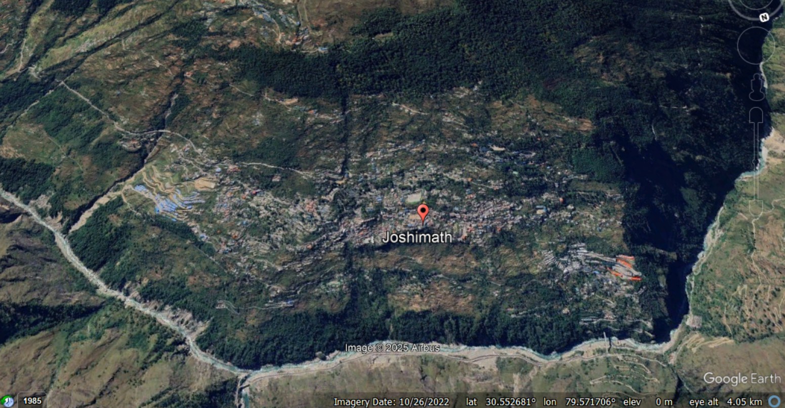
This will be a very useful finding for those who are having to manage developing failures in large slopes. It allows a first order prediction of likely behaviour of the slope upon failure. So, for example, I wrote yesterday about a study of the potential failure of the large landslide at Joshimath in India. It would be interesting to see where on the graph that slope plots – it appears to me that the inflow angle is c.90o?
Reference
Kharismalatri, H.S., Gomi, T. & Sidle, R.C. 2025. Geomorphic thresholds for cascading hazards of debris flows and natural dam formation caused by large landslides. Natural Hazards. https://doi.org/10.1007/s11069-025-07402-0