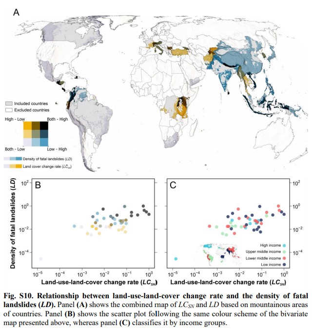
A new paper Fidan et al. (2026) demonstrates that wealth and the rate of land-cover change play a key role in determining the occurrence of fatal landslides in mountain areas. These factors are statistically more significant that precipitation and topography. A fascinating new paper (Fidan et al. 2026 – this paper is both open access […]
landslides
Posted inThe Landslide Blog
Fatal landslides in March 2026
In March 2026 I recorded 61 fatal landslides causing 520 fatalities, the highest March total on record. This is my regular update for the number of fatal global landslides, focusing on March 2026. AAs usual, this data has been collected in line with the methodology described in Froude and Petley (2018) and in Petley (2012). References are listed […]
Posted inThe Landslide Blog
On the economic benefits of rural roads in Nepal
A new paper (Adhikari et al. 2026) in the journal Asian Development Review shows that earthen roads in the hilly areas of Nepal generate limited economic benefits but carry a high landslide cost. Loyal readers of this blog will have seen many posts that cover the problematic landslide history of low technology rural roads in […]
Posted inThe Landslide Blog
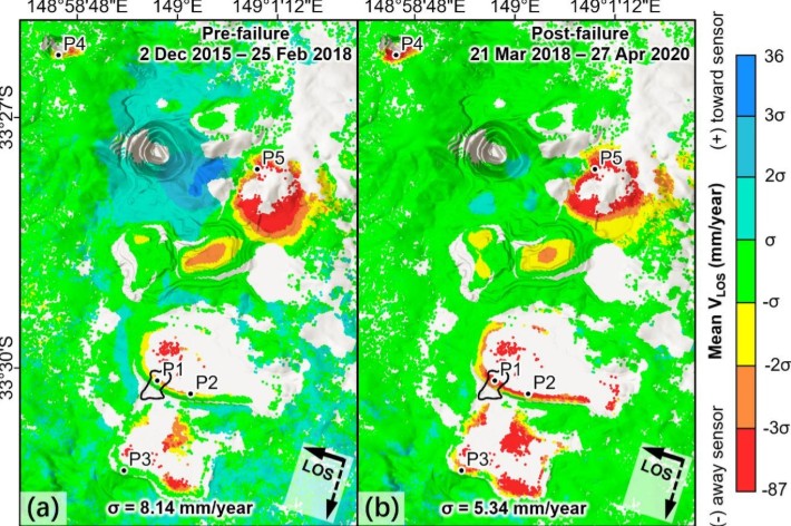
Monitoring pre- and post-failure InSAR-derived deformation in surface mining complexes
A new paper in the International Journal of Applied Earth Observation and Geoinformation uses InSAR to explore the complex patterns of deformation that occur in and around large mining operations. I have frequently discussed landslides in mining operations on this site, highlighting repeatedly the unacceptable losses that result from slope failures. In many cases, these […]
Posted inThe Landslide Blog
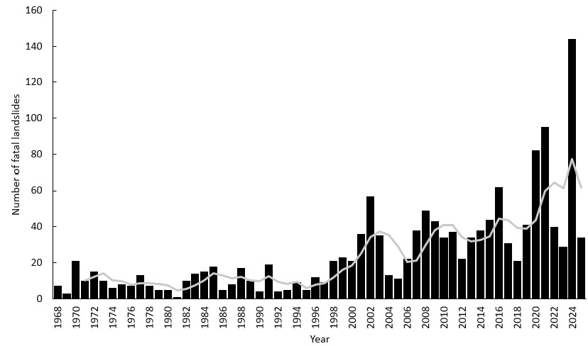
Fatal landslides in Nepal since 1968
Since 1968, there have been over 1,400 fatal landslides in Nepal, killing over 6,000 people. I’m currently writing a paper on the patterns of fatal landslides in Nepal since 1968. This is an update on the paper we wrote almost 20 years ago (Petley et al. 2007) that examined the changing patterns of landslides there. […]
Posted inThe Landslide Blog
Global fatal landslides in January and February 2026
The number of fatal landslides in 2026 to the end of February was considerably above both the long term mean and the year with the highest total, 2024. To bring everything back up to date, I am providing an update on fatal landslides for both January and February 2026. As usual, this data has been […]
Posted inThe Landslide Blog
Global fatal landslides in 2025
In 2025, I recorded 663 global fatal landslides, costing 5,091 lives. I have fallen a little behind with providing updates on global fatal landslides – a consequence of the pressures associated with changing jobs. I hope that normal service can now be resumed – I have been collecting the data through this period. I am […]
Posted inThe Landslide Blog
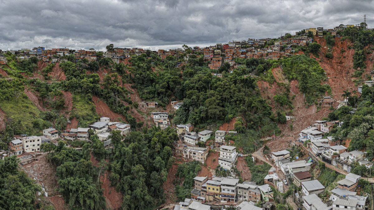
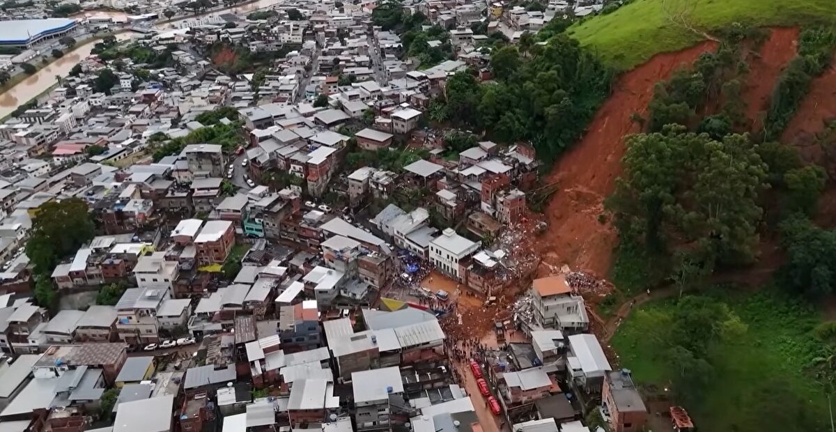
The 23-24 February 2026 landslide disaster in Juiz de Fora, Brazil
Heavy rainfall in the Zona da Mata area of Brazil has triggered multiple landslides. Over 50 people have been killed. Over the period of 23 and 24 February 2026, extremely intense rainfall struck the Zona da Mata area of Minas Gerais (MG), Brazil, triggering landslides and flooding. The most seriously affected area was the city […]
Posted inThe Landslide Blog
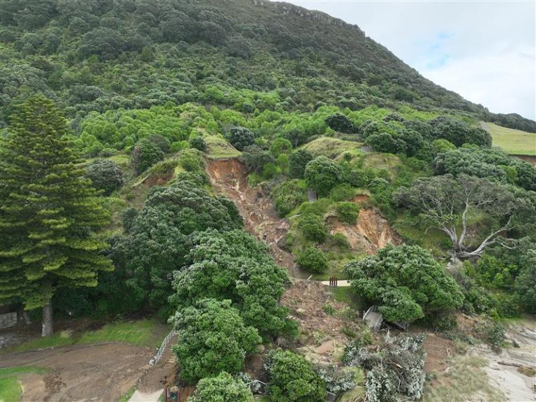
Landslides on Mauao in New Zealand following the 22 January 2026 rainfall event
To date, 42 landslides have been identified on Mauao (Mount Manganui) in New Zealand following the 22 January 2026 rainfall event. The extreme rainfall event that affected parts of the North Island of New Zealand triggered two fatal landslides, of which the major failure at the Mount Maunganui Beachside Holiday Park on the flanks of […]
Posted inThe Landslide Blog
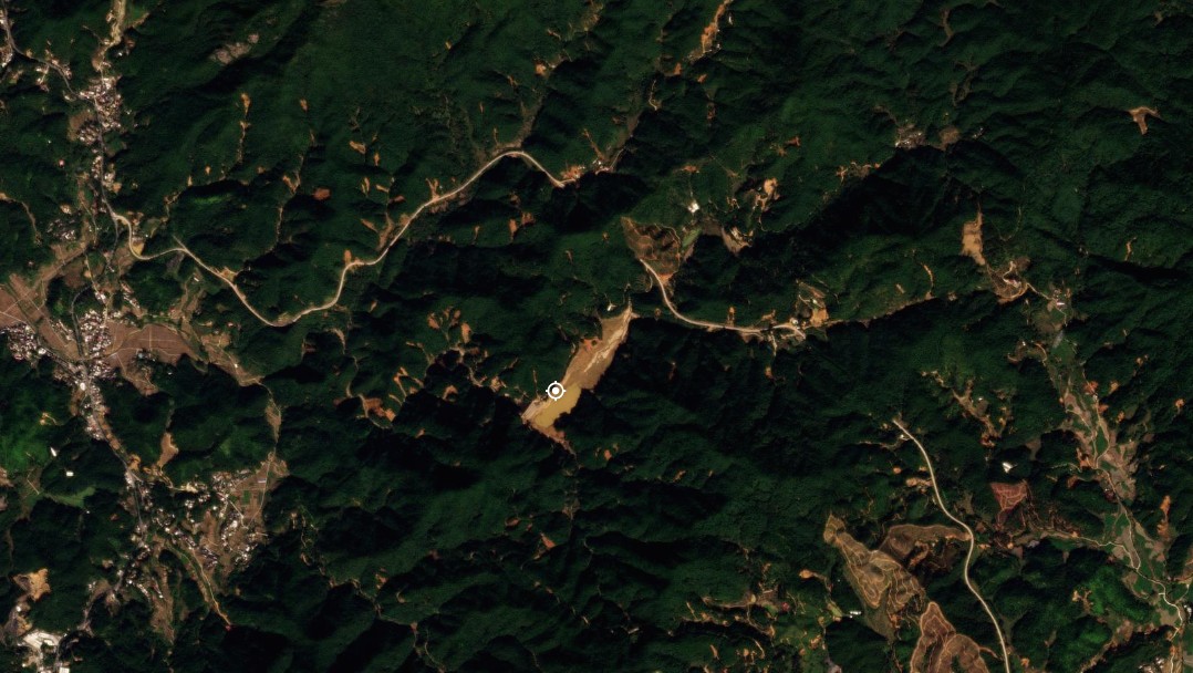
The 16 June 2024 landslide cluster in Wuping County, Fujian Province, China
Six people were killed when intense rainfall triggered over 6,500 landslides On 16 June 2024, an extreme rainfall event triggered a dense cluster of landslides and channelised debris flows in Wuping County, Fujian Province, China. This is one of many such events in recent years – anecdotally at least, these events are becoming more common […]