Some excellent before and after imagery is now available showing the evolution of the Matai’an landslide dam.

The active GIS/spatial analysis community in Taiwan has produced some fascinating analysis of the Matai’an landslide. Much of this has been posted to Facebook (which is not my favourite platform, but sometimes you have to go where the information resides).
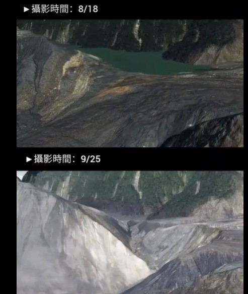
Tony Lee has produced an incredibly interesting comparison of the dam before and after the overtopping and breach event, based upon imagery captured before the event on 18 August and after the event on 25 September. Unfortunately, WordPress really doesn’t like Facebook embeds, so you’ll need to follow this link:
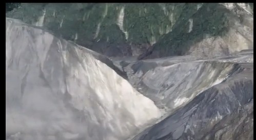
This is a still from the video:-
The depth and scale of the incision is very clear – the flow clearly rapidly cut into and eroded into the debris. It has left very steep slopes on both sides in weak and poorly consolidated materials.
So, a very interesting question will now pertain to the stability of these slopes. How will they perform in conditions of intense rainfall and/or earthquake shaking? Is there the potential for a substantial slope failure on either side, allowing a new (enlarged) lake to form.
This will need active monitoring (InSAR may well be ideal). The potential problems associated with the Matai’an landslide are most certainly not over yet.