Fieldwork is a fundamental part of the geosciences, and there is a longstanding tradition of teaching field methods as part of the undergraduate curriculum. As the geosciences have become increasingly reliant on technology to acquire data for research, educators are expressing a growing interest in introducing these technologies into field education curricula.
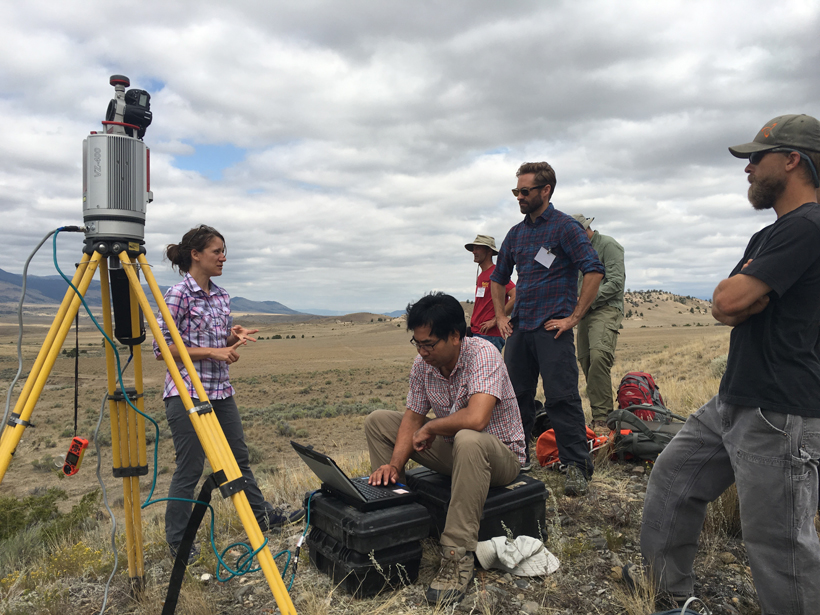
A short course last August at the Indiana University Judson Mead Geologic Field Station in Montana brought together 21 geoscience field instructors to learn about incorporating terrestrial laser scanning (TLS; sometimes called ground-based lidar) and structure from motion (SfM) photogrammetry into geoscience courses with field components. Both methods can be used to generate high-resolution, three-dimensional topographic models that can be applied to hazard assessment, geomorphic change detection, and stratigraphic sequence analysis, to cite a few examples.
The workshop was built around the learning module “Analyzing High Resolution Topography with TLS and SfM,” the first published component of the Geodesy Tools for Societal Issues (GETSI) Field Collection. This module teaches students to design and execute surveys that answer geoscience questions of societal importance. Instructors can choose to use either TLS or SfM or both methods in their courses. Both techniques have advantages and disadvantages, depending on what equipment the instructor has available and the type of geological problem being investigated. Fundamentally, both techniques produce similar point cloud data sets that can be used in analysis. Also, both methods require students to learn and use new quantitative skills.
During the workshop, the field instructor participants completed the basics of the two methods, just as their students would. For example, above is an animation of an SfM scan of workshop participants, and below is a similar animation using a TLS scan. Note how both techniques resolve detailed features.
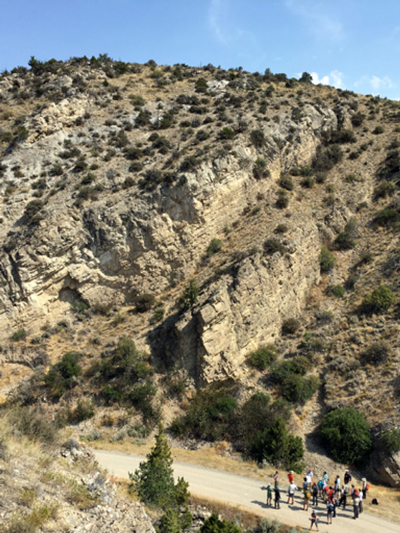
After introductory lectures on the survey methods, most of the first 2 days was spent in the field applying and practicing the survey methods at different field sites. During the latter part of each day, participants learned how to process data to generate point clouds and derive digital topographic models. The final day was devoted to further work on data analysis for different field applications, discussing and planning potential integration into courses, and becoming more familiar with the learning module components.
Participants gave positive feedback; survey results showed that many of them intended to use the teaching resources in summer field camps and academic courses with field elements during the coming year.
The “Analyzing High Resolution Topography” module contains five units. Unit 1 is an introduction to TLS and SfM survey methods. Units 2–4 are each tailored to different scientific applications: Instructors can choose to implement one unit or all three, depending on the aims of the course. The featured applications are sedimentology/stratigraphy, fault scarp analysis, and geomorphic change detection. Unit 5 is a summative assessment of student learning. For courses in which students are unable to collect data in the field, the module also provides prepared data sets.
The teaching module development has been a long-term collaboration between Indiana University and UNAVCO, which runs the National Science Foundation’s (NSF) Geodesy Advancing Geosciences and EarthScope (GAGE) Facility. Funding came from NSF through a supplement to the GAGE Facility (EAR-1261833) and the Improving Undergraduate STEM Education collaborative project to UNAVCO, Indiana University, and Idaho State University (EHR-1612248).
—Beth Pratt-Sitaula (email: [email protected]), Education and Community Engagement, UNAVCO, Boulder, Colo.; Benjamin Crosby, Department of Geosciences, Idaho State University, Pocatello; and Christopher Crosby, Geodetic Imaging, UNAVCO, Boulder, Colo.
Citation:
Pratt-Sitaula, B., B. Crosby, and C. Crosby (2017), Integrating topographic imaging into geoscience field courses, Eos, 98, https://doi.org/10.1029/2017EO067411. Published on 07 February 2017.
Text © 2017. The authors. CC BY-NC-ND 3.0
Except where otherwise noted, images are subject to copyright. Any reuse without express permission from the copyright owner is prohibited.