
Last weekend, NASA successfully launched the first of a constellation of powerful weather-monitoring satellites tasked with improving weather forecasts and helping meteorologists track dangerous storms like tornadoes and hurricanes.
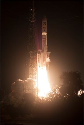
The Geostationary Operational Environmental Satellite-R (GOES-R) lifted off from Cape Canaveral Air Force Station in Florida at 6:42 p.m. Eastern Standard Time on 19 November. In 2 weeks, the highly advanced satellite will situate into a geostationary orbit more than 35,000 kilometers above the surface. This means it will orbit at the same speed as Earth is rotating.
“GOES-R is one of the most sophisticated Earth-observing platforms ever devised,” said Kathryn Sullivan, administrator of the National Oceanic and Atmospheric Administration (NOAA), the agency that developed and operates the GOES series of satellites. “GOES-R’s instruments will be capable of scanning the planet 5 times faster and with 4 times more resolution than any other satellite in our fleet. With these new instruments and powerful new capabilities, GOES-R will strengthen NOAA’s ability to issue life-saving forecasts and warnings and make the United States an even stronger, more resilient weather-ready nation.”
Weather-Tracking Technology
Six new instruments aboard the satellites will provide better weather forecasting than ever before, according to NOAA. The Advanced Baseline Imager, which is GOES-R’s primary instrument for imaging the planet’s weather and oceans, will provide images every 30 seconds, allowing for nearly real time weather forecasting. To compare, the current GOES satellites generate images every 30 minutes.
Another instrument, the Geostationary Lightning Mapper, will help meteorologists forecast storms. The first-of-its-kind lightning mapper measures total lightning activity continuously over North and South America and nearby ocean areas, collecting data on frequency and location of lightning activity. These data will help storm watchers predict where extreme weather events like tornadoes may form before damaging winds have a chance to develop. Check out this video to learn more about the lightning mapper.
Additionally, the GOES-R satellites will monitor space weather, which can be a significant threat to telecommunications and power grids on Earth. The instrument will be able to “see features on the Sun that contribute to space weather and measure the space weather changes directly,” Mark Moldwin, a space physicist at the University of Michigan in Ann Arbor, told Eos.
Coupling weather observations of both Earth and space in one class of satellites is a first, allowing the satellites to “give better insights to understand geomagnetic storms and ground-induced currents that can impact the power grid,” he added.
GOES-R is the first of the new four-satellite constellation that is expected to be operational through 2036. The remaining three satellites of the series, S, T, and U, are progressing through various stages of being built, refined, and prepared for their future launches.
—JoAnna Wendel (@JoAnnaScience), Staff Writer
Citation:
Wendel, J. (2016), First of next generation of U.S. weather satellites hits the sky, Eos, 97, https://doi.org/10.1029/2016EO063423. Published on 23 November 2016.
Text © 2016. The authors. CC BY-NC-ND 3.0
Except where otherwise noted, images are subject to copyright. Any reuse without express permission from the copyright owner is prohibited.