• About
  • Sections
  • Topics
    • Climate
    • Earth Science
    • Oceans
    • Space & Planets
    • Health & Ecosystems
    • Culture & Policy
    • Education & Careers
    • Opinions
  • Projects
    • ENGAGE
    • Editors’ Highlights
    • Editors’ Vox
    • Eos en Español
    • Eos 简体中文版
    • Print Archive
  • Blogs
    • Research & Developments
    • The Landslide Blog
  • Newsletter
  • Submit to Eos
  • AGU.org
  • Career Center
  • Join AGU
  • Give to AGU
  • About
  • Sections
  • Topics
    • Climate
    • Earth Science
    • Oceans
    • Space & Planets
    • Health & Ecosystems
    • Culture & Policy
    • Education & Careers
    • Opinions
  • Projects
    • ENGAGE
    • Editors’ Highlights
    • Editors’ Vox
    • Eos en Español
    • Eos 简体中文版
    • Print Archive
  • Blogs
    • Research & Developments
    • The Landslide Blog
  • Newsletter
  • Submit to Eos
Skip to content
  • AGU.org
  • Career Center
  • Join AGU
  • Give to AGU
Eos

Eos

Science News by AGU

Support Eos
Sign Up for Newsletter
  • About
  • Sections
  • Topics
    • Climate
    • Earth Science
    • Oceans
    • Space & Planets
    • Health & Ecosystems
    • Culture & Policy
    • Education & Careers
    • Opinions
  • Projects
    • ENGAGE
    • Editors’ Highlights
    • Editors’ Vox
    • Eos en Español
    • Eos 简体中文版
    • Print Archive
  • Blogs
    • Research & Developments
    • The Landslide Blog
  • Newsletter
  • Submit to Eos

I. Overeem

This aerial photo taken over Alaska shows one of the ways that thawing permafrost reshapes the landscape.
Posted inScience Updates

A Modeling Toolbox for Permafrost Landscapes

by I. Overeem, E. Jafarov, K. Wang, K. Schaefer, S. Stewart, G. Clow, M. Piper and Y. Elshorbany 28 September 20188 November 2021

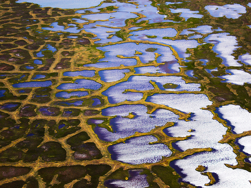
A new resource makes it easier for researchers to explore predictions of how melting permafrost might affect carbon release, wetlands, and river deltas as they evolve and other interacting effects.

The Limpopo River in Mozambique, which can pose a threat to human infrastructure when floodwaters rise
Posted inScience Updates

Can We Build Useful Models of Future Risk from Natural Hazards?

by A. J. Kettner, I. Overeem and G. Tucker 10 September 201812 December 2022

Geoprocesses, Geohazards—CSDMS 2018: A CSDMS hosted Workshop; Boulder, Colorado, 22–24 May 2018

A view of a Washington, D.C., skyline from the Potomac River at night. The Lincoln Memorial (at left) and the Washington Monument (at right) are lit against a purple sky. Over the water of the Potomac appear the text “#AGU24 coverage from Eos.”

Features from AGU Publications

Research Spotlights

How Greenland’s Glacial Troughs Influence Ocean Circulation

29 May 202529 May 2025
Editors' Highlights

Seasonal Iron Cycle and Production in the Subantarctic Southern Ocean

29 May 202529 May 2025
Editors' Vox

Keeping Soil Healthy: Why It Matters and How Science Can Help

29 May 202529 May 2025
Eos logo at left; AGU logo at right

About Eos
ENGAGE
Awards
Contact

Advertise
Submit
Career Center
Sitemap

© 2025 American Geophysical Union. All rights reserved Powered by Newspack