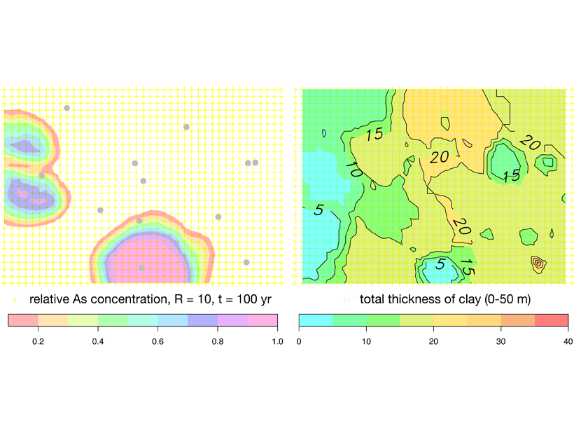
Inhabitants of Bangladesh have deepened drinking water wells to avoid extracting arsenic-rich groundwater from shallow aquifers, but these may not be free from pollution either.
Marc F. P. Bierkens
Editor, Water Resources Research
Posted inEditors' Highlights
Reconstructing Natural Streamflow at Unprecedented Resolution
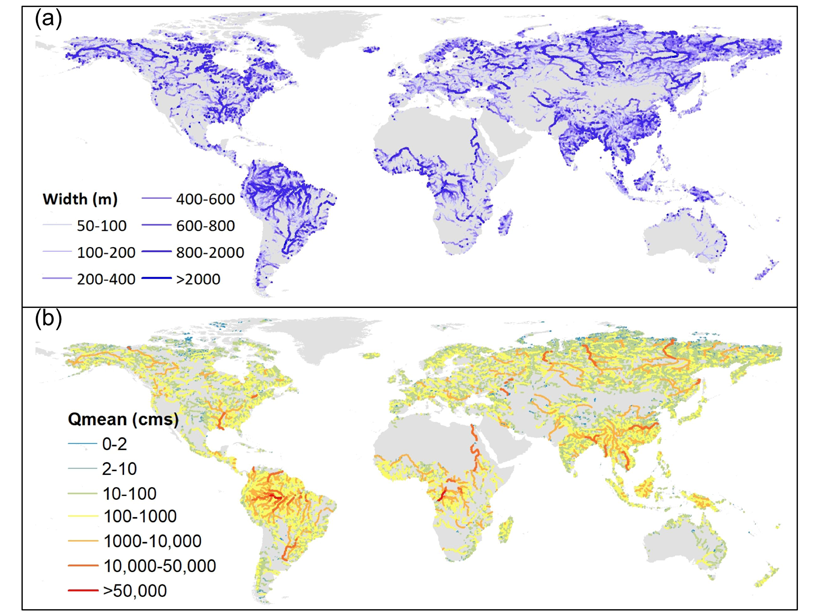
A new research effort has mapped 35 years of naturalized streamflow for 2.94 million river reaches worldwide: an invaluable dataset for hydrology, biogeochemistry, ecology, and remote sensing.
Posted inEditors' Highlights
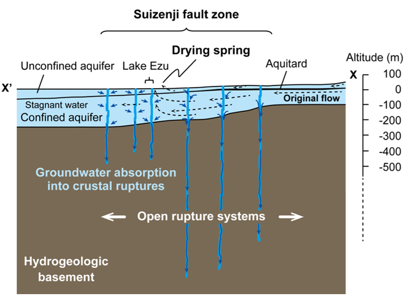
Groundwater Drawn Downward After Kumamoto Quake
A unique set of high-frequency groundwater level monitoring reveals a loss of approximately ten million cubic meters of groundwater after a major earthquake.
Posted inEditors' Highlights
Calibrating Hydrological Models by Satellite
Hydrological models are usually calibrated using observations of streamflow, but a new method uses remotely sensed land surface temperature for this purpose.
Posted inEditors' Highlights
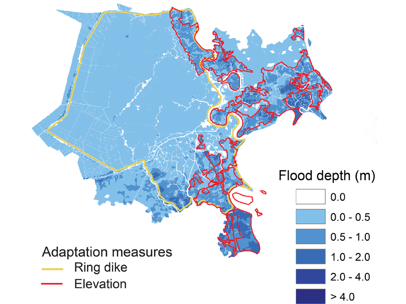
A City’s Challenge of Dealing with Sea Level Rise
A well-developed case study in Ho-Chi Min City, Vietnam, exemplifies how other mega-cities located on deltas could face the major challenge of adapting to rising sea-level.