Source: Water Resources Research
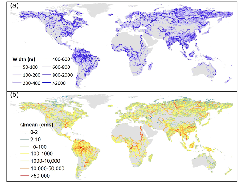
Knowing streamflow up to the smallest tributary is important for the understanding the global water cycle, the role of freshwater systems in nutrient and carbon cycling, and how water depths and velocities impact freshwater biodiversity. However, until now, streamflow was only available at resolutions coarser than 10 kilometers using global hydrological models or as observations at points.
A group of hydrologists from the United States, China, and Japan used a combination of hydrological modeling, over 14,000 streamflow observations, machine learning, and a new bias-correction method to estimate natural streamflow (without impacts of dams and water use) for over 2.94 million individual river reaches worldwide.
Lin et al. [2019] is not only an important resource for hydrological, biogeochemical and ecological research, but this dataset will also serve as a much-needed benchmark for estimating streamflow from space with the upcoming Surface Water and Ocean Topography (SWOT) mission.
Citation: Lin, P., Pan, M., Beck, H. E., Yang, Y., Yamazaki, D., Frasson, R., et al. [2019]. Global reconstruction of naturalized river flows at 2.94 million reaches. Water Resources Research, 55. https://doi.org/10.1029/2019WR025287
—Marc F. P. Bierkens, Editor, Water Resources Research
Text © 2019. The authors. CC BY-NC-ND 3.0
Except where otherwise noted, images are subject to copyright. Any reuse without express permission from the copyright owner is prohibited.