• About
  • Special Reports
  • Topics
    • Climate
    • Earth Science
    • Oceans
    • Space & Planets
    • Health & Ecosystems
    • Culture & Policy
    • Education & Careers
    • Opinions
  • Projects
    • ENGAGE
    • Third Pod from the Sun
    • Eos en Español
    • Eos 简体中文版
    • Print Archive
  • Newsletter
  • Submit to Eos
  • AGU.org
  • AGU Publications
    • AGU Journals
    • Editors’ Highlights
    • Editors’ Vox
  • Career Center
  • AGU Blogs
  • Join AGU
  • Give to AGU
  • About
  • Special Reports
  • Topics
    • Climate
    • Earth Science
    • Oceans
    • Space & Planets
    • Health & Ecosystems
    • Culture & Policy
    • Education & Careers
    • Opinions
  • Projects
    • ENGAGE
    • Third Pod from the Sun
    • Eos en Español
    • Eos 简体中文版
    • Print Archive
  • Newsletter
  • Submit to Eos
Skip to content
  • AGU.org
  • AGU Publications
    • AGU Journals
    • Editors’ Highlights
    • Editors’ Vox
  • Career Center
  • AGU Blogs
  • Join AGU
  • Give to AGU
Eos

Eos

Science News by AGU

Sign Up for Newsletter
  • About
  • Special Reports
  • Topics
    • Climate
    • Earth Science
    • Oceans
    • Space & Planets
    • Health & Ecosystems
    • Culture & Policy
    • Education & Careers
    • Opinions
  • Projects
    • ENGAGE
    • Third Pod from the Sun
    • Eos en Español
    • Eos 简体中文版
    • Print Archive
  • Newsletter
  • Submit to Eos

M. Wang

ORCID: 0000-0001-7019-3125

A true-color satellite image of the Gulf of Mexico on 17 July 2019
Posted inScience Updates

Filling the Gaps in Ocean Maps

by X. Liu and M. Wang 21 November 20199 February 2022

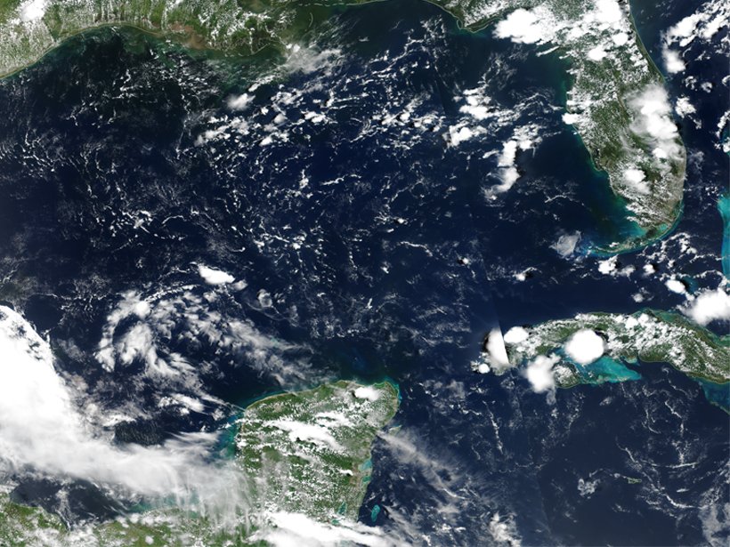
A new software application merges ocean color data from instruments aboard two satellites to provide gap-free, near-real-time monitoring of the global ocean environment.

Secchi reading by Tim Plude on Wisconsin’s Lake Tomahawk, October 2012.
Posted inOpinions

Global Water Clarity: Continuing a Century-Long Monitoring

by Z. Lee, R. Arnone, D. Boyce, B. Franz, S. Greb, C. Hu, S. Lavender, M. Lewis, B. Schaeffer, S. Shang, M. Wang, M. Wernand and C. Wilson 7 May 201814 February 2023

An approach that combines field observations and satellite inferences of Secchi depth could transform how we assess water clarity across the globe and pinpoint key changes over the past century.

Satellite image of an algae bloom near the Falkland Islands, one example of ocean color imagery that OCView can interpret.
Posted inScience Updates

Interactive Online Maps Make Satellite Ocean Data Accessible

by K. Mikelsons and M. Wang 1 May 201822 October 2021

A new online resource from the National Oceanic and Atmospheric Administration provides an interactive view of global satellite ocean color and true-color imagery.

Features from AGU Journals

RESEARCH SPOTLIGHTS
Geophysical Research Letters
“Neural Networks Map the Ebb and Flow of Tiny Ponds”
By Sarah Derouin

EDITORS' HIGHLIGHTS
Community Science
“Collaboration Helps Overcome Challenges in Air Quality Monitoring”
By Muki Haklay

EDITORS' VOX
Reviews of Geophysics
“What We Know and Don’t Know About Climate Tipping Elements”
By Seaver Wang

Eos logo at left; AGU logo at right

About Eos
ENGAGE
Awards
Contact

Advertise
Submit
Career Center
Sitemap

© 2023 American Geophysical Union. All rights reserved. Proudly powered by Newspack by Automattic