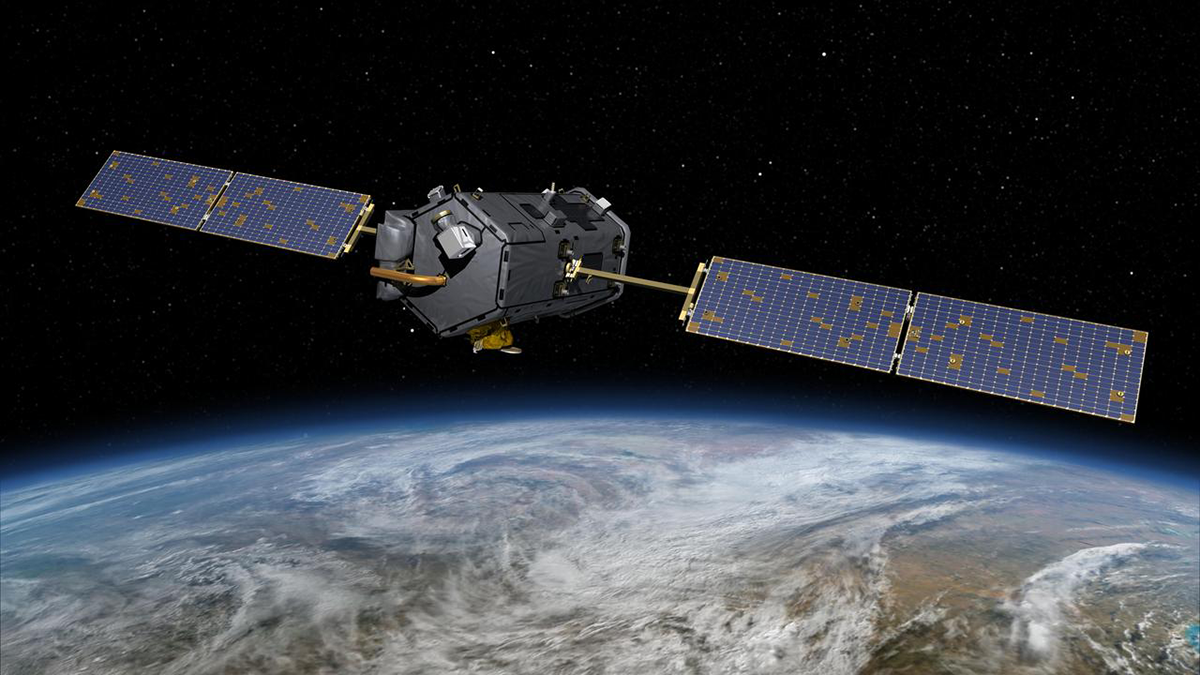
NASA’s Orbiting Carbon Observatory-2 satellite reveals an impressively dynamic picture of the Earth’s carbon cycle, yet it may be prematurely decommissioned and destroyed due to budget cuts.
Editors’ Highlights
Posted inEditors' Highlights
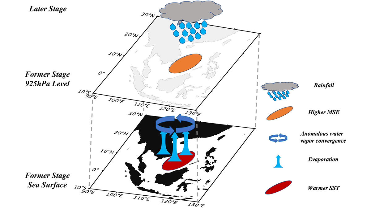
Marine Heatwaves Reshape Precipitation Patterns
Most marine heatwaves experience reduced precipitation throughout their lifetime, but warmer events in the early stage can trigger increased precipitation after reaching peak intensity, causing faster decay.
Posted inEditors' Highlights
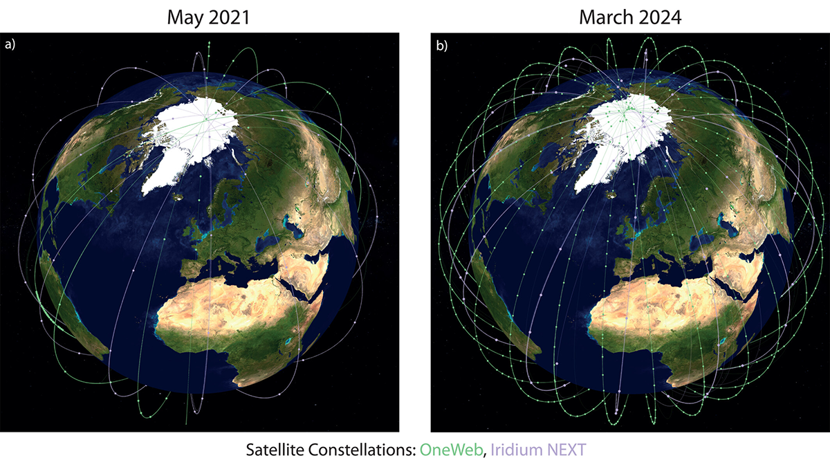
Space Weather Monitoring from Commercial Satellite Mega-Constellations
Enabling unprecedented monitoring of key electric current systems in low-Earth orbit using commercial satellite mega-constellations advances space weather monitoring.
Posted inEditors' Highlights
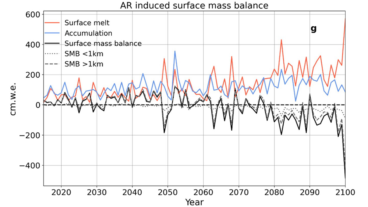
Atmospheric Rivers Shaped Greenland’s Ancient Ice
New simulations reveal how atmospheric rivers influenced Greenland’s ice sheet during the Last Interglacial—offering clues to future melt in a warming world.
Posted inEditors' Highlights
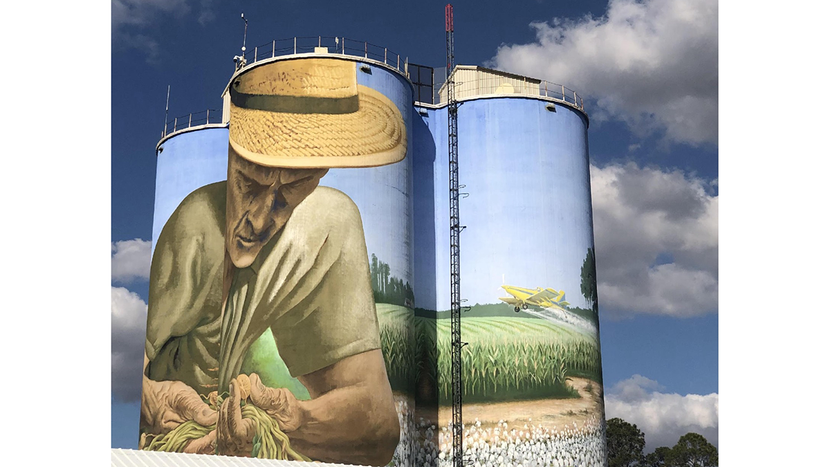
Voicing Farmers’ Concerns on the Future of Agriculture
A new study explores the deep, multi-faceted concerns of small- and mid-scale farmers about the direction of farming and food systems in the United States.
Posted inEditors' Highlights
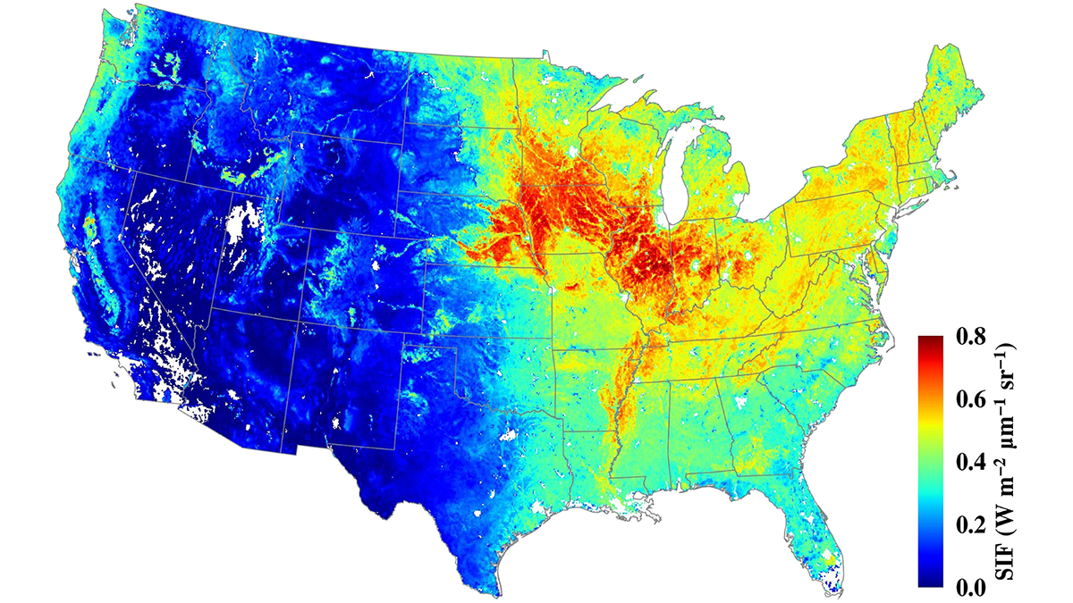
Serendipity in Space: NASA’s Eye in the Sky
The Orbiting Carbon Observatory-2 (OCO-2) mission, proposed for early termination, has turned out to be a boon to forest and agricultural management.

Posted inEditors' Highlights
Rising Temperature and Decreasing Snow Cover Increase Soil Breakdown
With climate change and rising temperatures, soil freeze-thaw – which is in turn causing soil breakdown – may counterintuitively increase in the hillslopes where snow cover is decreasing.

Posted inEditors' Highlights
Beavers are Not Concerned About Groundwater
But, scientists are! A new study illuminates the complex interactions of beaver dam induced ponding and floodplain inundation with shallow groundwater storage and flow patterns.
Posted inEditors' Highlights
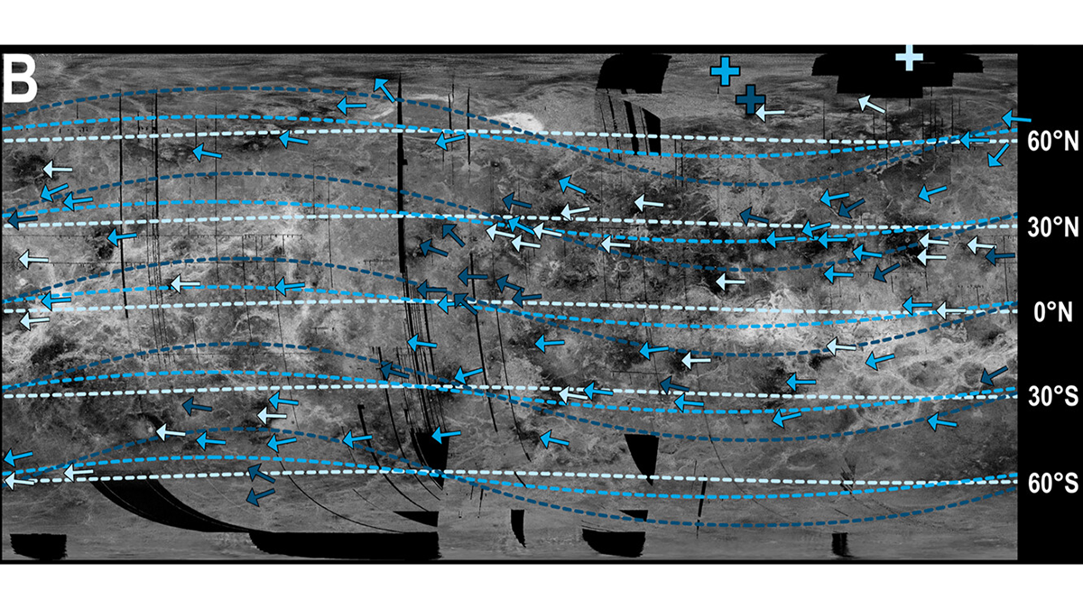
New Evidence for a Wobbly Venus?
The orientation of wind-blown impact deposits on Venus is not consistent with modeled wind directions, suggesting Venus’s rotation axis may have changed.
Posted inEditors' Highlights
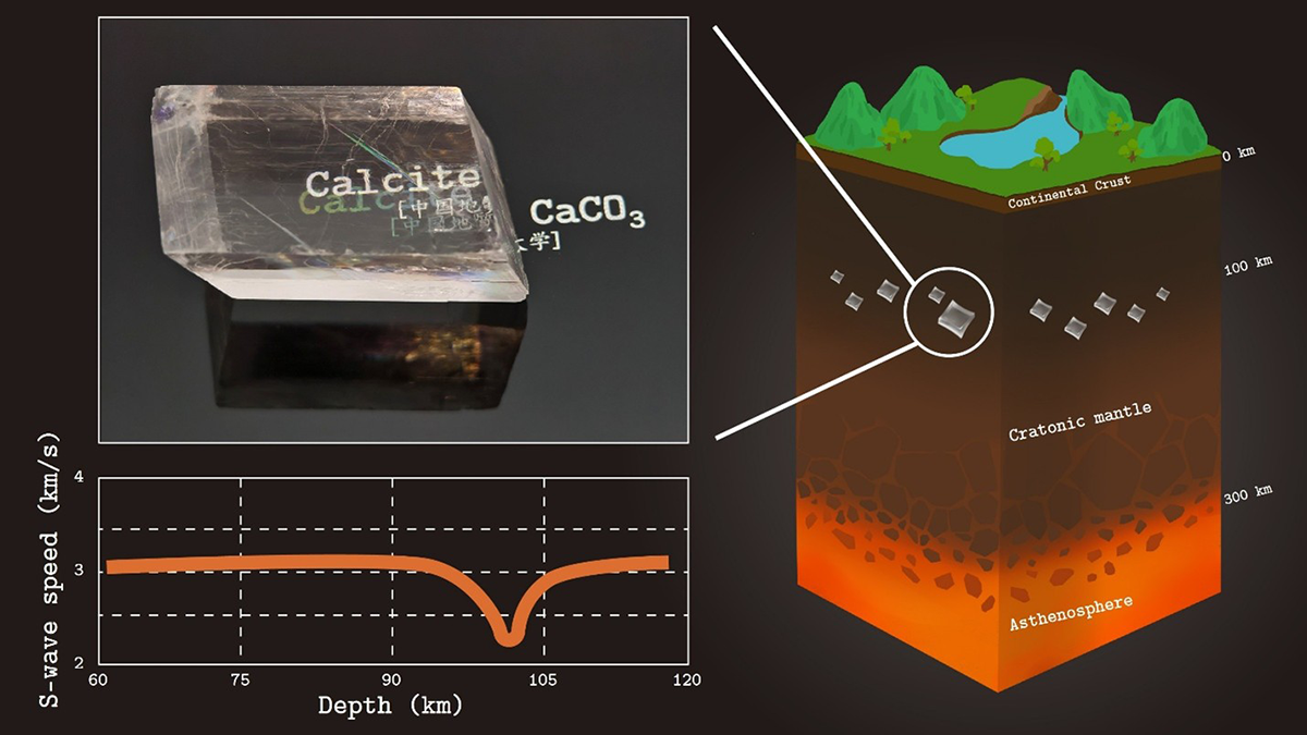
Unexpected Carbonate Phase Revealed by Advanced Simulations
Advanced simulations reveal a new calcium carbonate phase whose unusual elastic behavior may explain puzzling seismic and electrical anomalies beneath ancient continents.