Rates of continental-scale sediment flux and denudation are similar between glacial and interglacial periods when the aggradation of glacier-eroded sediment inhibits fluvial erosion downstream.
Editors’ Highlights
Posted inEditors' Highlights
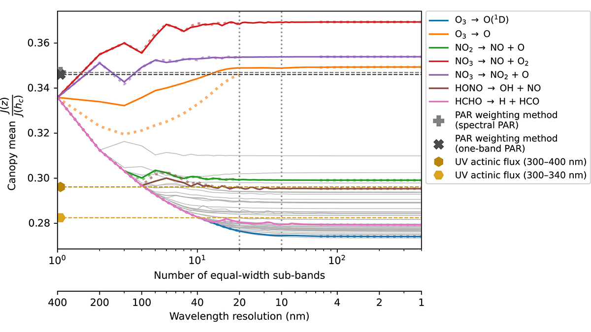
Spectral Solar Radiative Transfer in Plant Canopies
Spectrally resolved radiative transfer is needed to compute reliable estimates of sunlight transmission and photolysis of molecules within plant canopies.
Posted inEditors' Highlights
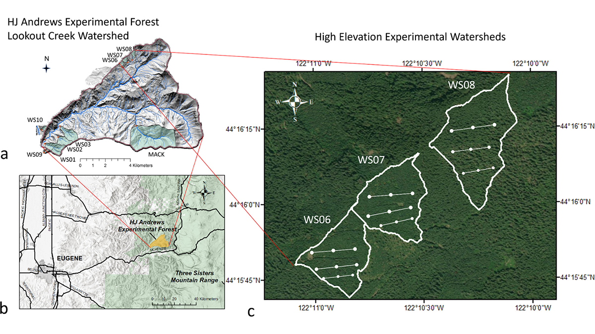
Understanding Carbon-Water Tradeoffs in Pacific Northwest Forests
A new study documents how spruce forests differing in management and age structure influence individual tree growth, carbon stocks, and landscape-water balance in the Pacific Northwest.

Posted inEditors' Highlights
Fixing Pollution from Space Needs Global Coordination
Remote sensing is a tool of choice for monitoring regions for air pollution, but the scale of the problem requires extending geostationary soundings globally.
Posted inEditors' Highlights
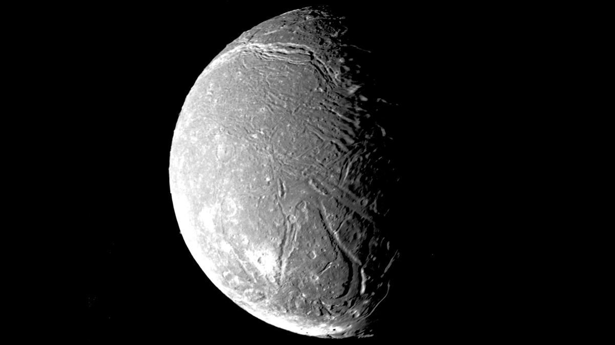
Investigating Origins of CO2 Ice on Uranian Moons
A new study investigates the role of volatile migration in the unique Uranian thermal environment.
Posted inEditors' Highlights
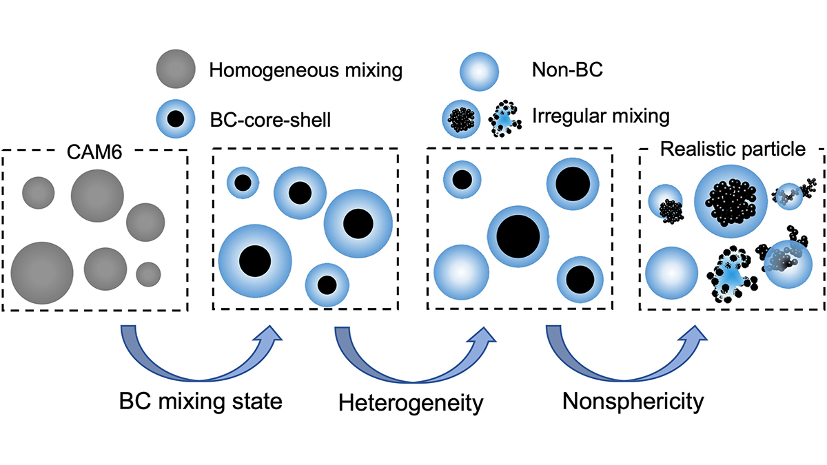
Improving Climate Models: Black Carbon Mixing and Shape Effects
A new study introduces a parameterization scheme to capture the complex optical properties of atmospheric black carbon, accounting for its mixing state, nonsphericity, and heterogeneous coatings.
Posted inEditors' Highlights
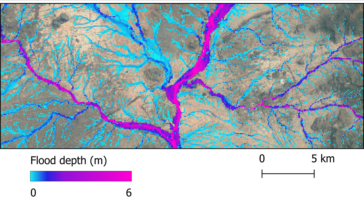
Future Global Flood Hazards at Unprecedented Accuracy
A global flood hazard map at 30-meter resolution is constructed using latest hydrology, topography, and climate data, and its accuracy is approaching that of local to regional scale flood inundation maps.

Posted inEditors' Highlights
Using Satellite Data to Estimate Atmospheric CO2 Growth Rates
A new method improves growth rate estimates of carbon dioxide increase in the atmosphere by combining the standard NOAA approach with satellite data.
Posted inEditors' Highlights
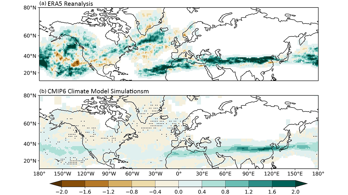
Past and Future Changes in Atmospheric Clear-Air Turbulence
A new study evaluates long-term changes in atmospheric clear-air turbulence based on meteorological reanalysis and climate model simulations.
Posted inEditors' Highlights
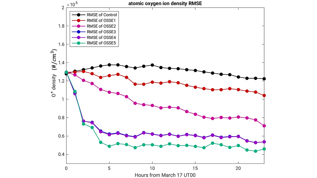
Impact of NASA’s GDC Measurements on Predicting Earth’s Upper Atmosphere
A new study finds that assimilating observations of the ionosphere and thermosphere reduces the error in model predictions more than modeling either one individually.