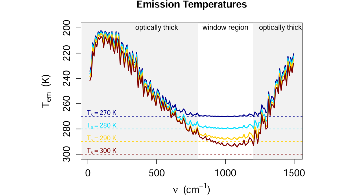
The choice of a fixed relative humidity leads to a simpler picture of climate feedbacks than fixing absolute humidity.
Editors’ Highlights
Posted inEditors' Highlights
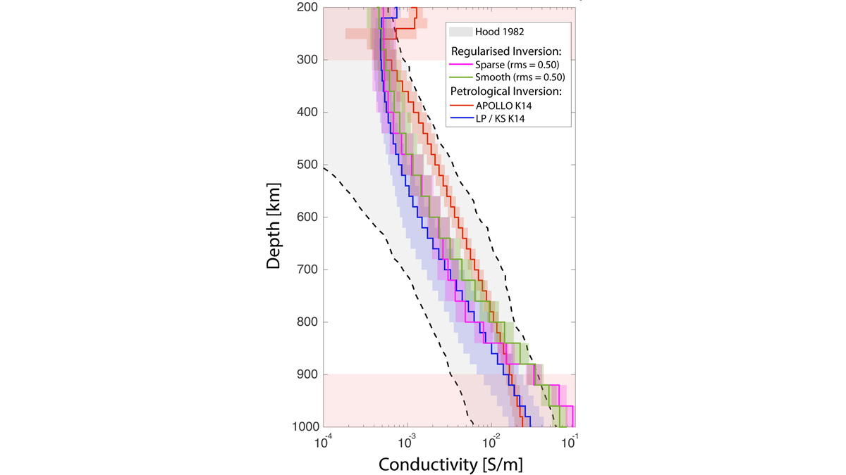
A Better Look at the Moon’s Middle Mantle
A new analysis strategy sheds new light on the electrical conductivity of the lunar mantle between 300 and 900 km depth.
Posted inEditors' Highlights
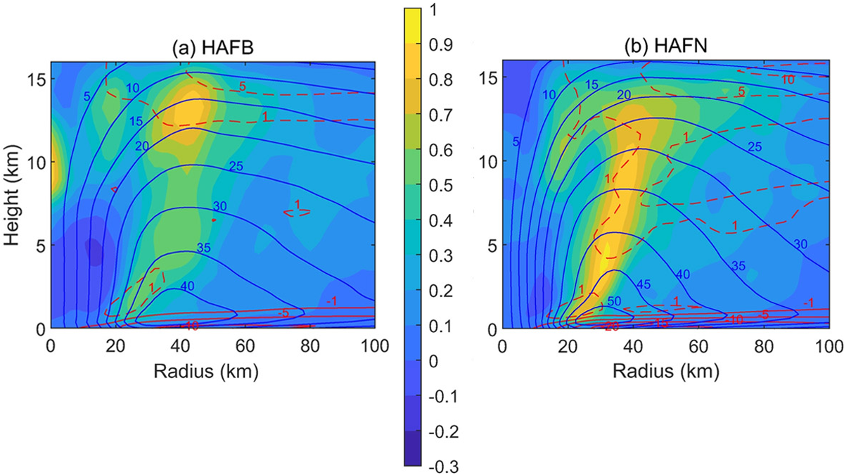
Hurricane Forecast Improvement with Better Turbulent Processes
A new look at turbulent processes has improved the prediction of hurricane rapid intensification by properly accounting for the unique environment of a hurricane eyewall.
Posted inEditors' Highlights
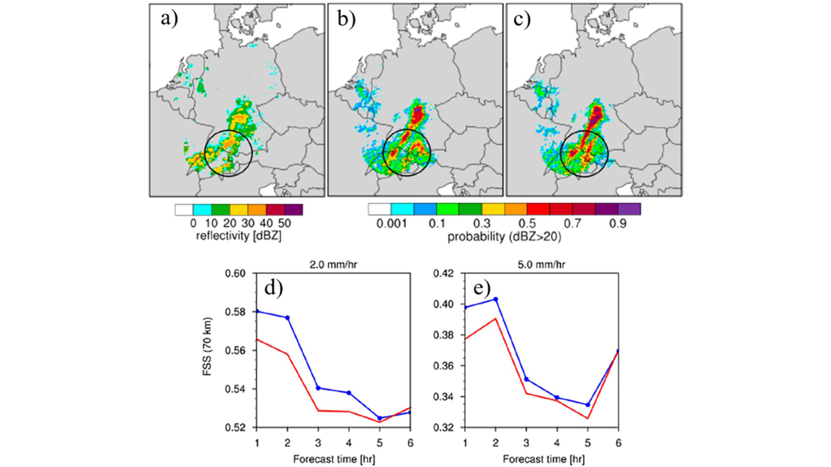
A New Way to Represent Microphysical Uncertainty
A new way of representing microphysical uncertainty in convective-scale data assimilation reduces biases in model states and improves the accuracy of short-term precipitation forecasts.
Posted inEditors' Highlights
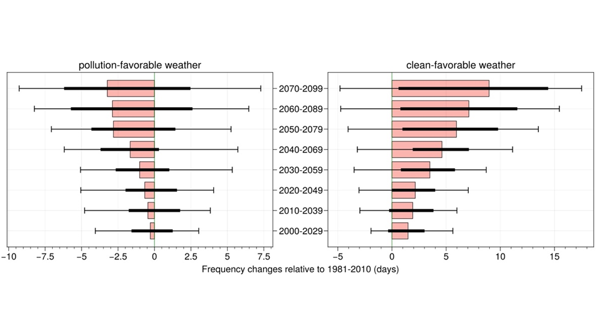
Reduced Winter PM2.5 in Northern India Under Global Warming
Global warming is projected to alleviate PM2.5 pollution in Delhi by decreasing pollution-favorable weather days and increasing clean-favorable weather days.
Posted inEditors' Highlights
Finding the Right Words: A Common Language for Data Deposition
Discovering climate signals in the archives: how using a common language for data deposition ensures your data are found, understood and cited.

Posted inEditors' Highlights
ICESat-2 Adds Estimates of Sea Level Trends to Accomplishments
The high spatial resolution and high orbit of ICESat-2 make it suited for measuring sea level close to the coast and in the polar regions, filling a gap in our sea level observational system.
Posted inEditors' Highlights
Importance of High Clouds and Moisture in Rainstorm Aggregation
A study of the impacts of radiative interactions with different cloud types on aggregation of rainstorms finds that interactions with high-clouds and water vapor are key.

Posted inEditors' Highlights
AeroCom Models Improved with Aerosol and Albedo Constraints
Satellite data has been used to correct the aerosol loading and land surface albedo in several AeroCom models, which has improved shortwave flux biases between models and observations.
Posted inEditors' Highlights
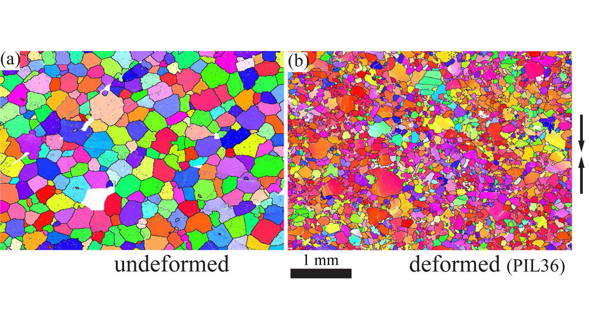
Ice on a Deadline: More Stress Makes Ice Move Faster
Anyone seeing photographs of glacier and ice sheets from above clearly sees that they flow; recent laboratory tests on ice further reveal the conditions that control just how fast this happens.