
For the first time, simultaneous measurements of upper atmosphere temperatures over altitudes 80 to 110 kilometers have been made by two complementary lidar techniques.
CC BY-NC-ND 2018

Posted inNews
How Old Is the Mekong River Valley?
Granite samples collected from the Mekong River Valley reveal that the river’s path was incised roughly 17 million years ago, most likely by increased erosion from monsoon precipitation.
Posted inResearch Spotlights
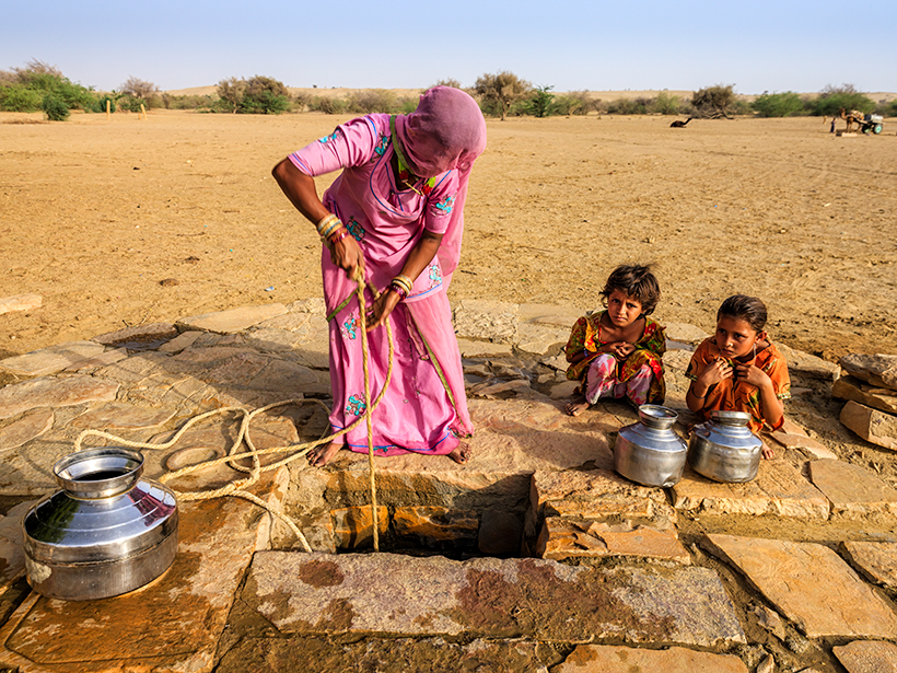
A Closer Look at the Sustainability of Our Groundwater Aquifers
Researchers use a new approach to assessing the world’s largest aquifers in hopes of improving groundwater management during drought periods.

Posted inNews
U.S. Mint Unveils Design for Special Apollo 11 Coin
The showcase of a commemorative coin kicks off national celebrations of the Apollo anniversaries.
Posted inEditors' Highlights
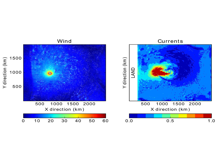
Can Coastal Surface Currents Improve Hurricane Forecasts?
An idealized model explores whether hurricane intensity forecasts could potentially be improved by incorporating coastal surface currents data.
Posted inNews
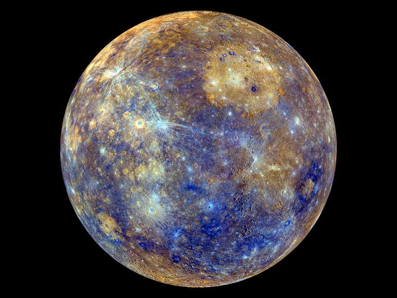
Mercury Mission Will Map Morphology and Measure Magnetics
BepiColombo may launch as early as this weekend. It seeks to unravel the mysteries of Mercury’s geologic and magnetic past and map the small planet’s cratered surface.

Posted inFeatures
Making Sense of Landslide Danger After Kerala’s Floods
Scientists traveled to Kerala, a state in India recently devastated by severe monsoon rains. They found a vulnerable population that will soon face fresh landslide risks as a new monsoon approaches.
Posted inEditors' Vox
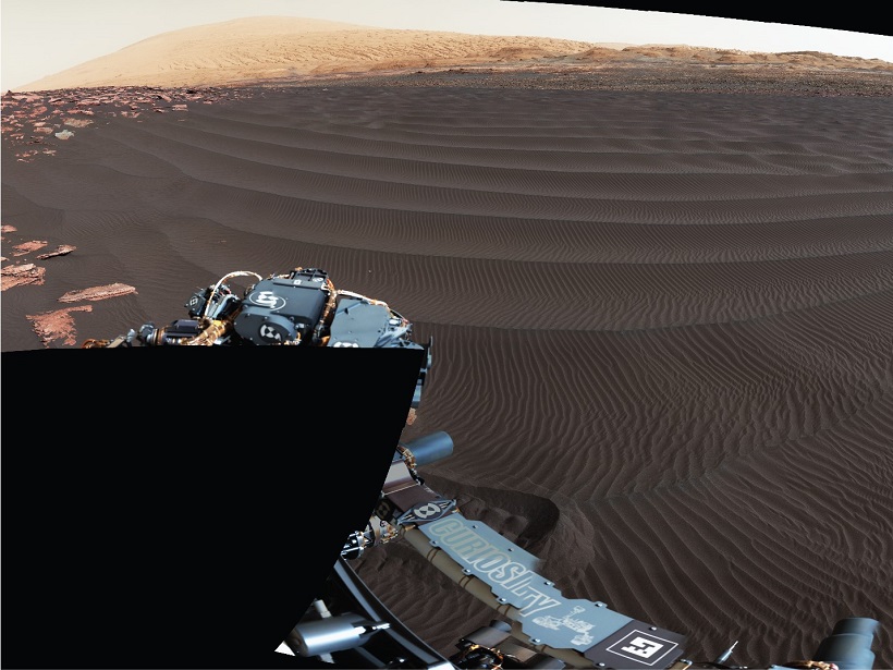
Seeing Mars in a Grain of Sand
The second phase of Curiosity’s campaign at the Bagnold Dunes brought new observations of windblown sands during Mars’s windy season.

Posted inEditors' Highlights
Energetic Electrons Can Penetrate the Stratosphere
Precipitations of electrons with energies greater than 30 kiloelectron volts from the slot region penetrate at low altitude and can contribute to destroy ozone.

Posted inGeoFIZZ
Can You Express Your Science in 17 Syllables?
Researchers are taking to Twitter to tell the world about their research through the lines of haiku. Now it’s your turn!