Source: Geophysical Research Letters
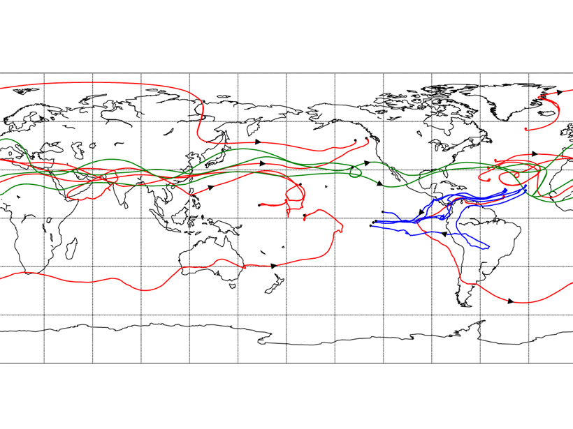
In the present-day climate, the Atlantic is saltier than the Pacific because more freshwater is exported from the Atlantic to the Pacific than the other way around. The difference in salinity between the two ocean basins shapes the deep overturning circulation of the ocean, which is associated with differences in buoyancy, or density, determined by temperature and salinity.
Because the Atlantic is saltier, deep convective sinking occurs in the North Atlantic, and the loop described as a “conveyor belt” is closed by slow upwelling in the North Pacific. Previous studies highlighted the tropical pathway for freshwater transport from the Atlantic to the Pacific: easterly winds, that is, winds blowing humidity from the east across Central America. However, using a Lagrangian model, Dey and Döös [2020] show that westerly winds, which prevail in mid-latitudes and blow across Eurasia, actually contribute about 60 percent of transport, significantly more than previously thought.
Citation: Dey, D., & Döös, K. [2020]. Atmospheric freshwater transport from the Atlantic to the Pacific Ocean: A Lagrangian analysis. Geophysical Research Letters, 47, e2019GL086176. https://doi.org/10.1029/2019GL086176
—Alessandra Giannini, Editor, Geophysical Research Letters
Text © 2020. The authors. CC BY-NC-ND 3.0
Except where otherwise noted, images are subject to copyright. Any reuse without express permission from the copyright owner is prohibited.