
一项新研究有助于我们更清晰地了解太阳活动影响天气的机制。
Geophysical Research Letters
Posted inResearch Spotlights
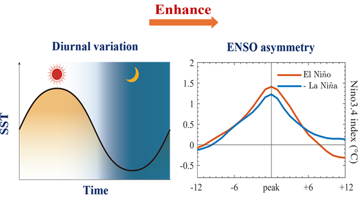
El Niño Warming Is Stronger Than La Niña Cooling. What’s the Right Way to Model This Asymmetry?
A new study looks at daily swings in sea surface temperatures for new insights.
Posted inResearch Spotlights
Machine Learning Rediscovers Equations Governing Ocean Biogeochemistry
Researchers used a process called symbolic regression to derive the equations from a biogeochemical model of the ocean.

Posted inResearch Spotlights
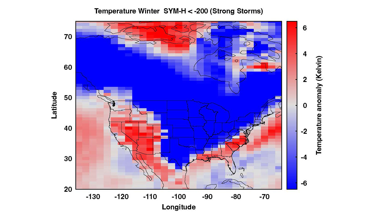
Solar Storms Can Affect Earth’s Weather. A New Study Examines How.
New findings could help narrow down the mechanisms by which solar activity influences our weather.
Posted inResearch Spotlights
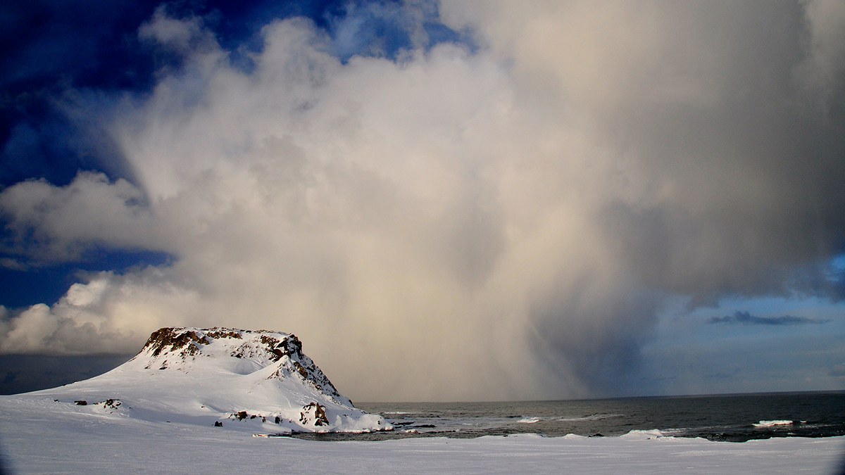
Rivers in the Antarctic Sky, Captured in 3D
A new study shows that atmospheric rivers may be responsible for up to 90% of Antarctica’s annual precipitation.
Posted inResearch Spotlights
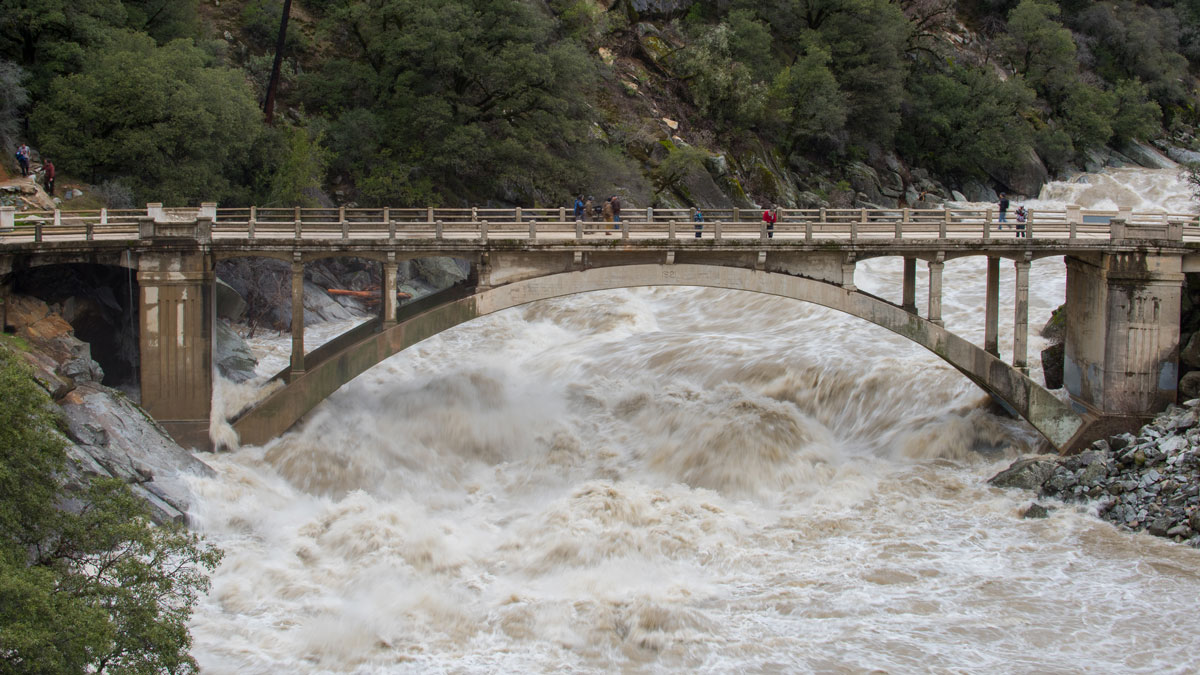
Keeping Humans in the Loop Improves Flood Forecasting
Artificial intelligence and machine learning can improve flood predictions—but human expertise still matters for accurate warnings, new research says.
Posted inResearch Spotlights
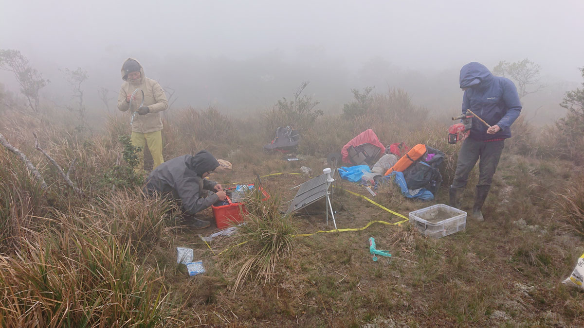
Seismic Attenuation Techniques Reveal What Lies Beneath Taiwan
A new imaging modality explores the complex subduction‐collision transition zone below southern Taiwan.
Posted inEditors' Highlights
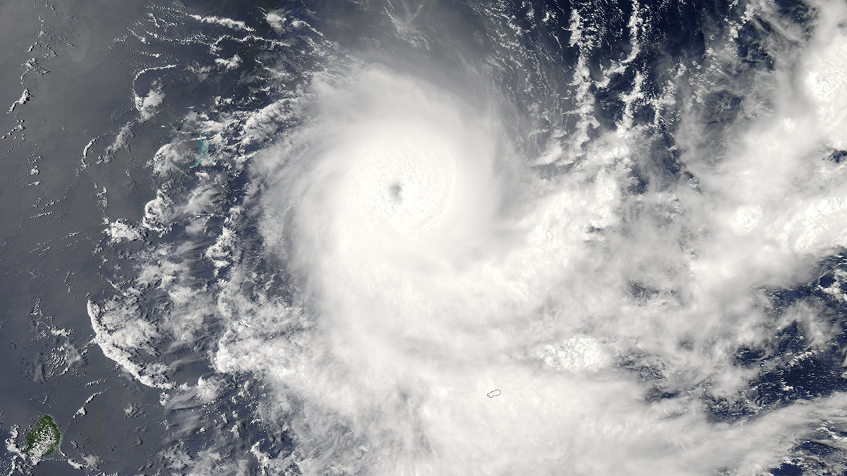
Tropopause Temperature Drives Tropical Cyclone Simulation Diversity
Tropopause temperature biases create major tropical cyclone differences in models; cooler air boosts storm potential intensity, raising global cyclone frequency and hurricanes in experiments.
Posted inEditors' Highlights
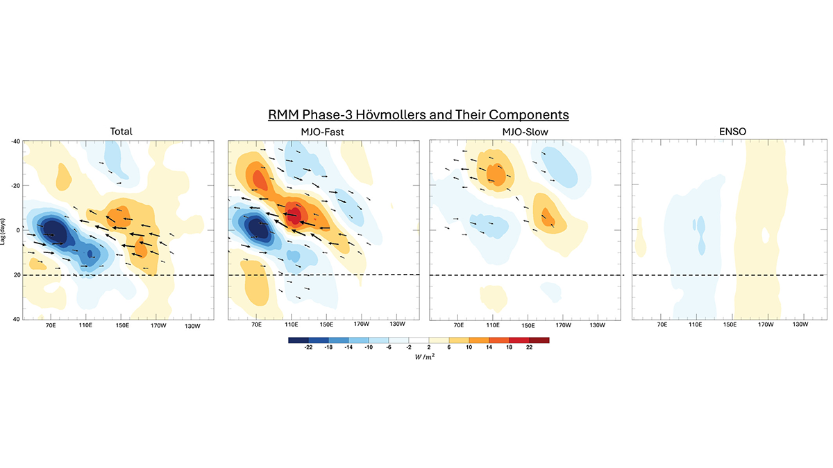
Slow and Fast Madden-Julian Oscillation Modes
The skill of Madden-Julian Oscillation (MJO) forecasts can be improved by identifying slow- and fast-MJO modes and their superposition.