Editors’ Highlights are summaries of recent papers by AGU’s journal editors.
Source: Geophysical Research Letters
River discharge is an important variable for a wide range of water management applications, yet many rivers (even in the United States) remain ungauged or under-gauged due to the difficulty of conventional field methods, especially in regions of complex terrains. Existing remote sensing methods need gauge data for calibration and are subject to other limitations.
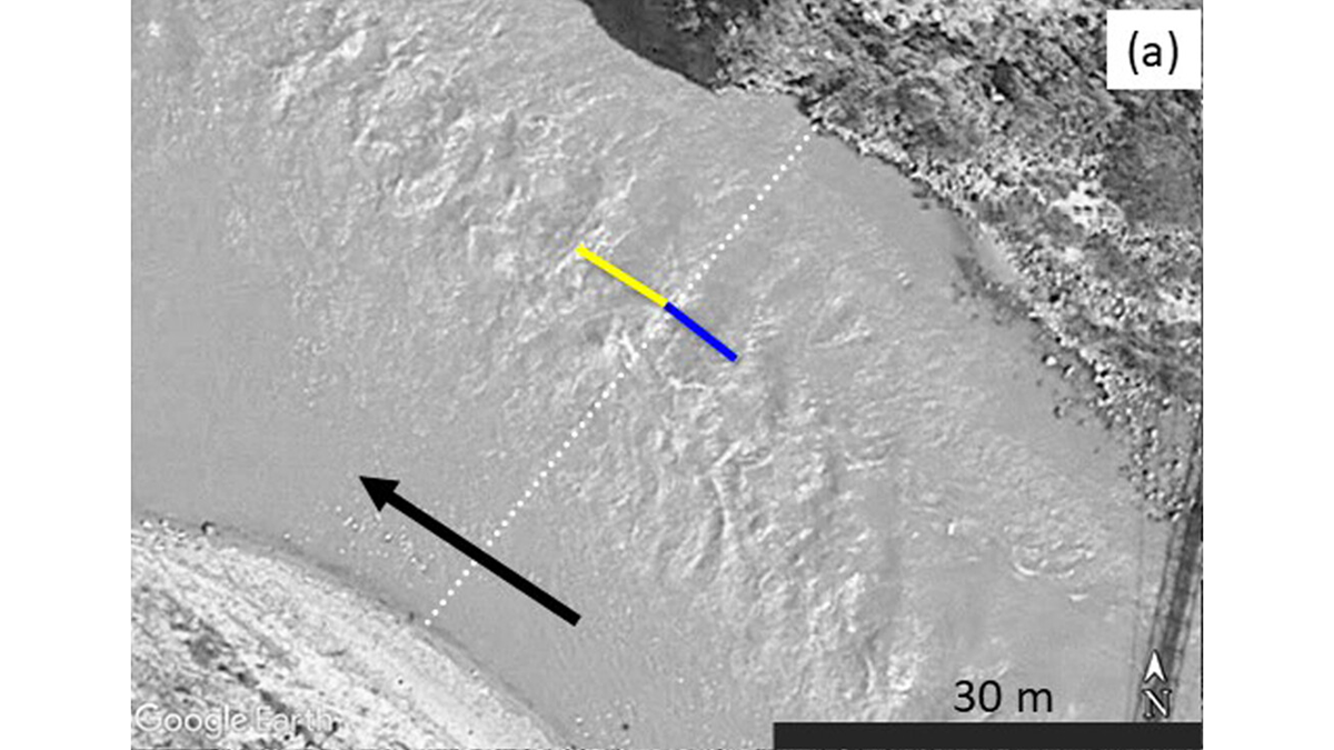
Legleiter et al. [2025] propose a new image-based method to infer river discharge based on critical flow theory. Specifically, slope transitions (from steep to mild) or channel constrictions can induce critical flow conditions, causing undular hydraulic jumps in the form of well-defined standing wave trains. For critical flow (with Froude number equal to 1), the spacing of the waves, the velocity of the flow, and the depth of the water are all uniquely related to one another, so the discharge can be calculated from basic measurements of wavelength and channel width.
The newly proposed method is used to derive discharges from 82 Google Earth images, which agreed closely with gauge records, providing preliminary confirmation for the reliability of the method. Although the method is only applicable to rivers with standing waves (which typically occur on steep slopes or near channel constrictions), these conditions are frequently met in mountainous regions, exactly where new monitoring methods are the most needed due to the lack or sparsity of gauge stations. This study provides a foundation for further evaluation and refinement of the theoretically grounded approach to river discharge estimation.
Citation: Legleiter, C. J., Grant, G., Bae, I., Fasth, B., Yager, E., White, D. C., et al. (2025). Remote sensing of river discharge based on critical flow theory. Geophysical Research Letters, 52, e2025GL114851. https://doi.org/10.1029/2025GL114851
—Guiling Wang, Editor, Geophysical Research Letters