
Geodetic strain and slip deficits reveal where the Tianshan is storing stress and which faults may generate the next major earthquakes in the region.
Geophysical Research Letters
Posted inResearch Spotlights
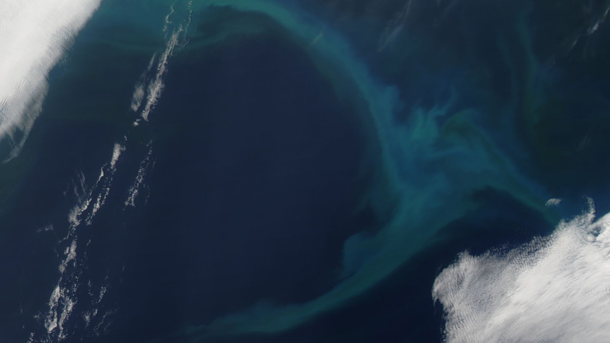
Wintertime Spike in Oceanic Iron Levels Detected near Hawaii
Seasonal rainfall and runoff of sediments from the Hawaiian Islands could be responsible for the previously undetected peak.

Posted inResearch Spotlights
Maybe That’s Not Liquid Water on Mars After All
A “very large roll” of a radar instrument offers new insight into a highly reflective area near the Martian south pole.
Posted inEditors' Highlights
From Mantle Flow to River Flow: Shaping Earth’s Surface from Within
The convection of the Earth’s mantle shapes its surface, carving fault networks into the lithosphere that can guide the course of rivers.
Posted inResearch Spotlights
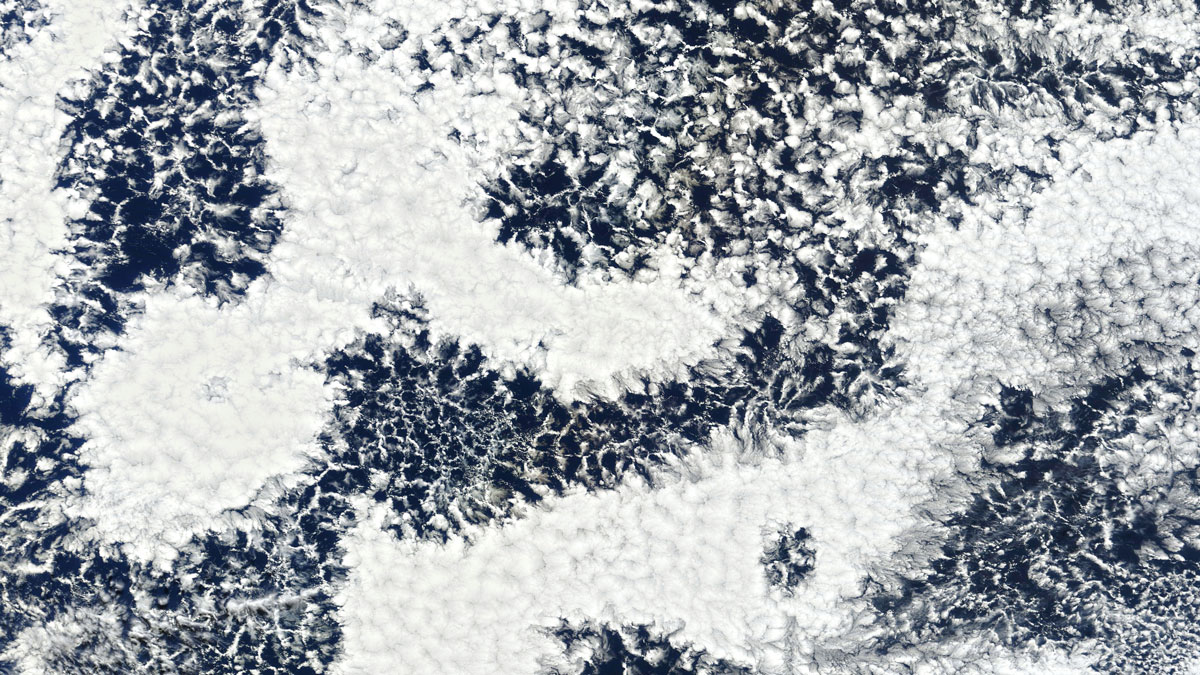
Understanding Cloud Droplets Could Improve Climate Modeling
The microphysical structure of cloud droplets affects behavior like precipitation. Current models may be underestimating how much these structures can vary within a single cloud.
Posted inResearch Spotlights
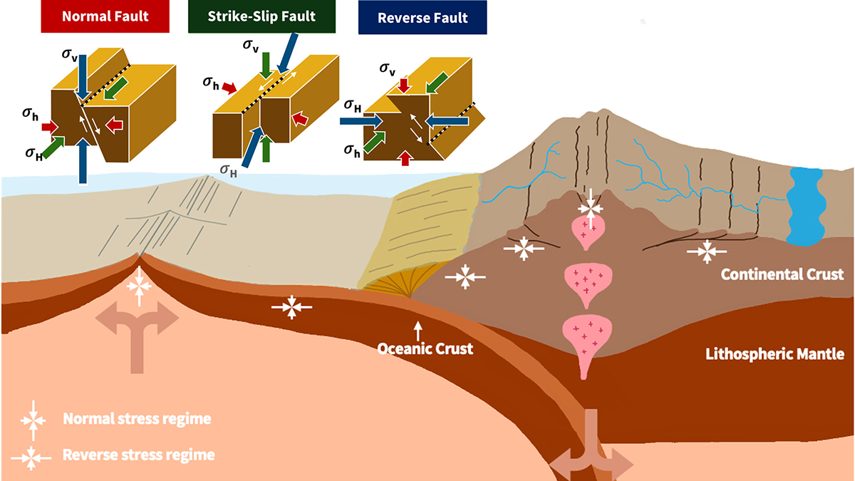
New Earthquake Model Goes Against the Grain
Subducting plates are stronger in certain directions than others, which may be a factor in how earthquakes occur and how seismic waves propagate.
Posted inResearch Spotlights
Finding the Gap: Seismology Offers Slab Window Insights
Studying slow tremors has helped researchers home in on the youngest part of the Chile Triple Junction’s gap between subducting plates, which offers a window to the mantle.
Posted inEditors' Highlights
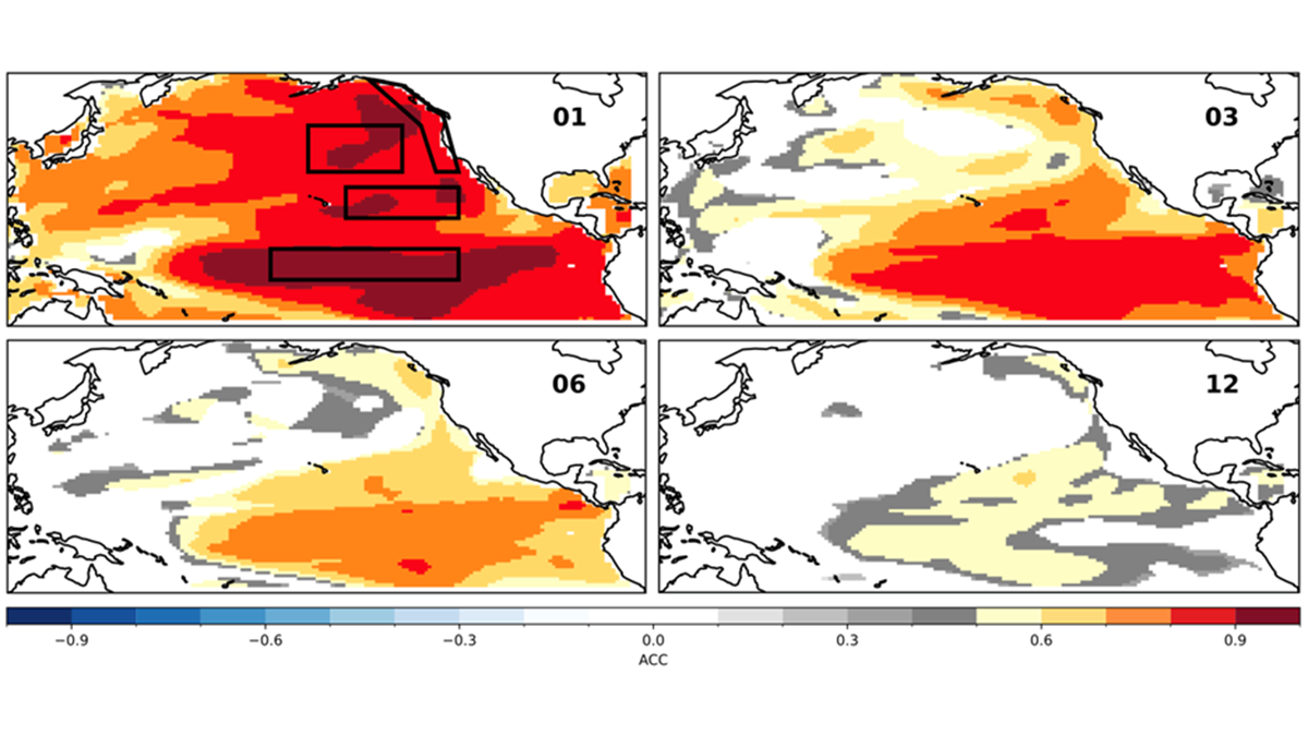
Decadal Forecasts with a SMYLE
Scientists use a large suite of simulations with an established climate model to predict the Pacific Decadal Oscillation up to one year in advance, but El Niño can still get in the way.
Posted inEditors' Highlights
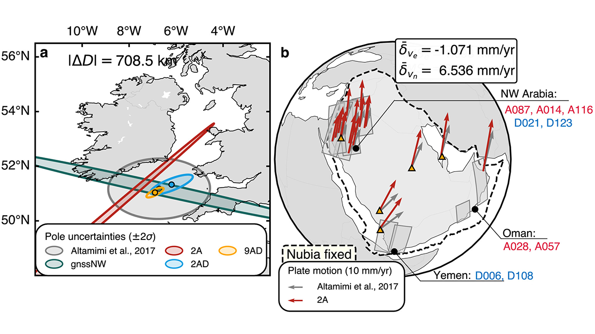
Mapping the Whereabouts of Continents
A new method integrates Interferometric Synthetic Aperture Radar (InSAR) with conventional ground geodetic networks, taking us closer to high-resolution mapping of plate motions.
Posted inResearch Spotlights
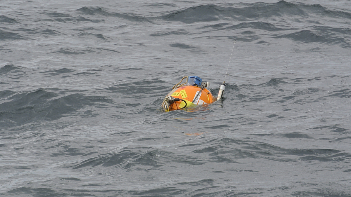
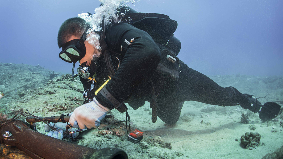
A Transatlantic Communications Cable Does Double Duty
A new device enables existing submarine cable networks to measure deep-sea movements. It could ultimately help improve tsunami warnings and climate monitoring.