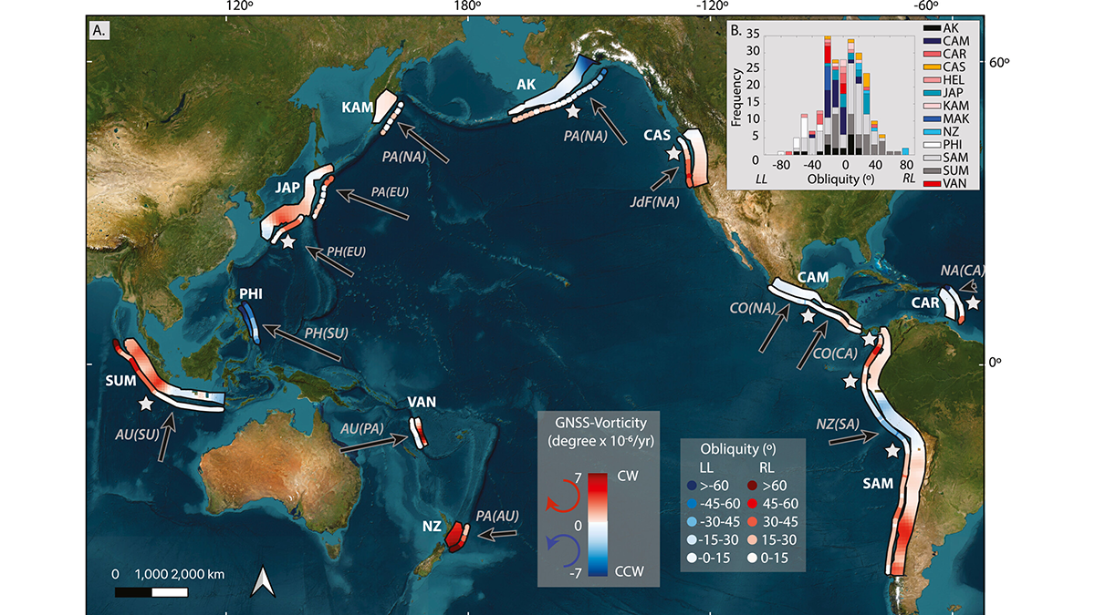
A global reanalysis of both short- and long-term deformation clarifies how obliquity affects strain partitioning in convergent plate boundaries.
Editors’ Highlights
Posted inEditors' Highlights
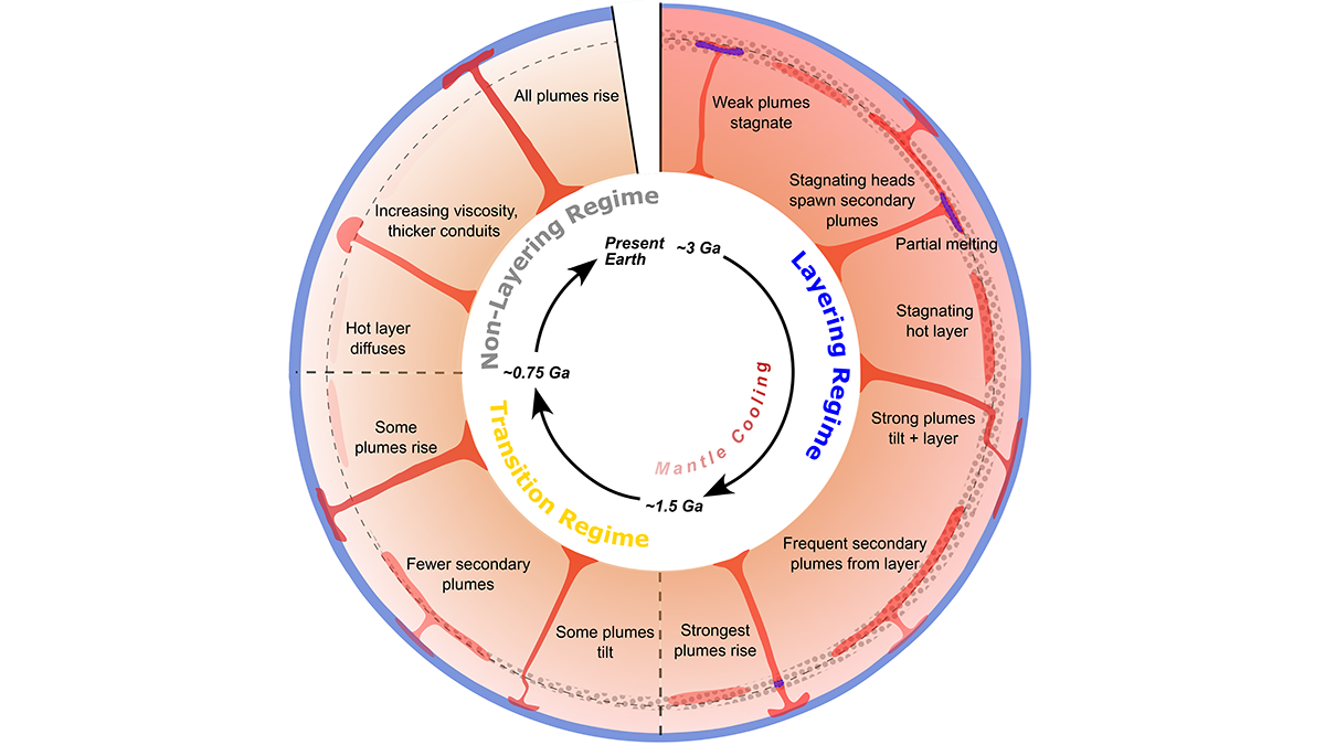
Modeling Mantle Dynamics as the Earth Slowly Cools
An update of the convection code ASPECT enables full coupling of plume dynamics with buoyancy effects of transition zone phase relations, showing how early layering gave way to whole-mantle plumes.

Posted inEditors' Highlights
Using Satellite Data for More Effective Disaster Response
Satellite data play a crucial role in disaster assessment and response. Meeting expanding demand requires not only accelerated data processing but increased collaboration with responders.
Posted inEditors' Highlights
T-waves May Improve Tsunami Early Warning Systems
A unique acoustic wave related to the generation of tsunamis could be used to enhance early warning systems.
Posted inEditors' Highlights
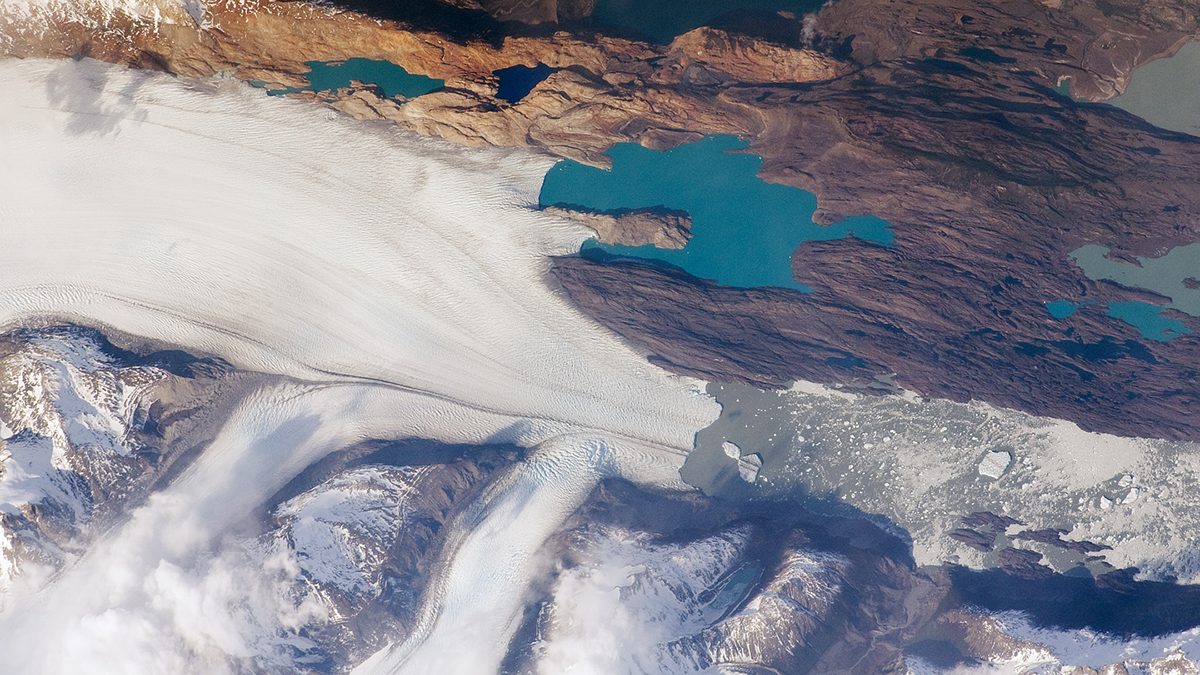
The Pulsed Pace of Glacial Erosion
New data from Lago Argentino, Patagonia reveal that glacial erosion occurs in discrete pulses, which challenges previous ideas that erosion rates have increased over time due to climate change.
Posted inEditors' Highlights
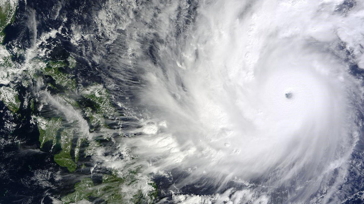
Impacts of Urban Heat and Friction on a Tropical Cyclone
A new computer modeling-based study demonstrates dual mechanisms that reduce pre- and post-landfall tropical cyclone intensity.

Posted inEditors' Highlights
Ice boost! Why Rock Avalanches Containing Ice Travel So Far
Researchers identify a new mechanism that allows avalanches containing a mixture of rock and ice to travel very long distances.
Posted inEditors' Highlights
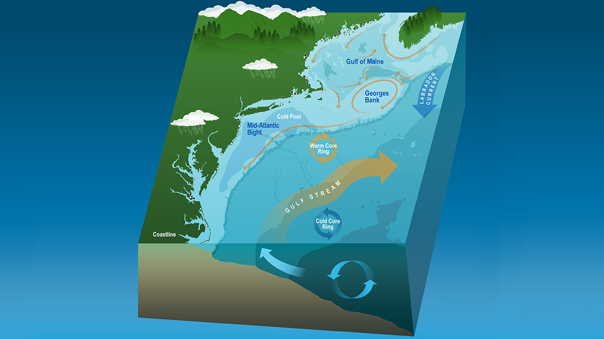
Coastal Dynamics Revealed by Satellite Salinity Data
One decade of high-quality satellite salinity observations provide valuable insights into the complex dynamics in the Mid-Atlantic Bight.
Posted inEditors' Highlights
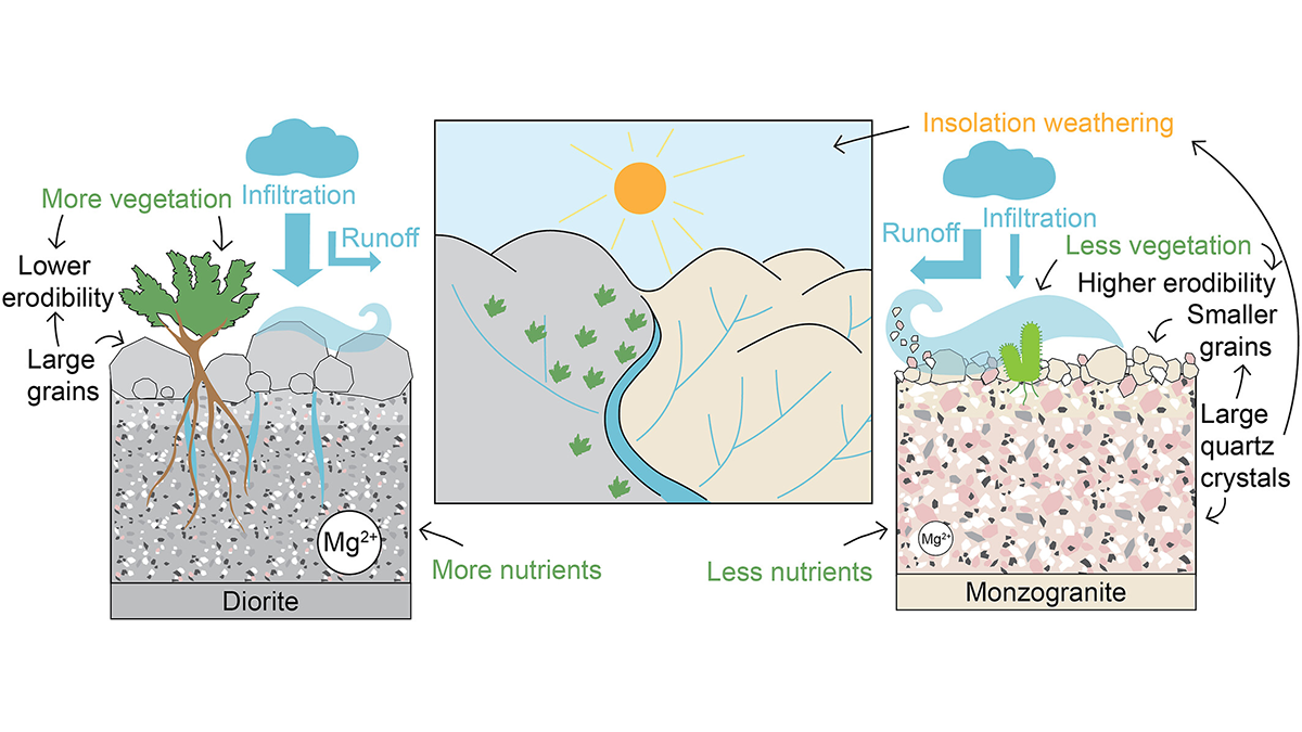
How Rock Type Shapes River Networks and Influences Landscape Evolution
A new study in Chile shows how small differences in rock type can drive large differences in erosion, vegetation, and river networks, illuminating the role of mineralogy in shaping landscapes.

Posted inEditors' Highlights
Characterizing the Space Between Clouds and Clear Sky
The area near clouds is often classified as ‘clear sky’, but a new study demonstrates the potential biases of misclassifying these transition zones and their significance for Earth’s energy budget.