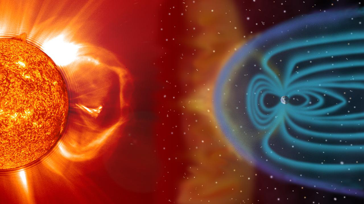
The impact of geomagnetic storms, which can disrupt satellites, GPS, and power grids, is shown to depend on their onset timing.
Editors’ Highlights
Posted inEditors' Highlights
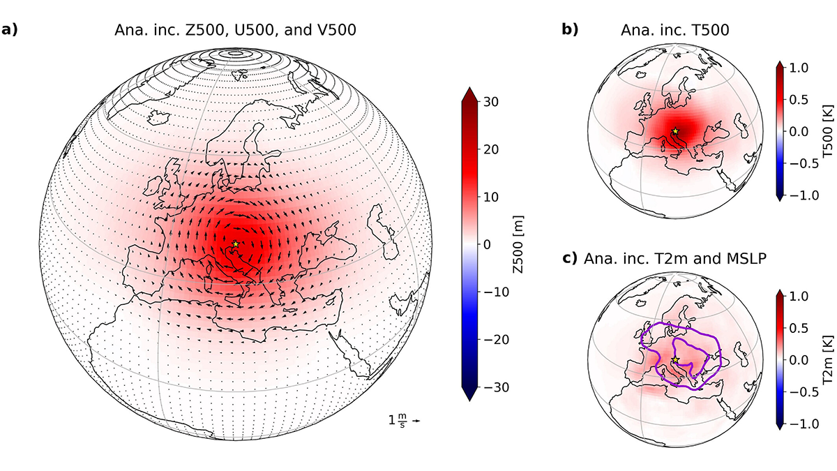
Machine Learning Can Improve the Use of Atmospheric Observations in the Tropics
Scientists develop a novel machine learning-based technique that is equally effective in gaining information from observations about the unobserved state variables in the midlatitudes and tropics.

Posted inEditors' Highlights
Constructive Debate on the Rise of the Tibetan Plateau
A constructive debate on Himalayan tectonics shows how respectful scientific dialogue helps test competing ideas about how Earth’s highest plateau formed.
Posted inEditors' Highlights
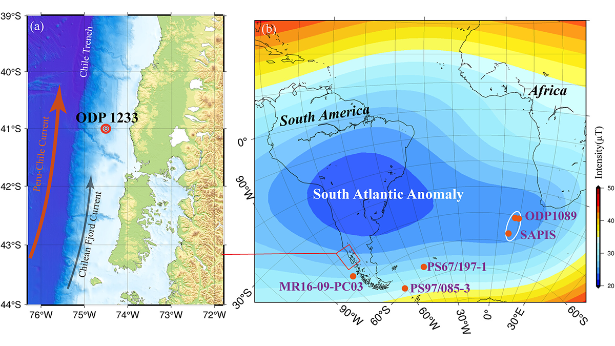
How Sediment Magnetism Captures the South Atlantic Anomaly
Magnetic data from an ODP core deposited during normal secular variation (65-41 thousand years ago) off the Chilean margin help clarify geomagnetic field behavior in the South Atlantic Anomaly region.

Posted inEditors' Highlights
Machine Learning Could Enhance Earth System Modeling
Based on tests of a machine learning-based (ML) hybrid model, combining ML with established physics-based frameworks represents a promising path toward developing ML-based Earth system models.

Posted inEditors' Highlights
Resolved Storm-Environment Interactions: Linking Local to Global Scales
Kilometer-scale global climate models offer unprecedented possibilities to simulate thunderstorms and analyze how they interact with their environment across many scales, shaping the climate state.
Posted inEditors' Highlights
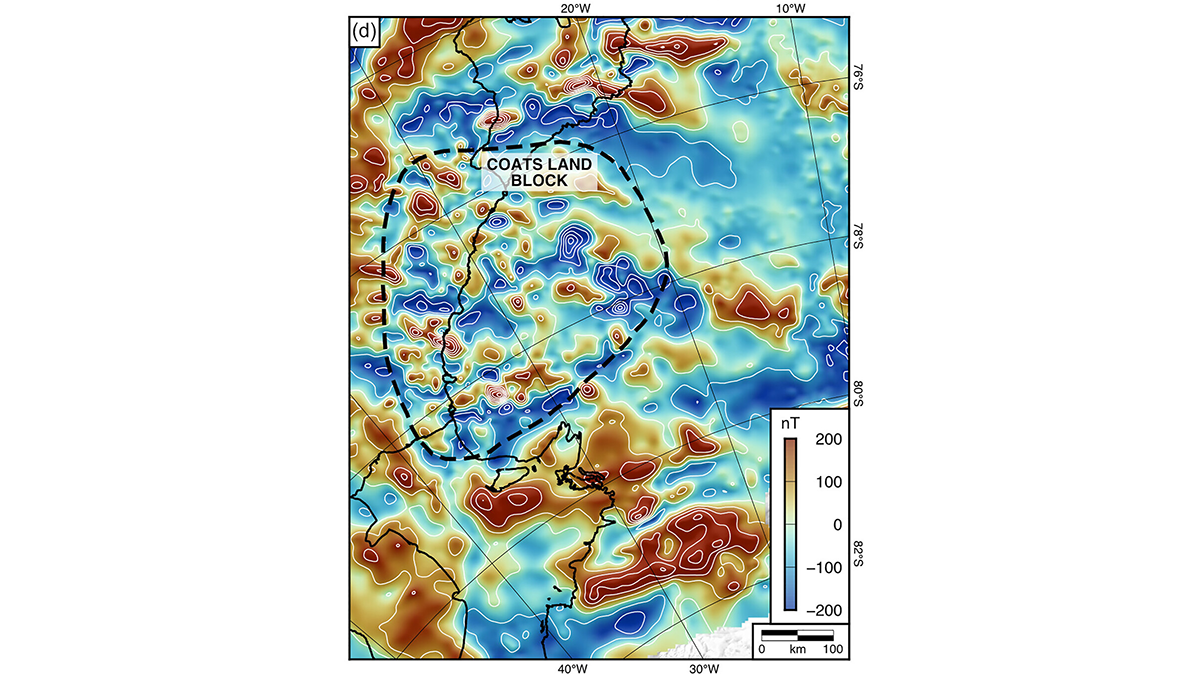
An Ancient Landscape Beneath the East Antarctic Ice Sheet
Geophysical observations of the subglacial topography of Coats Land reveal a landscape formed by tectonics and fluvial erosion that influenced the formation of the East Antarctic Ice Sheet.
Posted inEditors' Highlights
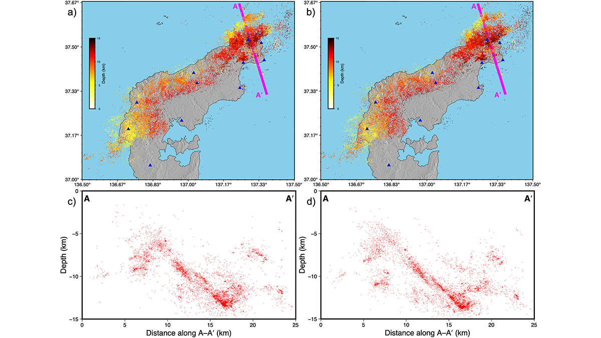
Taming the Seismicity Tsunami with a Scalable Bayesian Framework
By combining the power of artificial intelligence with advanced physics simulations, a new framework called “SPIDER” allows us to map seismic activity with unprecedented clarity.
Posted inEditors' Highlights
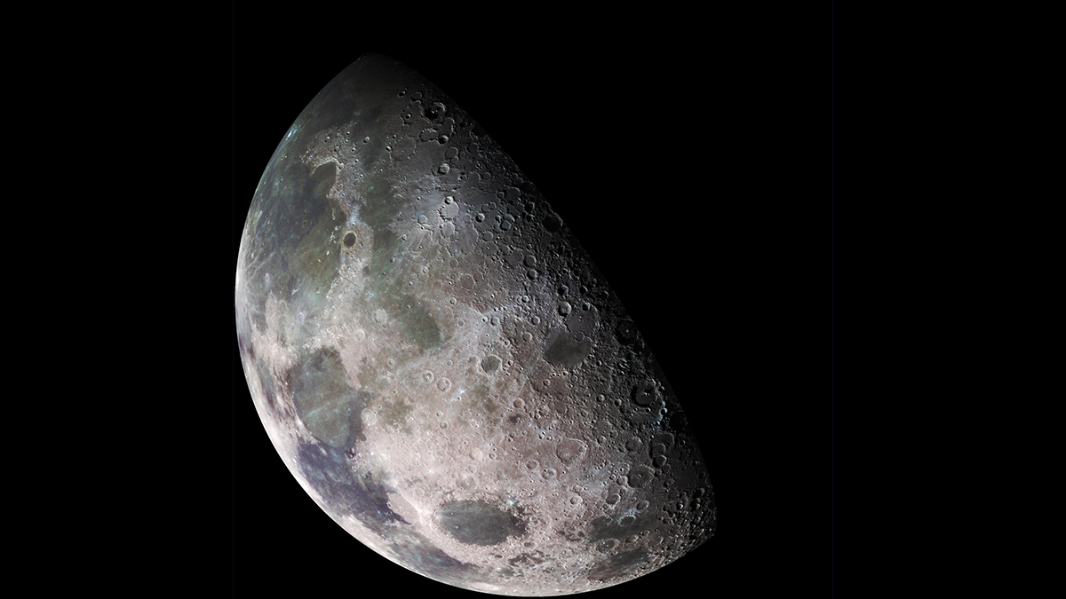
Using Distributed Acoustic Sensing (DAS) to Improve Lunar Seismic Monitoring
With the appropriate cable selection and deployment, unburied DAS is a viable technique for lunar seismic applications, enabling large-scale measurements without complex installation procedures.
Posted inEditors' Highlights
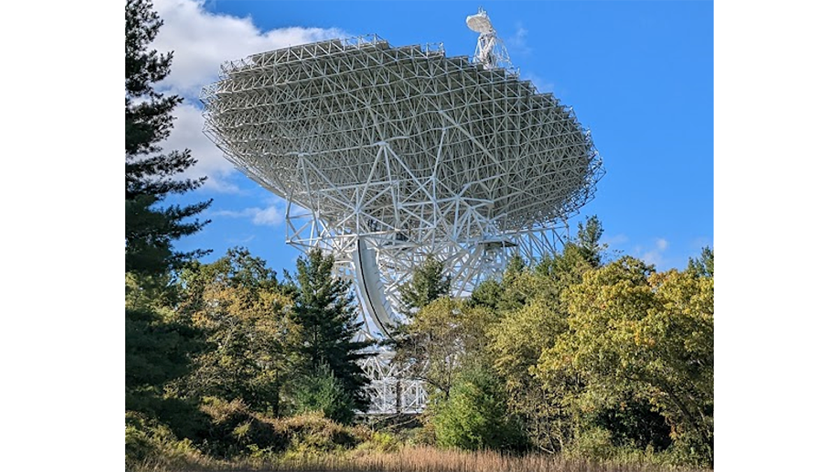
Revolutionizing Interference Detection to Protect the Silence of the Cosmos
TranQuiL is a groundbreaking system that revolutionizes Radio Quiet Zone enforcement by enabling long-range detection and precise localization of Wi-Fi and Bluetooth interference with unparalleled accuracy.