A new fluid solver from the Climate Modeling Alliance sets a benchmark in atmospheric modeling, with unmatched consistency in moist thermodynamics, energy conservation, and CPU/GPU scaling.
Editors’ Highlights
Posted inEditors' Highlights
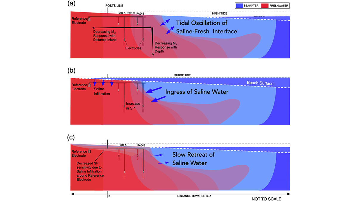
Tides Generate Detectable Electrical Signals in Coastal Aquifers
Spontaneous potentials show possibility for monitoring coastal saltwater intrusion.
Posted inEditors' Highlights
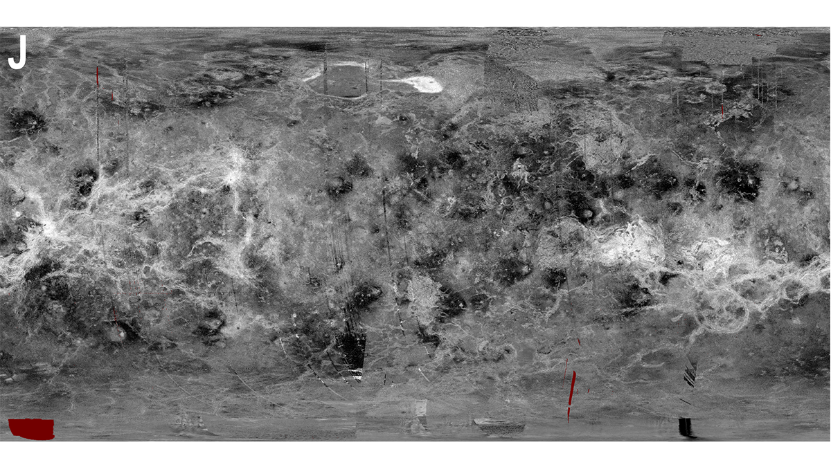
Opening a Treasure Trove: A Trip to the Historic Archives of Venus
Before 1989, pre-Magellan orbiter and ground-based exploration of Venus produced significant datasets that will be useful when planning future missions to the planet.
Posted inEditors' Highlights
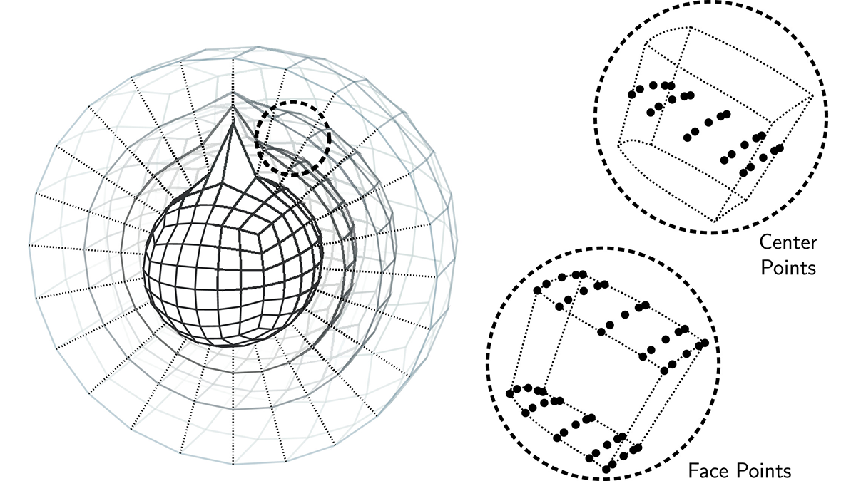
Robustness Through Diversity: Learning from Heterogeneous Aquifers
Learning from diverse aquifer structures, which are all over the place, leads to robust inverse methods.
Posted inEditors' Highlights
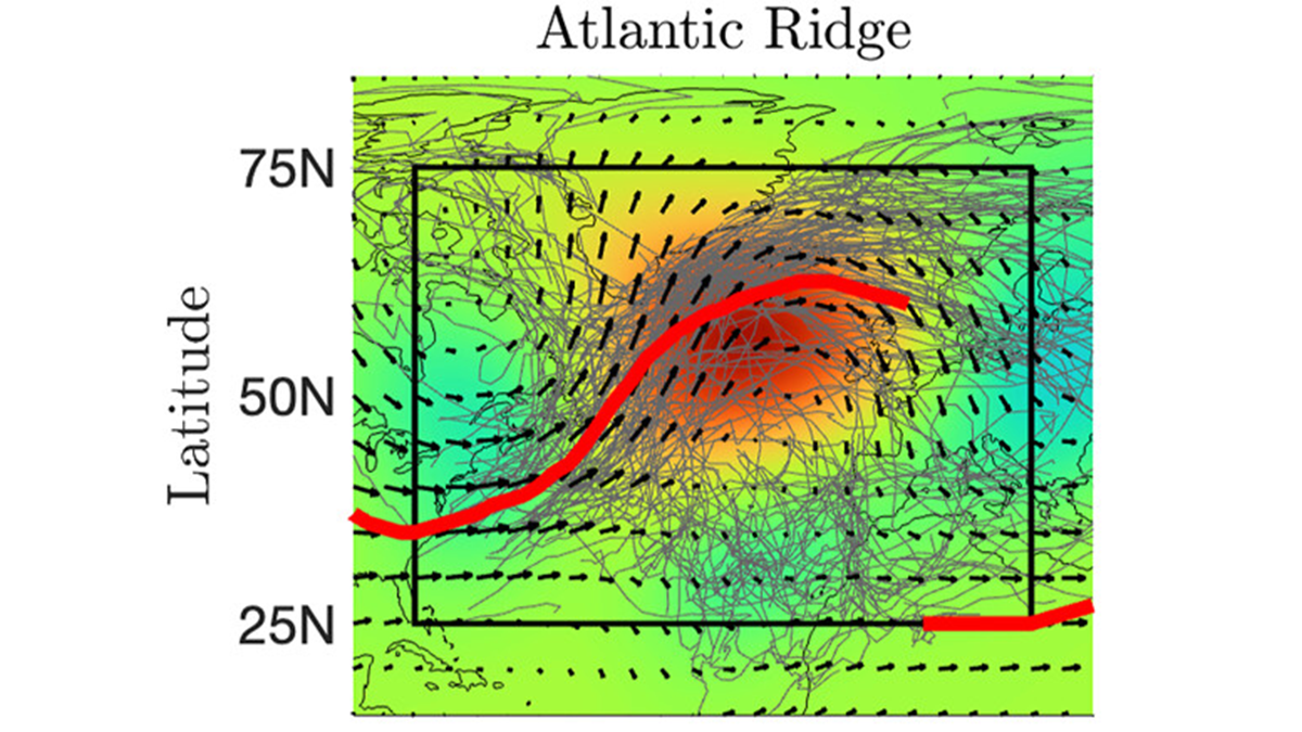
Slow Atmospheric Circulations Shape Storm Tracks and Wave-Breaking Patterns
Connections between fast and slow parts of the atmosphere are analyzed over 35 years to understand the links between storms, weather regimes, and atmospheric wave breaking events.
Posted inEditors' Highlights
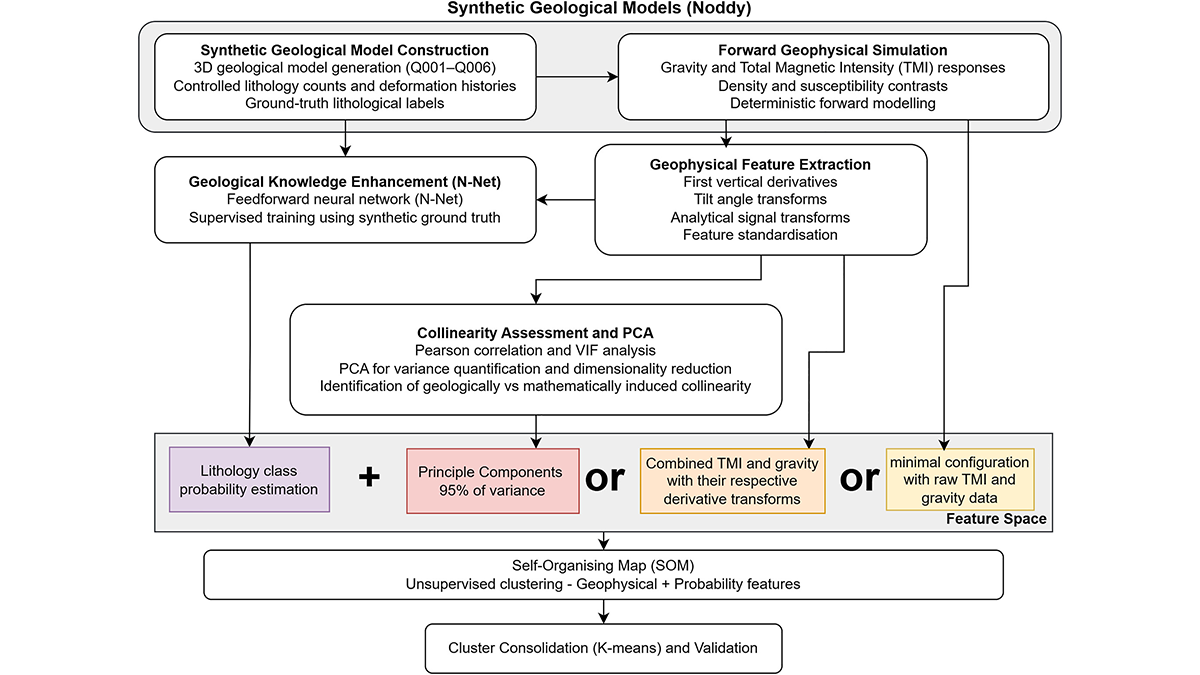
Collinearity is Not Always a Problem in Machine Learning
Collinearity is not always a showstopper for statistical machine learning (at least not for self-organizing maps).
Posted inEditors' Highlights
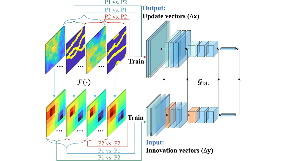
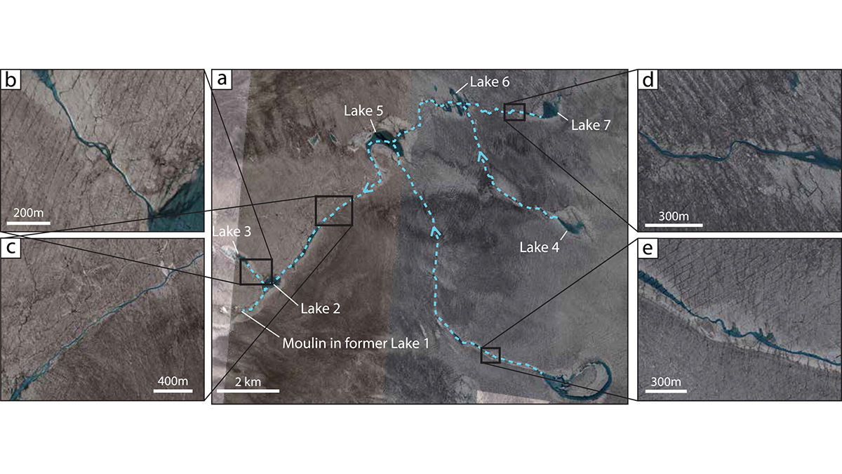
The Fate of the Greenland Ice Sheet: Deep Learning from SkySat Images
Surface meltwater ponding and drainage in the Greenland Ice Sheet is analyzed at high spatial and temporal resolution through SkySat imagery and deep learning.
Posted inEditors' Highlights
Tropopause Temperature Drives Tropical Cyclone Simulation Diversity
Tropopause temperature biases create major tropical cyclone differences in models; cooler air boosts storm potential intensity, raising global cyclone frequency and hurricanes in experiments.
Posted inEditors' Highlights
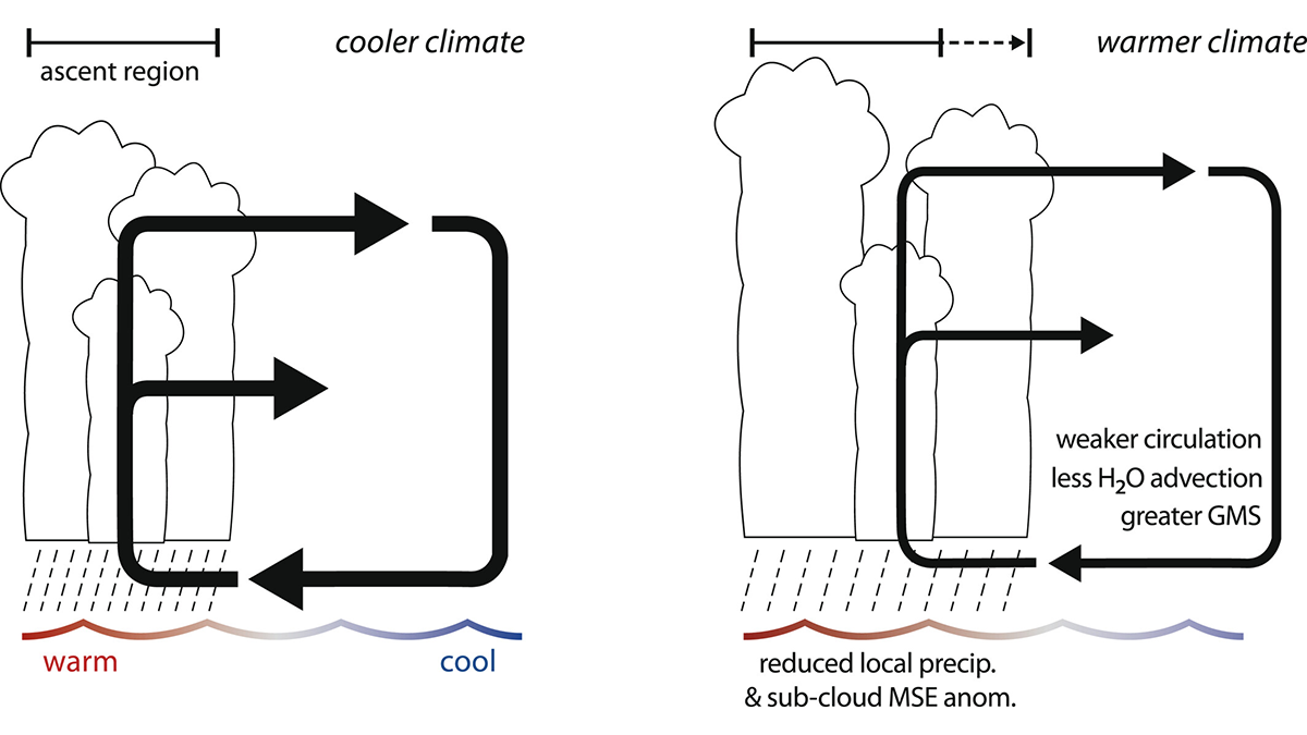
The “Wet-Gets-Wetter” Response to Climate Change Does Not Always Apply
While the precipitation response to a warming climate is often stated as the “wet gets wetter,” this response does not apply to east-west overturning circulations like the Pacific Walker circulation.
Posted inEditors' Highlights
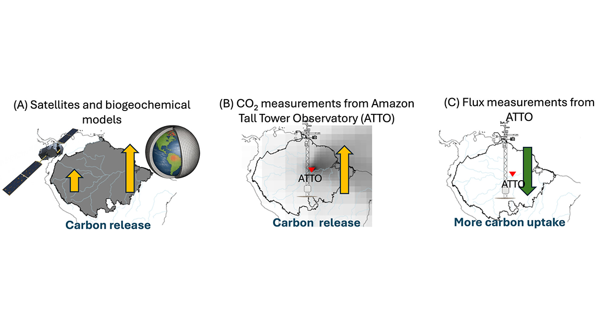
Severe 2023 Drought: Sinking Carbon Sink in the Amazon
The Amazon forest has been a reliable carbon sink, soaking up some of humanity’s carbon emissions, but a severe drought in 2023 adds to growing concern that this ecosystem service is at risk.