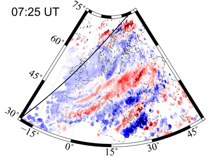
Dense GNSS networks enable scientists to track large-scale waves traveling through the upper atmosphere, away from sources in the auroral zone and the day/night terminator.
Editors’ Highlights
Posted inEditors' Highlights
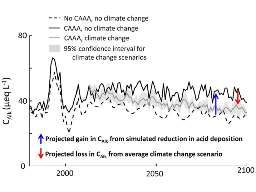
The Acid Tongue of Climate Change Strikes Our Streams
Clear air policies have led to dramatic reductions in acid rain and improved ecosystem health, but it now appears that climate change could counteract those gains.
Posted inEditors' Highlights
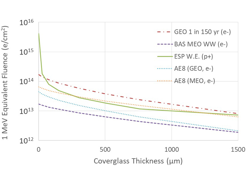
Double Threat to Solar Panels in Space
Protons accelerated in solar storms and electrons accelerated in geospace storms can reduce space mission lifetimes. What is the likelihood of extreme events during geospace storms?
Posted inEditors' Highlights
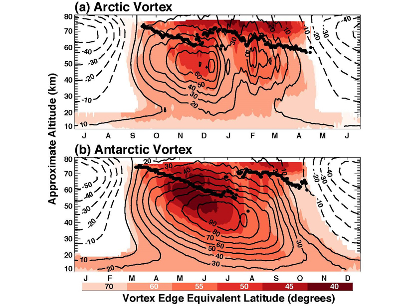
New Characterization of the Mesospheric Polar Vortices
Polar vortices play a central role in coupling the atmosphere from the ground to the middle atmosphere. New satellite diagnostics describe mesospheric polar vortices and coupling to lower altitudes.
Posted inEditors' Highlights
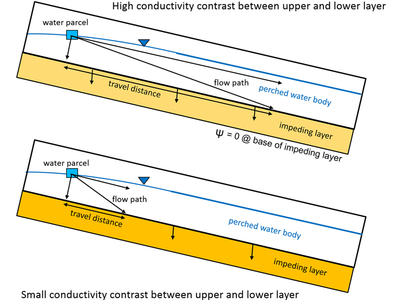
Upper Hillslopes May Not Contribute Directly to Stormflow
New research challenges long-held ideas about the path of subsurface water from hillslopes to streams.
Posted inEditors' Highlights
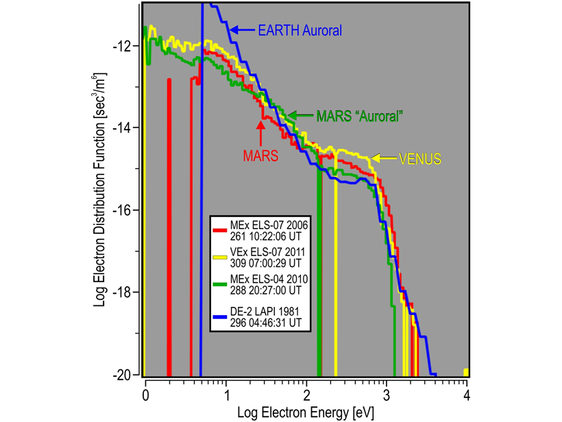
Extreme Space Conditions at Mars: The 10 Largest Electron Events
A solar cycle of data was scoured for the biggest electron energy fluxes seen in the Mars space environment.
Posted inEditors' Highlights
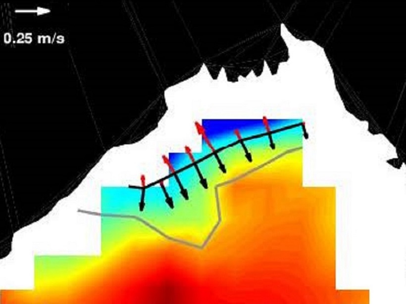
Dispersal of River Water by Ocean Eddies and Shallow Ekman Flow
Low-salinity water from the Ganga-Brahmaputra river is transported by mesoscale eddies in the Bay of Bengal, but when the monsoon winds strengthen, a shallow “Ekman” flow dominates dispersal of water.
Posted inEditors' Highlights
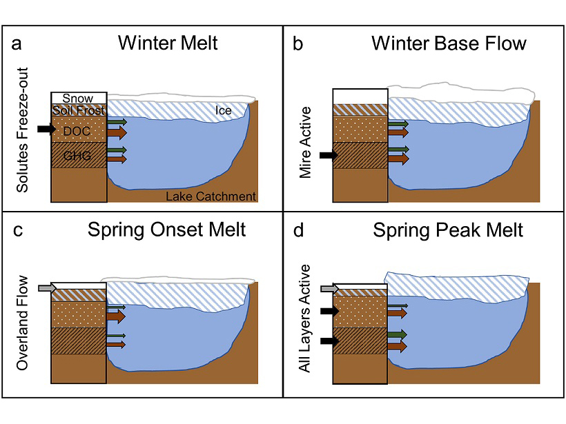
What Lies and Waits Beneath Lake Ice?
Rarely made detailed measurements of carbon dioxide and methane under lake ice reveal a story more complex than simple models of gas buildup, with surprising findings for climate change impacts.

Posted inEditors' Highlights
Massive Scale Evaporative Water Losses from Irrigation
Evaporation can demonstrate the effects of crop irrigation on decadal trends in evapotranspiration at a regional spatial extent.
Posted inEditors' Highlights
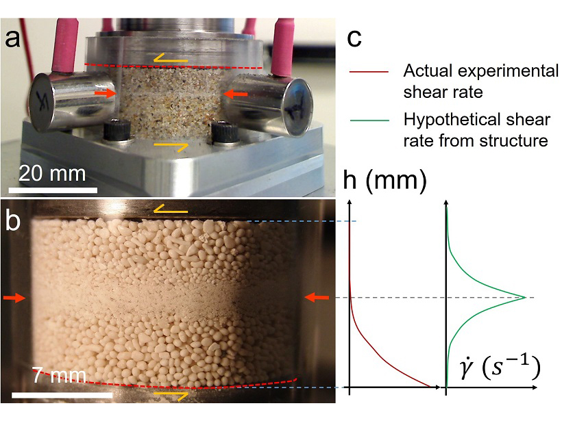
A New Spin on Grain Segregation in Fault Zones
Fine-grained layers in sheared fault gouge may be formed by shear-driven size-segregation in granular materials, rather than by shear localization.