Source: Space Weather
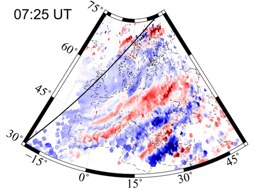
Global Navigation Satellite System (GNSS) monitoring stations provide high-quality data on the total electron content (TEC) of the ionosphere. Cherniak and Zakharenkova [2018] have used the rich networks of GNSS monitoring stations now available across Europe to generate images of TEC variations in the ionosphere over Europe. They use these images to monitor the propagation of large scale waves (traveling ionospheric disturbances or TIDs) through the upper atmosphere and to track these waves back to their sources in the auroral zone and the day/night terminator. These images will help non-experts to better understand why TIDs are an important space weather effect in the ionosphere, one that can disrupt a wide range of radio systems, including both practical applications and instruments used in other areas of science.
Citation: Cherniak, I., & Zakharenkova, I. [2018]. Large‐scale traveling ionospheric disturbances origin and propagation: Case study of the December 2015 geomagnetic storm. Space Weather, 16. https://doi.org/10.1029/2018SW001869
—Michael A. Hapgood, Editor, Space Weather
Text © 2018. The authors. CC BY-NC-ND 3.0
Except where otherwise noted, images are subject to copyright. Any reuse without express permission from the copyright owner is prohibited.