Source: Journal of Geophysical Research: Atmospheres
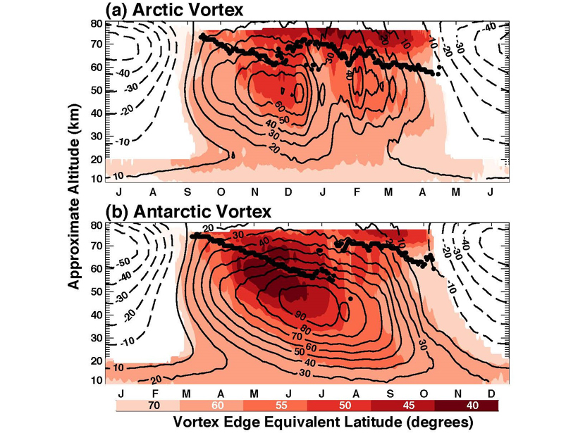
Weather at the edge of space shares certain important similarities to weather lower down in the atmosphere, but due to less observational data has been harder to quantify. By combining two satellite-based data sets, Harvey et al. [2018] present a unified description of the polar vortex from the stratosphere to upper mesosphere. Diagnostics include mean structure and seasonal evolution, and characterizing mesospheric response to extreme stratospheric ‘sudden warming’ events. This work will serve as a definitive benchmark for the emerging generation of so-called “high-top” climate models.
Citation: Harvey, V. L., Randall, C. E., Goncharenko, L., Becker, E., & France, J. [2018]. On the upward extension of the polar vortices into the mesosphere. Journal of Geophysical Research: Atmospheres, 123. https://doi.org/10.1029/2018JD028815
William J. Randel, Editor, JGR: Atmospheres
Text © 2018. The authors. CC BY-NC-ND 3.0
Except where otherwise noted, images are subject to copyright. Any reuse without express permission from the copyright owner is prohibited.