• About
  • Sections
  • Topics
    • Climate
    • Earth Science
    • Oceans
    • Space & Planets
    • Health & Ecosystems
    • Culture & Policy
    • Education & Careers
    • Opinions
  • Projects
    • ENGAGE
    • Editors’ Highlights
    • Editors’ Vox
    • Eos en Español
    • Eos 简体中文版
    • Print Archive
  • Science Policy Tracker
  • Blogs
    • Research & Developments
    • The Landslide Blog
  • Newsletter
  • Submit to Eos
  • AGU.org
  • Career Center
  • Join AGU
  • Give to AGU
  • About
  • Sections
  • Topics
    • Climate
    • Earth Science
    • Oceans
    • Space & Planets
    • Health & Ecosystems
    • Culture & Policy
    • Education & Careers
    • Opinions
  • Projects
    • ENGAGE
    • Editors’ Highlights
    • Editors’ Vox
    • Eos en Español
    • Eos 简体中文版
    • Print Archive
  • Science Policy Tracker
  • Blogs
    • Research & Developments
    • The Landslide Blog
  • Newsletter
  • Submit to Eos
Skip to content
  • AGU.org
  • Career Center
  • Join AGU
  • Give to AGU
Eos

Eos

Science News by AGU

Support Eos
Sign Up for Newsletter
  • About
  • Sections
  • Topics
    • Climate
    • Earth Science
    • Oceans
    • Space & Planets
    • Health & Ecosystems
    • Culture & Policy
    • Education & Careers
    • Opinions
  • Projects
    • ENGAGE
    • Editors’ Highlights
    • Editors’ Vox
    • Eos en Español
    • Eos 简体中文版
    • Print Archive
  • Science Policy Tracker
  • Blogs
    • Research & Developments
    • The Landslide Blog
  • Newsletter
  • Submit to Eos

Editors’ Highlights

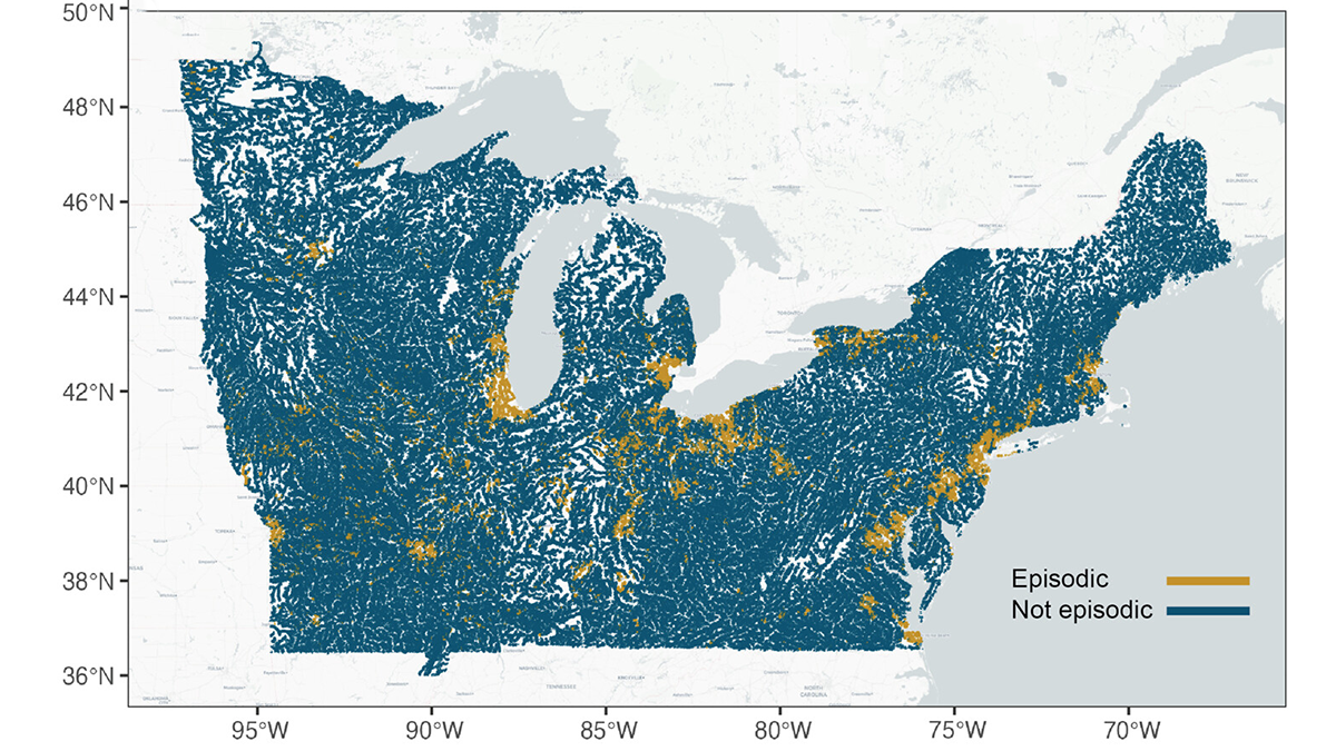
Map from the study.
Posted inEditors' Highlights

Trapped Charge Techniques Pinpoint Past Fault Slip

by Alexis Ault 18 August 202514 August 2025

Scientists combine two novel dating techniques on fault gouge to better pinpoint the timing and nature of past fault activity in the Eastern Alps.

Satellite images with lidar data.
Posted inEditors' Highlights

NASA Mission Creates a New Global Coastal Bathymetry Product

by Cathleen Jones 14 August 202514 August 2025

NASA’s Ice, Cloud, and land Elevation Satellite 2 (ICESat-2) mission recently released a new shallow water bathymetry product, which has already delivered data for 13.7 million kilometers of coastal waters.

4 maps from the study.
Posted inEditors' Highlights

Decadal Forecasts with a SMYLE

by Kristopher B. Karnauskas 13 August 202511 August 2025

Scientists use a large suite of simulations with an established climate model to predict the Pacific Decadal Oscillation up to one year in advance, but El Niño can still get in the way.

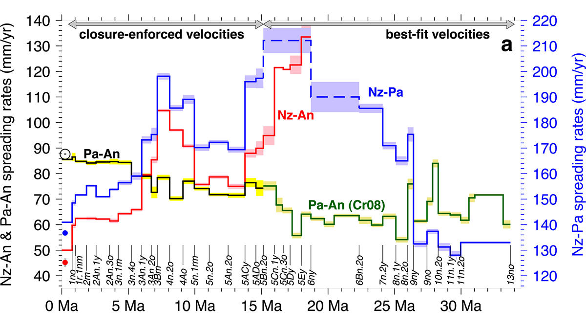
Graphs from the paper.
Posted inEditors' Highlights

Southern Hemisphere Subtropical Lower Stratosphere is Warming

by Donald Wuebbles 12 August 202511 August 2025

Warming of the Southern Hemisphere (SH) subtropical lower stratosphere is due to slowing of Brewer-Dobson Circulation, thus cooling the Antarctic lower stratosphere and masking anticipated ozone recovery.

Diagram from the study.
Posted inEditors' Highlights

Tracking the Sinking Ground from Coal Seam Gas Extraction

by Gabriel Rau 11 August 20257 August 2025

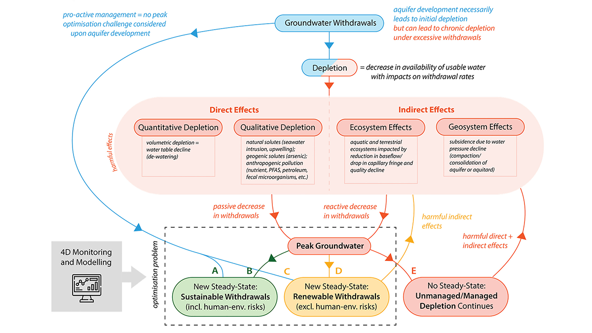
A new model shows how coal seam gas extraction causes land to sink by linking groundwater loss and coal shrinkage, helping predict impacts on farming in gas-producing areas.

2 graphs from the paper.
Posted inEditors' Highlights

How Flexible Enhanced Geothermal Systems Control Their Own Seismicity

by David Dempsey 7 August 20255 August 2025

A new study maps how microseismicity waxes and wanes with pressure in enhanced geothermal systems, offering a template for managing quakes in future heat-mining projects.

2 maps from the study.
Posted inEditors' Highlights

Nearly 94 Million Boulders Mapped on the Moon Using Deep Learning

by Jean-Pierre Williams 6 August 20255 August 2025

Scientists used a deep learning algorithm to map the size and location of nearly 94 million boulders on the lunar surface, highlighting differences in boulder densities and size distributions.

Posted inEditors' Highlights

Balancing Comparability and Specificity in Sustainability Indicators

by Xin Zhang 5 August 20254 August 2025

A new study shows how engaging national stakeholders in Austria helps adapt global sustainability indicators to better reflect regional agricultural priorities, especially social and economic aspects.

Diagram from the study.
Posted inEditors' Highlights

The State of Stress in the Nankai Subduction Zone

by Alexandre Schubnel 4 August 202531 July 2025

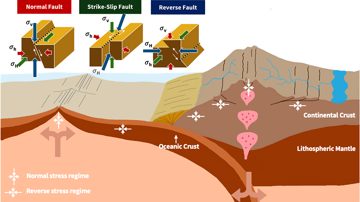
The Nankai subduction zone, in southern Japan, has hosted several large magnitude 8+ earthquakes during the last three hundred years. But, how stressed is it right now? 

Satellite photo of features on Europa.
Posted inEditors' Highlights

What Goes Up Must Come Down: Movement of Water in Europa’s Crust

by Kelsi Singer 31 July 202531 July 2025

Using Earth’s glaciers as an analog, a new study explores the possibility of downward propagation of fractures and melt in Europa’s icy crust.

Posts pagination

Newer posts 1 2 3 4 5 … 105 Older posts
A view of a Washington, D.C., skyline from the Potomac River at night. The Lincoln Memorial (at left) and the Washington Monument (at right) are lit against a purple sky. Over the water of the Potomac appear the text “#AGU24 coverage from Eos.”

Features from AGU Publications

Research Spotlights

New 3D Model Reveals Geophysical Structures Beneath Britain

10 October 202510 October 2025
Editors' Highlights

New Evidence for a Wobbly Venus?

29 September 202525 September 2025
Editors' Vox

All Publish, No Perish: Three Months on the Other Side of Publishing

29 September 202525 September 2025
Eos logo at left; AGU logo at right

About Eos
ENGAGE
Awards
Contact

Advertise
Submit
Career Center
Sitemap

© 2025 American Geophysical Union. All rights reserved Powered by Newspack