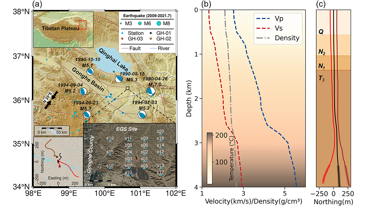
At China’s first Enhanced Geothermal System site, dense seismic observations, integrated with borehole data and stress modeling, reveal weak faults and scale-dependent control of stress and structure on induced seismicity.
Editors’ Highlights
Posted inEditors' Highlights
Model of Complex Blanket Bog Improves Prediction of Peat Expansion
Peat expansion is tightly coupled to the global climate cycle. As a nature-based solution to climate change, we need to know how they will respond to different climate scenarios.
Posted inEditors' Highlights
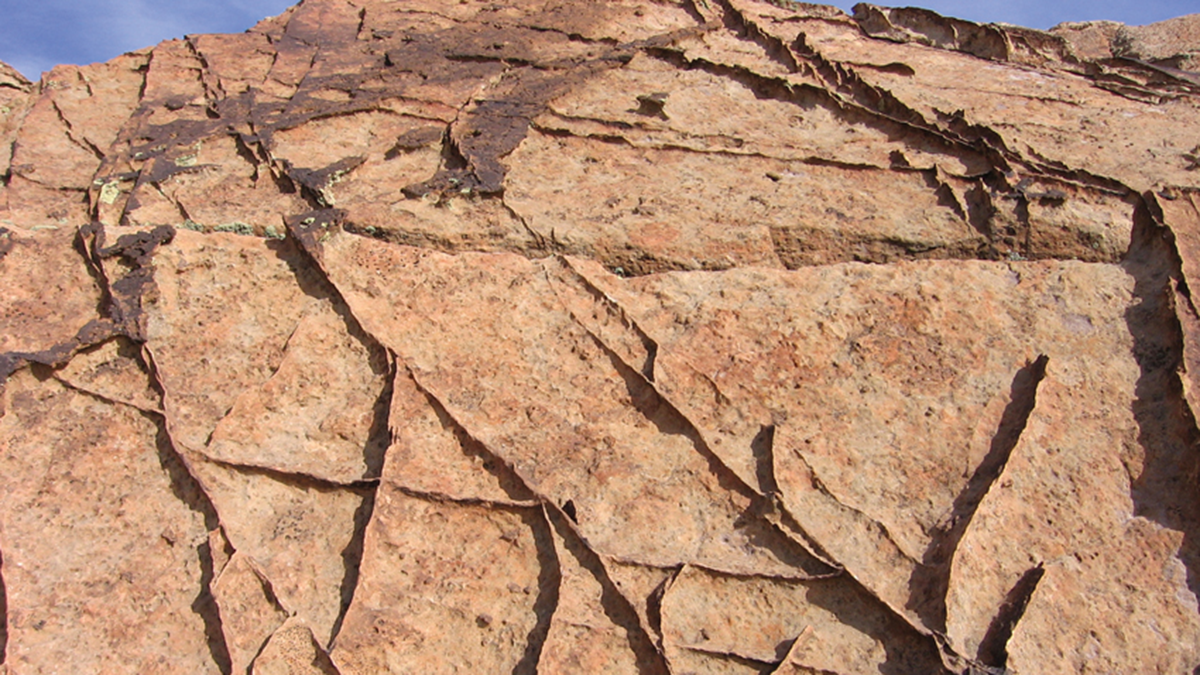
From Grains to Bands: Modeling Deformation in Porous Rocks
How do bands emerge in highly porous rocks? A study based on energy minimization reveals how microscale heterogeneity and stress conditions drive the formation of complex deformation bands.
Posted inEditors' Highlights
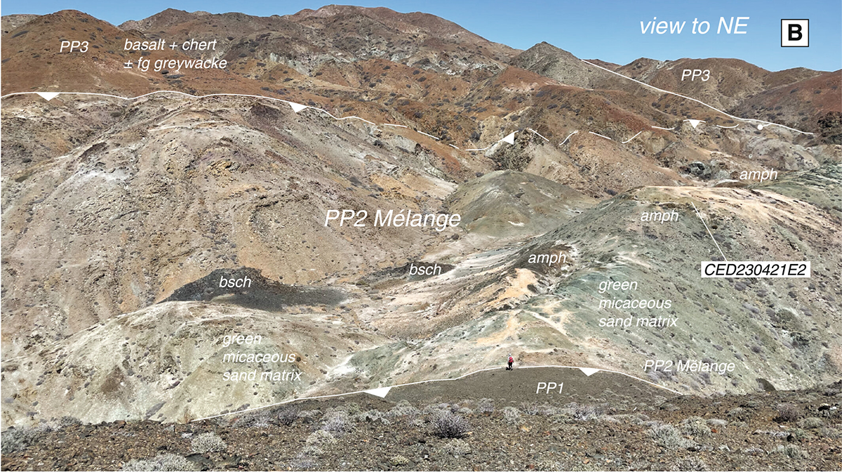
Recycled Rocks Reveal Subduction Zone Dynamics Off Baja California
High-pressure rocks on Cedros Island were exhumed, eroded, and redeposited into the subduction trench multiple times, reshaping interpretations of ancient plate boundary processes.

Posted inEditors' Highlights
Undulations in Auroral Arcs at Plasmaspheric Plume Boundary
Undulations in detached auroral arcs unveil intricate interactions between energetic ions and electromagnetic ion cyclotron waves at plasmaspheric plume boundary.
Posted inEditors' Highlights
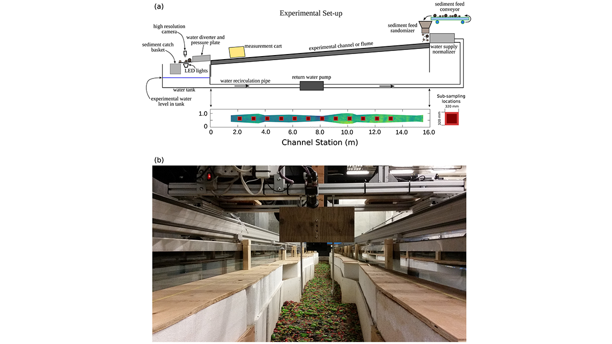
Small and Large Grains Move Differently in Water
A shift in perspective: flume experiments show that grain entrainment is far more complex than traditional models suggest.
Posted inEditors' Highlights
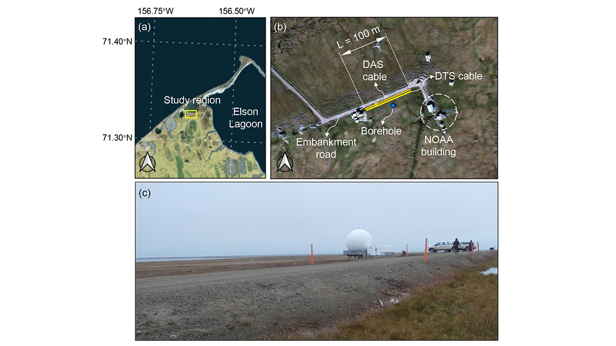
A Digital Twin for Arctic Permafrost Beneath Roads
A physics-informed digital twin uses high-resolution temperature data to track, update, and predict permafrost conditions beneath an Alaskan embankment road.
Posted inEditors' Highlights
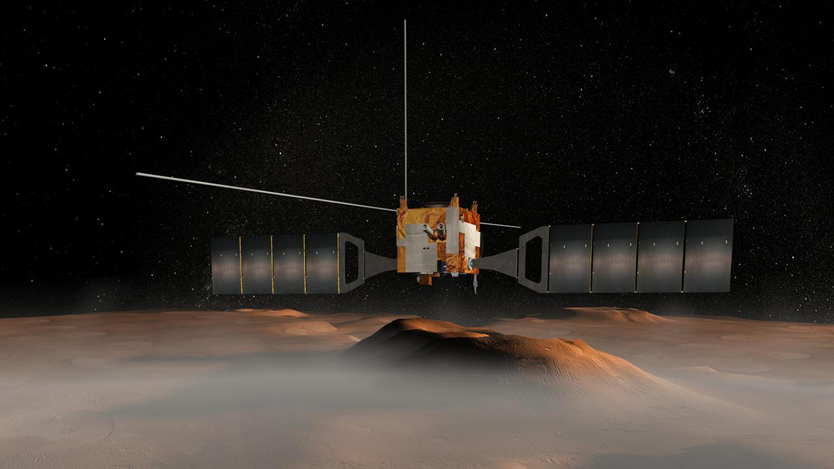
Martian Aerosols Reveal Dynamics of Dust and Cloud Transport
A new study presents a nine-Martian-year survey of dust and water ice clouds vertical distribution, key drivers of the planet’s climate.
Posted inEditors' Highlights
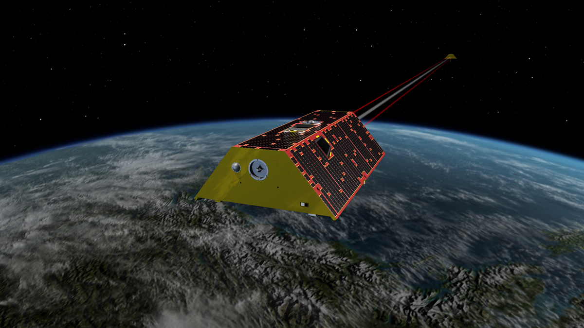
Taking the Pulse of Atmospheric Drag to Predict Satellite Trajectory
Scientists present a new method for estimating the density of the upper atmosphere to account for atmospheric drag when predicting satellite trajectory.
Posted inEditors' Highlights
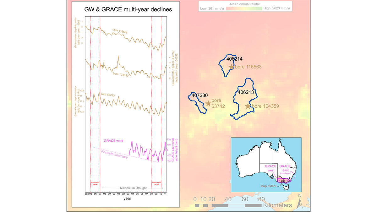
Let’s Not Forget About Long Droughts
Why do conceptual hydrologic models struggle to model long-term droughts? A new study investigates.