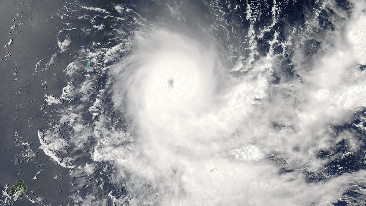
Tropopause temperature biases create major tropical cyclone differences in models; cooler air boosts storm potential intensity, raising global cyclone frequency and hurricanes in experiments.
Editors’ Highlights
Posted inEditors' Highlights
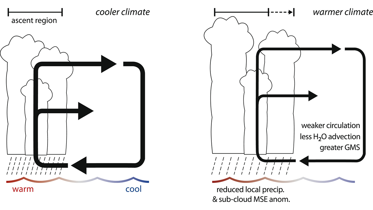
The “Wet-Gets-Wetter” Response to Climate Change Does Not Always Apply
While the precipitation response to a warming climate is often stated as the “wet gets wetter,” this response does not apply to east-west overturning circulations like the Pacific Walker circulation.
Posted inEditors' Highlights
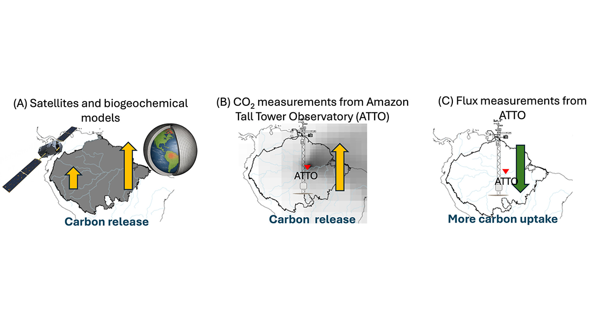
Severe 2023 Drought: Sinking Carbon Sink in the Amazon
The Amazon forest has been a reliable carbon sink, soaking up some of humanity’s carbon emissions, but a severe drought in 2023 adds to growing concern that this ecosystem service is at risk.
Posted inEditors' Highlights
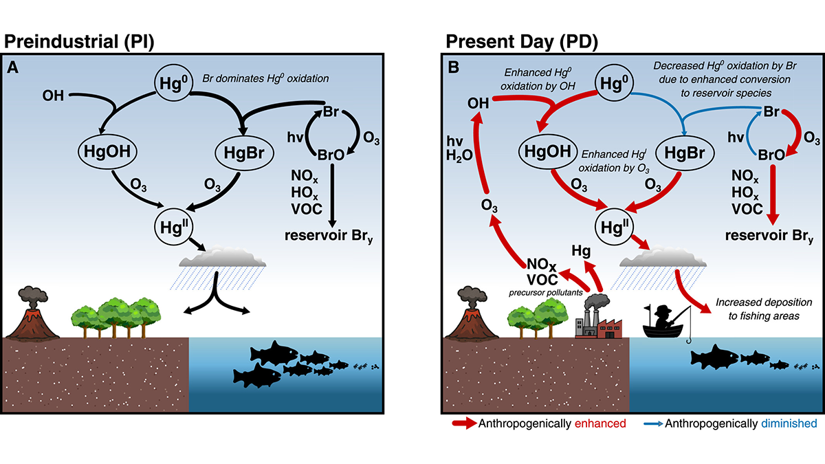
Human Effects on Background Atmosphere have Affected Mercury Chemistry
Atmospheric mercury chemistry has evolved over time due to changes in atmospheric composition, especially for changing concentrations of bromine radicals, hydroxyl radicals, and ozone.
Posted inEditors' Highlights
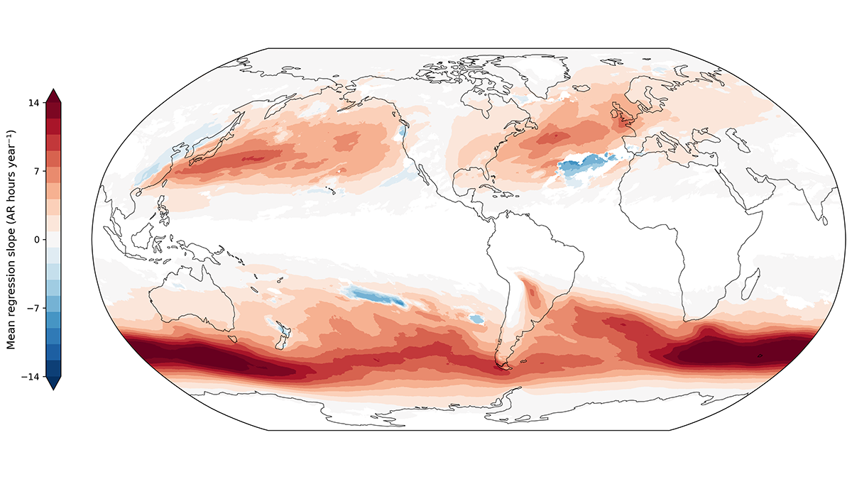
Future Hotspots of Hazardous Rivers in the Atmosphere
Atmospheric rivers can produce heavy precipitation and associated hazards worldwide. A new study identifies regions where these hazards have already, and will further, increase with global heating.
Posted inEditors' Highlights
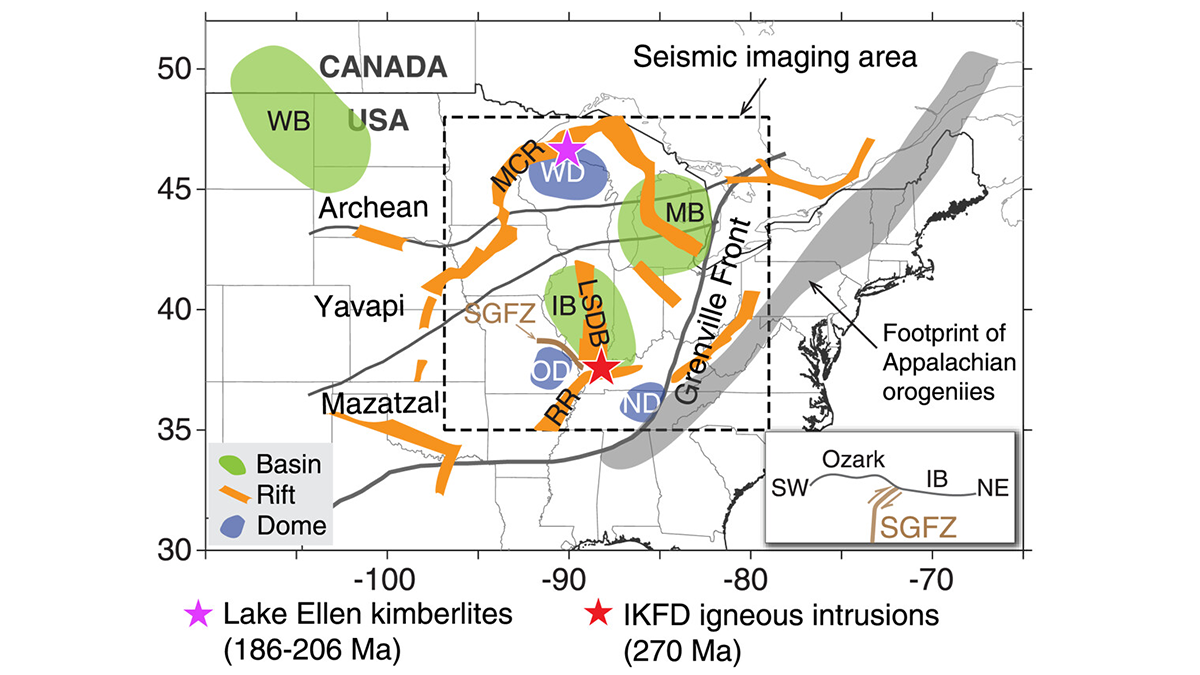
Tectonic Modifications Shape Surface Environment and Landscape
Earth observation through ambient noise tomography explains links between tectonic modification, ancient geological records, and landscape evolution.
Posted inEditors' Highlights
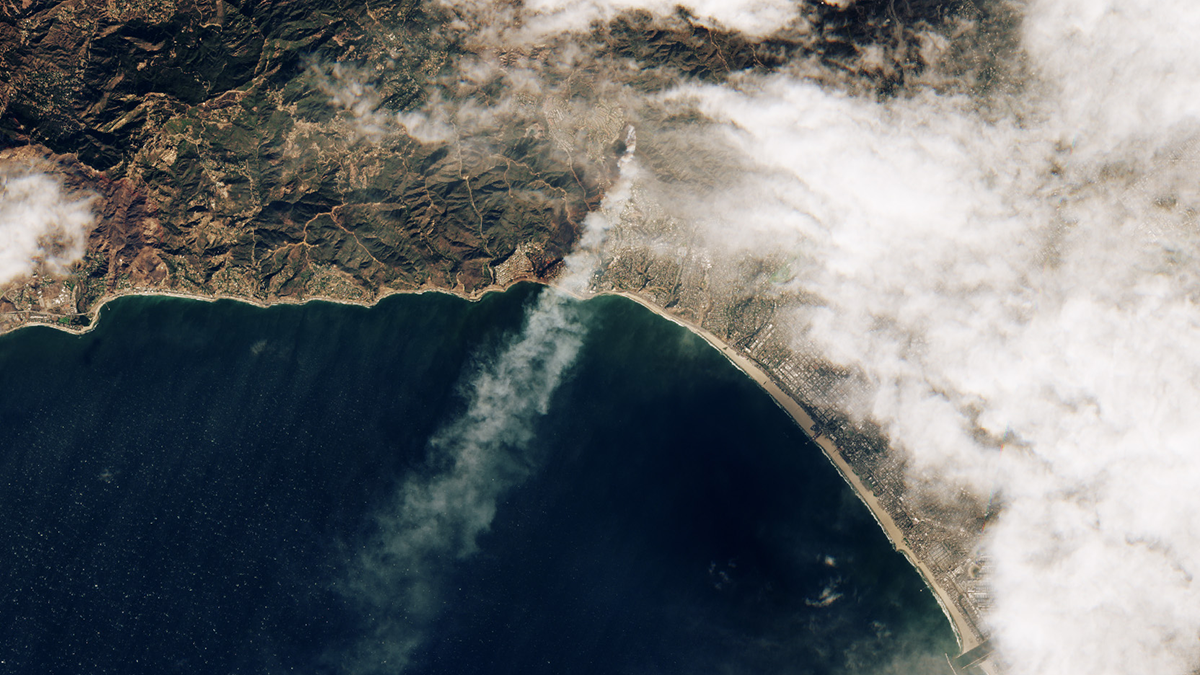
Satellite View of the California Wildfires of January 2025
Satellite observations of the southern California wildfires of 2025 reveal that almost all the burned areas were reached by fire within 24 hours, and wildfires in residential areas burned more intensely than nearby natural vegetation fires at night.
Posted inEditors' Highlights
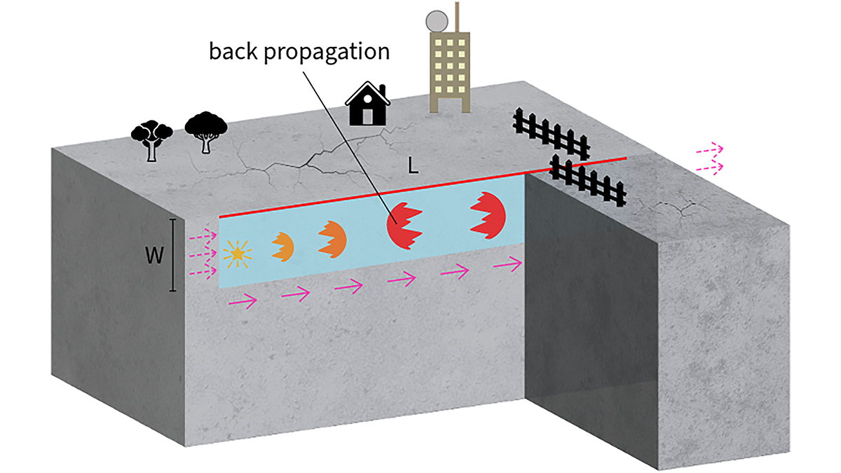
Boomerang Earthquakes Don’t Need Complex Faults
New simulations show earthquakes can reverse direction within seconds on simple, uniform faults, suggesting back-propagating subevents are more common than previously thought.

Posted inEditors' Highlights
Understanding Aerosol-Cloud Interactions is Pivotal for Improving Climate Predictions
Global cooperation and knowledge sharing are essential to improve our understanding of cloud formation and evolution through aerosol-cloud interaction.
Posted inEditors' Highlights
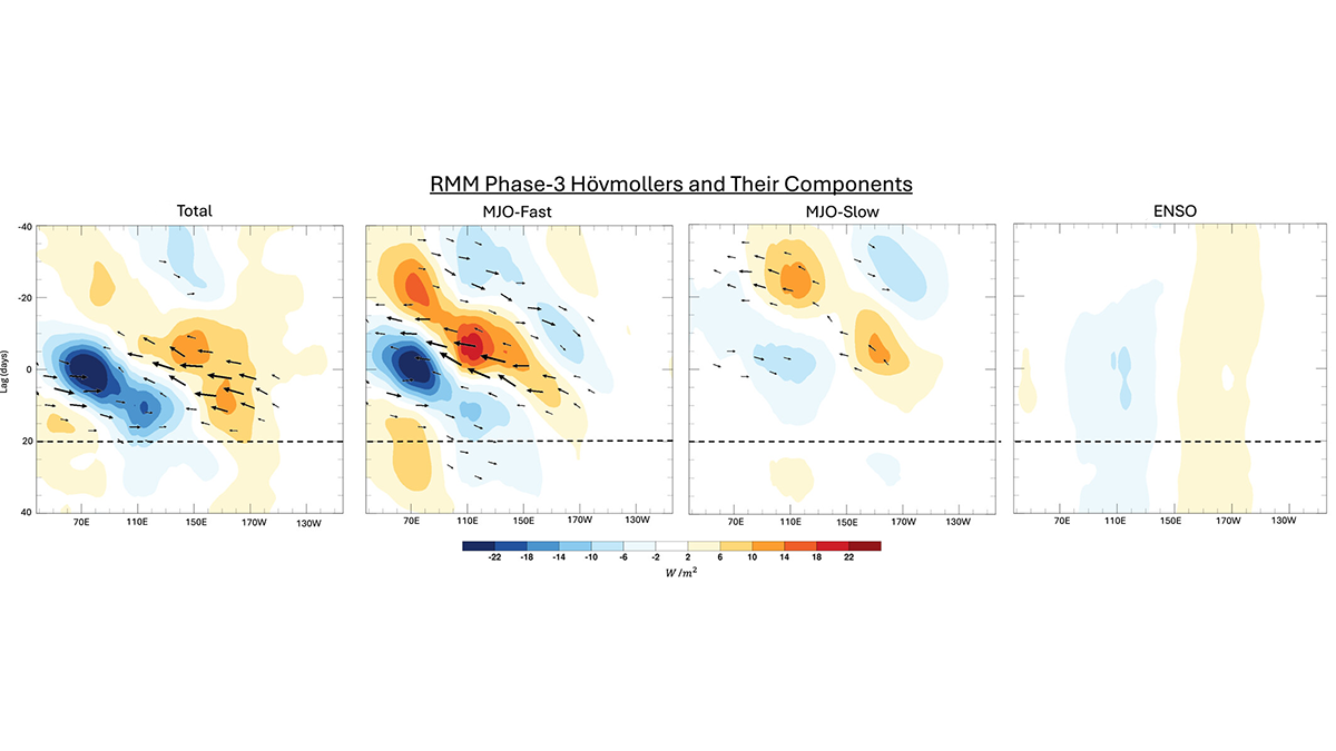
Slow and Fast Madden-Julian Oscillation Modes
The skill of Madden-Julian Oscillation (MJO) forecasts can be improved by identifying slow- and fast-MJO modes and their superposition.