Source: Water Resources Research
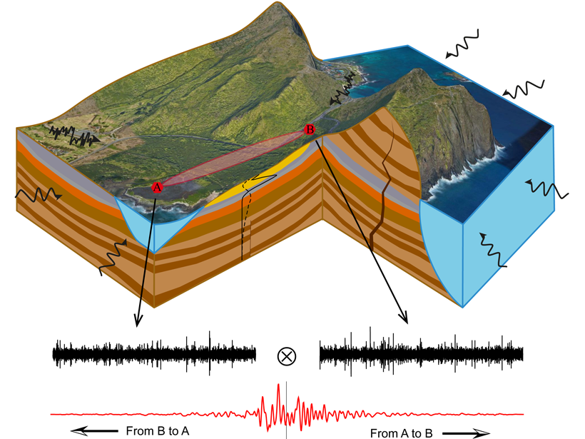
There is growing recognition of the value of combining data from multiple geophysical modalities for improved and unambiguous conceptualization of subsurface flow processes. Grobbe et al. [2021] focus on the use of passive seismic and self-potential measurements near the Kaiwi Coast, O’ahu, Hawai`i.
Analysis of ambient seismic noise from an array of surface geophones, permits the development of a 3D shear wave velocity model, and subsequently a conceptualization of lithology. The addition of self-potential measurements then permits an interpretation of flow pathways within the complex geological setting.
The authors reveal evidence that subsurface flow focuses along paleo-channels on the erosional surface between the basaltic bedrock and the overlying volcanic and sedimentary formations, at roughly 100 to 200 meters depth. This impressive demonstration is likely to prompt many further coupled applications of these two methods.
Citation: Grobbe, N., Mordret, A., Barde‐Cabusson, S., Ellison, L., Lach, M., Seo, Y.‐H., et al. [2021]. A multi‐hydrogeophysical study of a watershed at Kaiwi Coast (Oʻahu, Hawaiʻi), using seismic ambient noise surface wave tomography and self‐potential data. Water Resources Research, 57, e2020WR029057. https://doi.org/10.1029/2020WR029057
—Andrew Binley, Associate Editor, Water Resources Research
Text © 2021. The authors. CC BY-NC-ND 3.0
Except where otherwise noted, images are subject to copyright. Any reuse without express permission from the copyright owner is prohibited.