Editors’ Vox is a blog from AGU’s Publications Department.
Many geophysical structures, processes, and material movements are hidden from plain sight so imaging them can be challenging for scientists. One new technique, muography, allows scientists to visualize the internal makeup of solid geological structures at high resolution. A book just published in AGU’s Geophysical Monograph Series, Muography: Exploring Earth’s Subsurface with Elementary Particles, explores the application of this technique and how it can be used in conjunction with traditional observational methods. We asked the book’s editors some questions about muography, its applications in geophysics, and what readers can expect from their book.
What are muons and what is muography?
Muons are elementary particles similar to electrons, but the mass of a muon is approximately two hundred times heavier than the mass of an electron. The main source of muons is from nature. They are continuously created as byproducts of particle showers induced by collisions of cosmic rays with atmospheric nuclei. Muons travel with a velocity close to the speed of light, making them capable of reaching Earth’s surface due to relativistic effects, despite the short decay time.
Muons are observed everywhere on our planet (approximately one muon penetrates across a hand-sized surface every second). Muons are more penetrative than electrons due to their greater mass, and the most energetic muons can reach down even a few kilometers into Earth’s subsurface.
Muography is an imaging technique for visualizing the internal density composition of geological structures and human-made objects.
Muography is an imaging technique for visualizing the internal density composition of geological structures and human-made objects. It is similar to X-ray radiography in human bodies: the muons lose energy in all kinds of media and get absorbed if the energy runs out. The energy loss of muons depends on the integrated mass of the media; thus, the yield of muons which have penetrated a given media will provide information on the density of the traversed object.

How can muography be used in Earth science research?
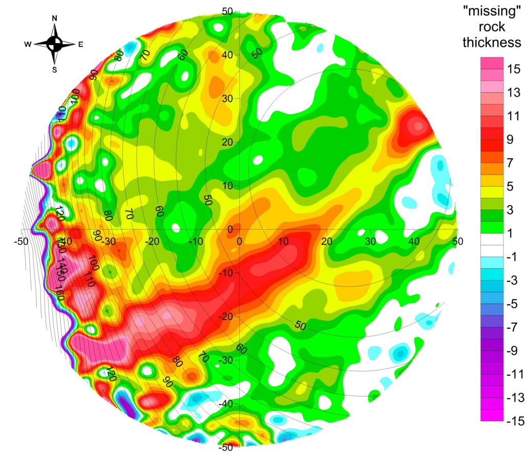
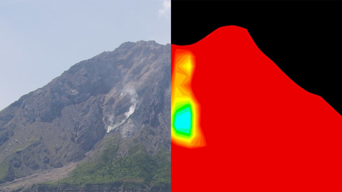
Muography produces “radiographic” images of Earth’s subsurface to reveal the density structure of deeper regions with a precision of a few meters. This technique can be utilized for monitoring material movements within geological structures and hydrologic systems, as well as for improving our understanding of geophysical phenomena.
One of the main applications of muography to date has been studying various phenomena inside volcanoes (such as the degassing process, eruption dynamics, magmatic plug formation, and hydrothermal activities) and monitoring volcanic edifices (for example, deposition of volcanic ejecta, and tectonic changes).
Besides volcanology, muography of the shallow subsurface has potential to improve our understanding of climate change induced processes in the cryosphere, to reveal evidence of past natural disasters, to enable the sustainable exploration of hidden underground resources, to improve geological engineering techniques, and much more.

Besides standalone muographic experiments, muography can also be used as a complementary monitoring technique; for example, it is possible to conduct joint analysis of muographic and gravimetric data for high-resolution three-dimensional density imaging of the subsurface.
What are the advantages of using muography compared to other imaging techniques?

Because it utilizes naturally occurring background radiation, muography offers passive and non-destructive imaging of the Earth’s subsurface.
The high penetration power of muons and the predictability of their trajectories in matter enable the imaging of kilometric objects with a spatial resolution of a few meters. With conventional geophysical techniques, large-scaled and dense sensor arrays are required to attain this level of resolution.
The high-resolution imaging capability also has practical benefits such as the observation of inaccessible or hazardous geological phenomenon from a safe distance.
What are the limitations of muography?

Since cosmic-ray muons come only from the sky, the viewing angle for muographic imaging is limited. Users must install observational instruments at elevations lower than targeted structures (such as in tunnels or boreholes) to explore the structure of the overburden.
Another limitation is that naturally occurring muons have a finite yield. The muographic scanning of thick objects requires careful design of the measurement setup (e.g. optimization of detector size, imaging resolution, exposure time) to compensate.
How have muographic observation instruments advanced in the past decade and how have these advancements impacted muographic practices?
In the past decade we have witnessed substantial progress in instrumentation. Different groups have succeeded in application-oriented development of instrumentation, and have performed joint muographic surveys at various sites to verify different technologies and demonstrate their applicability, such as in the Egyptian pyramids, at nuclear reactors, and around volcanic edifices.
Recently, compact detectors based on innovative technologies have provided fair imaging resolution, operational reliability, and efficiency in harsh and varied environments. The progress in technological development has made the instrumentation more user friendly and has broadened the applicability of this technique. For example, muography has recently been utilized for monitoring of the hydrosphere.
What are some of the unresolved questions in this field where further research, data gathering, or modeling are needed?
High definition muography is expected to contribute significantly to effective exploration of resources in the Earth’s subsurface and permanent monitoring of infrastructure. Muography also has the potential to contribute to assessment of both direct and indirect natural hazards. Joint measurements with other techniques are highly desired for successful social implementation of muography.

The strengthening of cooperation between the developers and potential users from both academia (such as researchers, teachers, and students) and the private sector (such as engineers and project managers) will be required to make muography a standardized technique – like X-ray based radiography – with optimized and compact devices running user-friendly interfaces for various applications.
The aim of our book is to provide topical information to improve cooperation between developers and users since this is key to finding an ever-broader range of applications for muography and to solving important problems in the years to come.
Muography: Exploring Earth Subsurface with Elementary Particles, 2022. ISBN: 978-1-119-72302-8. List price: $199.95 (hardcover), $160 (e-book)
—László Oláh ([email protected], ![]() 0000-0002-4300-8331), The University of Tokyo, Japan; Hiroyuki K. M. Tanaka (
0000-0002-4300-8331), The University of Tokyo, Japan; Hiroyuki K. M. Tanaka (![]() 0000-0002-3816-1630), The University of Tokyo, Japan; and Dezső Varga (
0000-0002-3816-1630), The University of Tokyo, Japan; and Dezső Varga (![]() 0000-0002-2450-1331), Wigner Research Centre for Physics, Hungary
0000-0002-2450-1331), Wigner Research Centre for Physics, Hungary
Editor’s Note: It is the policy of AGU Publications to invite the authors or editors of newly published books to write a summary for Eos Editors’ Vox.

