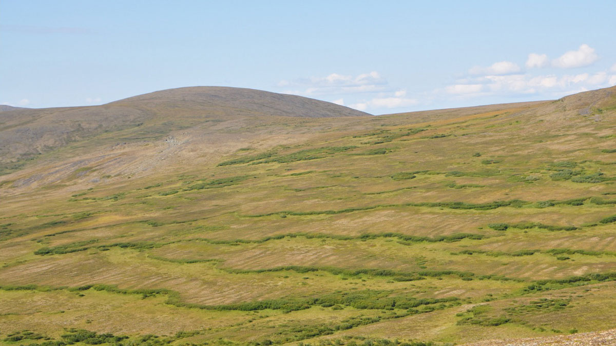
An enigmatic feature of frozen soils can be explained in part by non-Newtonian fluid physics. Enter the Oobleck.
geophysics
Posted inFeatures
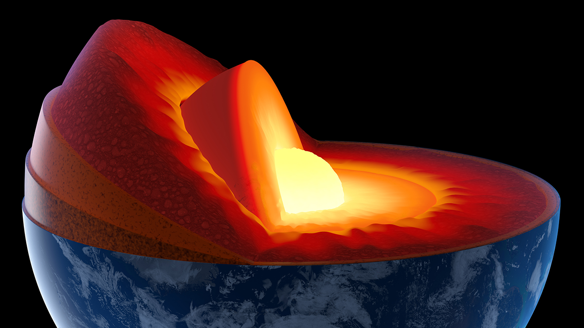
A Quiet Quantum Revolution in Earth’s Deep Interior
A subtle change in iron ions’ electronic configuration produces a measurable difference in seismic wave speeds through mantle rocks.

Posted inNews
How Einstein’s Lost Theory Could Help Us Find Minerals
New claims challenge inconsistencies in one of the foundational principles of physics. What could this mean for geophysics and Earth science applications?


Posted inNews
Changes in Sea Ice Microstructure Could Affect Climate Models
Granular sea ice needs to be twice as porous as columnar ice to allow water to flow through it—up to 10% brine by volume.
Posted inNews
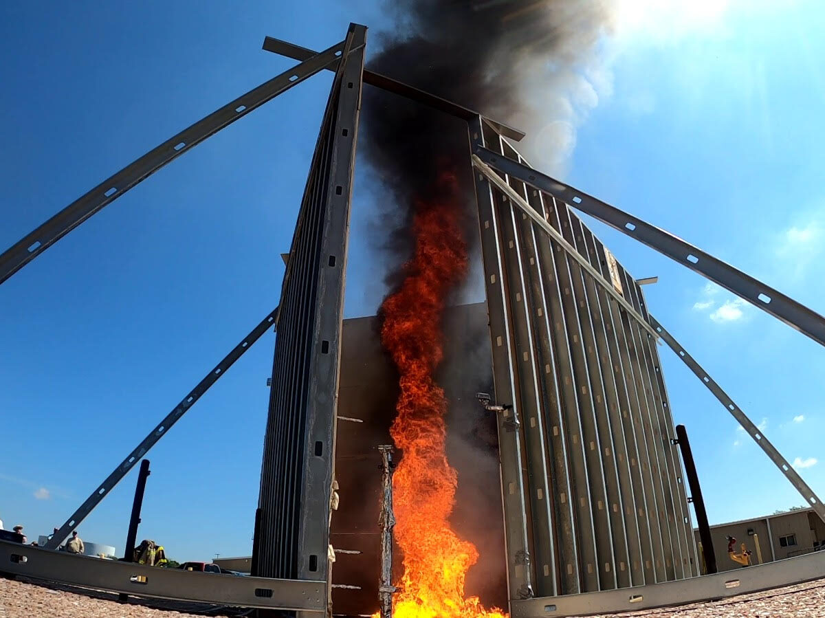
The Fiery Tornadoes That Could Mop Up Oil Spills
More than 15 years after the Deepwater Horizon disaster, researchers are still searching for new ways to tackle disastrous spills. Some are looking to flaming twisters.
Posted inResearch Spotlights
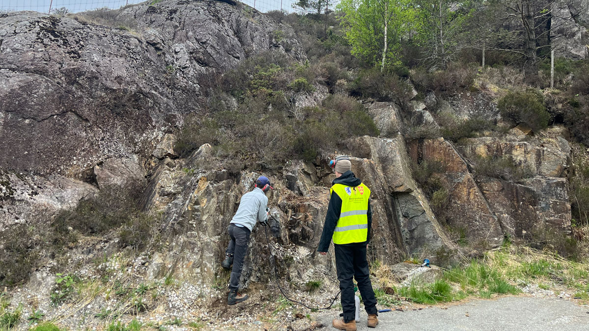
Where Was Baltica 616 Million Years Ago?
Disentangling magnetic signals in its ancient rocks gives an updated view of the paleocontinent’s position during the Ediacaran period.
Posted inNews
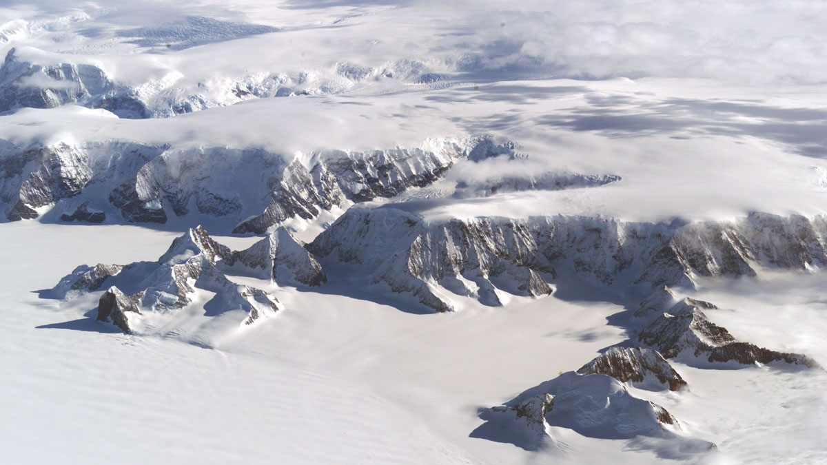
As Ice Recedes and Land Rebounds, Antarctica’s Mineral Resources Come into Focus
Melting ice, rebounding land, and rising seas will change what resources are available in Antarctica, a new analysis finds.
Posted inNews
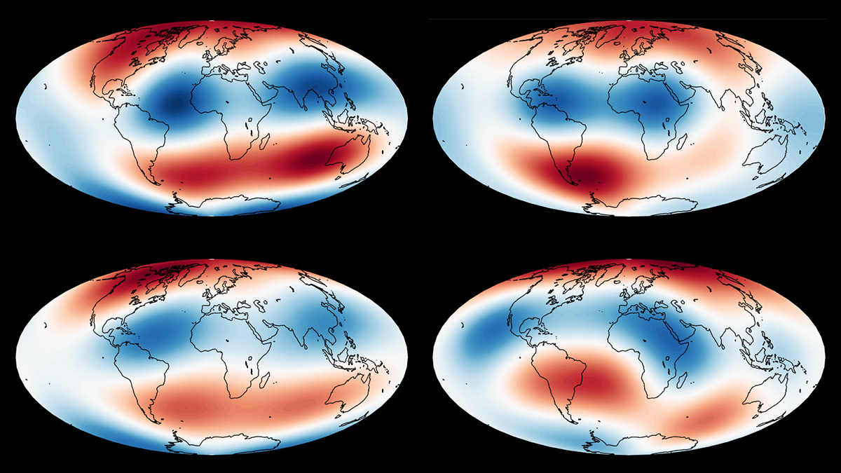
What do BLOBs Have to Do with Earth’s Magnetic Field? A Lot, It Turns Out
Enormous provinces of superheated mantle exert a powerful influence over our planet’s magnetic field, researchers have discovered.
Posted inNews
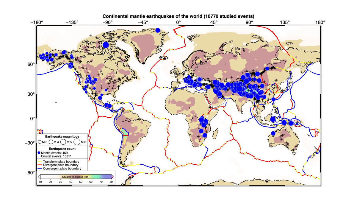
Scientists Create the First Map of Deep Earthquakes Beneath Continents
Scientists once thought Earth’s continental mantle was too weak for earthquakes. A new global map of 459 deep tremors suggests otherwise.