It’s a hidden part of the hydrological cycle but moisture in the soil plays an important role in many processes and influences the climate. Soil moisture can be measured by instruments in the field or by remote sensing techniques. A recent review article in Reviews of Geophysics discussed soil moisture data obtained from satellite observations and the methods for “downscaling” the information so that it can be applied in particular contexts. The editors asked one of the authors some questions about how techniques are advancing in this field.
Why is soil moisture important in the global climate system?
Soil moisture is crucial for plant growth. It is also a source of water for evapotranspiration. Because the evaporation of soil moisture requires energy, soil moisture has strong impacts on the surface temperature. Through controlling the exchange of water, energy and carbon fluxes between the land surface and the atmosphere, it plays important roles in various processes and feedback loops within the Earth system. Specifically, the soil moisture influences agricultural and hydrological processes, drought development, runoff generation and many other processes. Due to its importance for climate system, the soil moisture has been recognized as one of the Essential Climate Variables by the Global Climate Observing System.
How is soil moisture measured?
Soil moisture is usually defined as the total amount of water within the unsaturated zone. In practice, it is often separated into surface soil moisture corresponding to water in the upper soil, and the root zone soil moisture that is available to plants.
Traditionally, the soil moisture has been measured with ground instruments, including gravimetric methods, time domain reflectometry, capacitance sensors, neutron probes, electrical resistivity measurements, heat pulse sensors, and fiber optic sensors. These techniques have the advantages of easy installation, relative maturity, and the ability to measure moisture at different soil depths.
However, these ground techniques can only measure soil moisture at specific points, and this is not necessarily representative of neighboring areas due to the large spatial heterogeneity of soil moisture. This problem has been addressed with the development of remote sensing techniques which can be used to obtain soil moisture from regional to global scales.
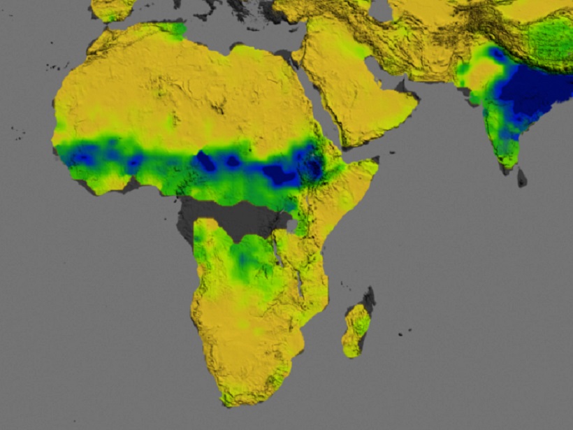
Satellite observations from active and passive microwave sensors are best suited for the retrieval of soil moisture. Microwave remote sensing cannot directly measure soil moisture but makes use of the direct relationship between soil dielectric constant and water content. Active microwave remote sensing techniques measure the energy reflected from the land surface after transmitting a pulse of microwave energy, while passive microwave sensors measure the self-emission of the land surface.
What are “downscaling methods” and why are they necessary?
The soil moisture products retrieved from microwave remote sensing have matured in recent decades. They have been widely validated against field campaigns and explored for a wide range of applications such as climate model evaluation and drought monitoring. These soil moisture products normally have a spatial resolution in the order of tens of kilometers, which serves well for global scale applications. However, this spatial resolution is often too coarse for regional hydrological and agricultural applications, which normally require a spatial resolution of several kilometers or even tens of meters. Within this context, various downscaling methods have been proposed to enhance the spatial resolution of these soil moisture products.
What are the main strengths and weaknesses of different downscaling methods in terms of measuring soil moisture?
The idea behind the downscaling method is to establish either a statistical correlation or a physically based model between coarse-scale soil moisture and fine-scale auxiliary variables. A range of different downscaling methods from satellite-based to geoinformation-based to model-based have been proposed and applied to improve the spatial resolution of soil moisture products. Each of these methods has its own advantages and disadvantages, and varies widely with different complexity and data requirements. Although each method has its applicability for certain purposes, and over different surface and climate conditions, none can be applied everywhere over the world without any calibration or improvements.
What further developments are required to improve the accuracy of downscaling methods?
There is a need to develop downscale schemes that combine multiple data sources: (1) other finer scale remote sensing; (2) ancillary data such as topography, soils, and landcover; and (3) models. As such, the optimal approach consists of models and algorithms that assimilate multiple data sets into model simulations to generate high-resolution soil moisture, which would be the ultimate synthesis of information from various sources.
A variety of applications will benefit significantly from high spatial resolution soil moisture products including climate modeling, numerical weather prediction, runoff modeling, flood forecasting, precision agriculture, and erosion modeling.
—Jian Peng, Max Planck Institute for Meteorology, University of Munich; email: [email protected]
Citation:
Peng, J. (2017), Seeing soil moisture from the sky, Eos, 98, https://doi.org/10.1029/2018EO074427. Published on 01 June 2017.
Text © 2017. The authors. CC BY-NC-ND 3.0
Except where otherwise noted, images are subject to copyright. Any reuse without express permission from the copyright owner is prohibited.