By what stretch of the imagination could Cubism’s landscape blasphemers share any overlap with their pious relations, the Earth scientists?
Mask on, glasses fogged, I studied the brightly painted courtyard scene on the canvas in front of me, one of David Hockney’s midcareer Cubist nods. Before the pandemic, I would have breezed by its bold colors in favor of the artist’s more subdued works. But after three long months cooped up in my small apartment, I savored every minute in the gallery, taking care to study each individual piece on display. I thought about Hockney’s treatment of perspective—it was summative. He had captured every angle of the courtyard from one vantage point. My seemingly stagnant dissertation weighing heavily on my mind, I found in Hockney’s painting a mirror of my own research on glacial landscapes and realized that I and his Cubist forbearers may have more in common than I previously thought.
For self-respecting scientists who pride themselves on the accurate description and reportage of scientific fact, equating Cubist art with scientific practice is, perhaps, a heretical suggestion. Georges Braque, Pablo Picasso, Juan Gris, and other Cubists scandalously distorted their subjects to the brink of unrecognition. Conversely, Earth scientists, and scientists more generally, pride themselves on a puritanical devotion to the study of a physics-grounded reality. By what stretch of the imagination could Cubism’s landscape blasphemers share any overlap with their pious relations, the Earth scientists?
Deconstructing Earth Science
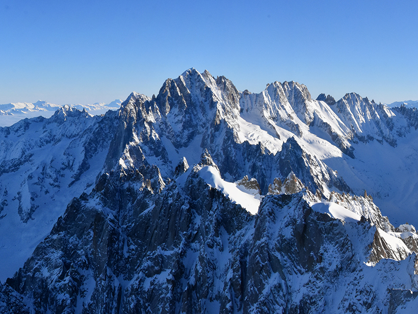
Viewed through the eyes of an Earth scientist, a mountain range is not a tall agglomeration of rock, soil, and vegetation, but evidence of a complex system of interwoven processes. Formed (in many cases) following the collision of tectonic plates, mountain building continues until the pressure between plates is relieved. This relief is often achieved when one of the plates subducts under the other and is consumed by the mantle below. At the surface, the mountain range weathers and erodes as a function of tectonics and climate. Weathering, erosion, and sediment transport occur during and after tectonic uplift and proceed, in theory, until the angle of the mountain slope relative to the surrounding terrain is near zero—that is, the surface is flat, and the mountains no longer exist.
This idealized portrait of the life cycle of a mountain range, however, remains rare and elusive in nature. The geometry of a subducting plate can affect the differential height of mountains in a range, and regions with complex tectonic regimes and histories (Southern California, Tibet, and Greece, to name a few) often experience multiple or even concurrent episodes of mountain building. Differing and temporally evolving climatic regimes sculpt landscapes into a mélange of past and present. Relict glacial features mingle with active floodplains; ancient fault scarps are cut by modern landslides.
“Archetype” landscapes that reflect current geomorphic processes are therefore rare on Earth. The Earth scientist’s role is to define distinct regimes within these palimpsests and use observations of Earth as it presently exists for informed inference. We study Earth and then carve it into its constituent pieces to make sense of it.
When considering the uplift and erosion of a mountain range, for instance, we could begin by thinking of the mountain as an equilateral pyramid eroding at a constant rate, then move on to more complicated geometries and erosion styles that better reflect real mountains. In doing so, we build an imagined, simplified reality—a reality that exists nowhere but allows us to draw out and emphasize certain elements we know to be important and to distill a numbingly complex landscape (or process) into its most essential components.
Geomorphic Cubism
Cubists, too, distill their landscapes to discrete elements.

Consider Braque’s Castle of La Roche-Guyon (1909). This work is characterized by sequential, retreating planes within a central lozenge shape and painted in a two-toned color scheme that facilitates the immediate division of textural forms into the more loosely painted green (suggesting foliage) and the yellow-ochre-beige shapes of the castle and associated buildings. Distilled into its most fundamental components, the scene is identifiable, but disorienting. One cannot quite distinguish the background from the foreground—and from what vantage point is the viewer observing this castle?
Braque’s landscape is a landscape compressed and reorganized, a landscape painted by an artist rejecting a scene he is told to conceive of and, rather, depicting one that he perceives. The centrality of perception, versus imitation, in early (analytic) Cubist art and the incorporation of variable perspectives separated these renegades from many of their 19th century forbearers. Braque himself said, “[scientific perspective] makes it impossible for an artist to convey a full experience of space, since it forces the objects in a picture to disappear away from the beholder instead of bringing them within his reach, as painting should.” Braque’s Castle of La Roche-Guyon therefore reflects his perception of a landscape, constructed to emphasize those components of the landscape he deems critical, appealing, or distinctive—in this case, drawing out the castle buildings from their natural surrounds.
Any scientist’s model, interpretation, or concluding representations are therefore fundamentally works in Cubist geomorphology.
In rejecting the imitation of a world as one explicitly sees it today, Braque and other Cubists labor in a manner similar to that of the Earth scientist. When geomorphologists reconstruct an ancient glacial environment, they select critical, singular components of the existent landscape (moraines, drumlins, overdeepenings) to study and interpret the unseen paysage of the past. This selection occurs in an iterative process, until the scientist has reconstructed the composition of the scene in question from meticulously selected, evidence-guided vantage points. Perhaps then a landscape evolution model is employed for additional interpretation or even the prediction of a landscape’s future evolution.
Many, if not most, models and experiments distill a system to varying degrees of natural “realism” depending on the research question of interest—an observation that has inspired previous analogies linking modeling and artistic realism. But through this studied distillation, researchers are not simply reducing the pictorial realism; they are additionally imbuing the experiment with their own subjectivity by determining which processes or variables are most critical for addressing the question at hand. Like Braque, who muddles the foliage and emphasizes the castle, the geomorphologist excludes features determined to be irrelevant for glacial reconstructions. The resultant model, interpretations, or concluding representations are therefore fundamentally works in Cubist geomorphology.
Toward an Integrative Geoscience
This Cubist example is one of many possible comparing the intellectual endeavors of artists and geoscientists and demonstrates the long-observed belief that both disciplines stand to strongly benefit from each other.
Studies evaluating the benefits of STEAM approaches to geoscience education (those involving science, technology, engineering, arts, and mathematics) have found mixed, though generally positive, results. Outside of education, many of the most prominent examples of art and geoscience collaboration center on communicating the urgency of the climate crisis to the general public. Efforts like “Erratics,” a curatorial project exploring the human experience of climate change in combination with glacial and geologic forces, are particularly intriguing.
GLACIER: A Climate Change Ballet, choreographed by a climate policy expert, demonstrates attentiveness to both ice-ocean interactions and the aesthetics of polar environments. These projects press scientists (and artists and audiences!) to consider their research and the methods by which they derive their findings from alternative perspectives.
Generally, (geo)scientists limit themselves to viewing the arts as a disseminative tool, rather than valuing them as an intellectual and creative exercise equally as rigorous as scientific research.
Still, artists and scientists are often divided on who benefits most from collaboration, with artists believing scientists benefit more and scientists viewing the artists as the primary benefactors. And indeed, rather than focusing on the benefits of arts collaboration for research quality, much discussion of geoscience research and arts intersectionality focuses on the utility of art as illustration in research, the representation of science as subject in art, or artistic means of engaging in public science outreach. Perhaps this focus is due to the difficulty in evaluating whether arts collaboration improves intended research outcomes. But generally, (geo)scientists limit themselves to viewing the arts as a disseminative tool, rather than valuing them as an intellectual and creative exercise equally as rigorous as scientific research. Rejecting this premise and pushing beyond the superficial bounds of methodology would benefit geoscientists, and efforts with this aim are both exciting and promising.
Looking again to the Cubists, Braque and others of the avant-garde worked not in an artistic vacuum, but rather in the heady surrounds of belle epoque Paris, translating the conversations of their café society lives into provocative works of art. Postulating and creating in the midst of philosophers, mathematicians, and other artists, they broke from tradition and pushed their disciplines in new directions. Albert Einstein’s rejection of ether drift and discovery of a more aesthetic solution to the special relativity problem occurred contemporaneously with similar discussions in the patent office at Bern.
As we press further into the digital age, full of mixed-media possibilities for both art and science, we should step away from an exclusively transactional (product-oriented) relationship with the arts and endeavor to facilitate and fund constructive engagement with the arts throughout the entirety of a research project, from ideation to data dissemination.
—Donovan Dennis (@donovan__dennis), Geoscientist
Citation:
Dennis, D. (2021), Cubist geomorphology: Your kinship with Picasso, explained, Eos, 102, https://doi.org/10.1029/2021EO154362. Published on 10 February 2021.
Text © 2021. The authors. CC BY-NC-ND 3.0
Except where otherwise noted, images are subject to copyright. Any reuse without express permission from the copyright owner is prohibited.