Source: Journal of Geophysical Research: Atmospheres
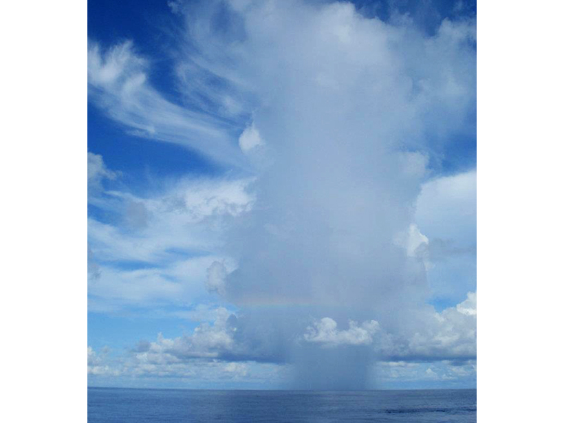
In the tropic seas around the equator, the Earth’s weather comes and goes in pulses—eastward gusts of rain and wind that surge every 30 to 60 days. This phenomenon, known as the Madden-Julian Oscillation (MJO), affects weather in this region and outside the tropics. Scientists have been studying the phenomenon for decades but recently launched a new campaign using in situ observations to better understand the MJO’s inner workings.
Here Rowe and Houze used highly sensitive weather radar technology to track cloud development and rainfall, along with other atmospheric data, as the MJO cycled over the Indian Ocean during October, November, and December of 2011. The radar network makes use of multiple wavelengths of radiation to study the full spectrum of clouds with complex computer algorithms that help combine the data and filter out noise in the signal.
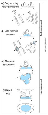
Many prior studies have revealed that MJO weather patterns typically follow a predictable progression from small cumulus clouds to deep, larger rain systems. In the wet tropics, rising columns of moist air condense to form clouds. The new study shows that the formation and movement of these early clouds is driven by wind shear created by vertical layers of wind moving at different speeds and in different directions. The radar measurements show that the early clouds are oftentimes oriented in rows parallel to this wind shear, where some of the clouds will begin to rain.
One good way to predict if the early clouds will condense into a bigger storm is to use radar to look for the presence of “cold pools.” As the name suggests, these are pockets of cool, dense air that are created when some of the early clouds begin to precipitate during the afternoon. These cold pools lift warmer, moist air along their edges, leading to new cloud formation. These new clouds then begin to rain, creating a positive feedback loop that leads to increasingly deeper, larger precipitating clouds along intersecting cold pool boundaries. Thus, after analyzing the different patterns of early cloud formation, the scientists could then watch the formation and evolution of cold pools and, eventually, how and when mesoscale convective systems—in other words, large thunderstorms—were created relative to the time of day and part of the MJO cycle over the Indian Ocean.
The results confirm that the MJO is variable both within a single day and within a season. Rainfall tended to peak in the afternoon during calm, suppressed periods of the MJO but peaked in the night and tapered off in the early morning during active days of the MJO cycle. Different wind patterns across months—such as the particularly weak winds in November—also influenced how the oscillation developed. Overall, the active rainy periods of the MJO tended to begin in the middle of each of the 3 months and last for a few weeks. In addition to providing details on the evolving cloud population critical to the MJO, the findings may also help illuminate how the MJO interacts with other climate patterns, like El Niño, allowing scientists to better predict and prepare for weather events around the world. (Journal of Geophysical Research: Atmospheres, doi:10.1002/2014JD022948, 2015)
—David Shultz, Freelance Writer
Citation: Shultz, D. (2016), Radar study examines pulsing tropical climate, Eos, 97, doi:10.1029/2016EO046407. Published on 22 February 2016.
Text © 2016. The authors. CC BY-NC 3.0
Except where otherwise noted, images are subject to copyright. Any reuse without express permission from the copyright owner is prohibited.