Against a backdrop of increasing fiscal challenges to ocean sciences infrastructure, academic, industry, and government representatives of the marine seismic data community met in San Francisco on 11–13 December, just prior to the AGU Fall Meeting.
Among the items discussed were successful examples of academic use of the marine industry’s seismic data, strategies to acquire new data from joint industry-government-academic partnerships, the potential for a revised operational model for the University National Oceanographic Laboratory System’s R/V Marcus G. Langseth, exploration of more efficient use of national and non-U.S. seismic databases, codification of access to industry sources of seismic data, and links to the National Science Foundation’s EarthCube initiative. Discussions on the latter sought to specifically identify current limitations to marine seismic research in terms of data management, processing, analysis, and visualization.

Action Items
Discussions were lively and productive, despite a citywide power failure on the first day! Action items from the workshop, which the conveners hope to pursue with follow-on EarthCube Research Coordination Network funding, include
- developing a road map outlining a joint industry project to analyze shallow geomorphology using “nonsensitive” (i.e., upper 1 second) industry, two-dimensional/three-dimensional (2-D/3-D) seismics in the Mississippi Canyon, Gulf of Mexico,
- scheduling EarthCube presentations on seismic imaging, particularly in relation to important science drivers and challenges, at selected professional society meetings in 2015,
- developing increased interoperability between both public domain and industry seismic databases,
- expanding (i.e., with reduced receiver spacing) long-offset ocean bottom seismometer seismic refraction collection,
- encouraging independent testing of seismic source arrays to evaluate marine wildlife impact, and
- considering bringing students on board industry seismic vessels for training purposes.
Charting a Course for the Marcus G. Langseth
Workshop participants, many of whom had collected data on Langseth, identified the following action items for invigorating utilization of this national seismic imaging resource:
- Develop a regional planning model for Langseth, perhaps partly through soliciting periodic letters of intent.
- Provide guidance for international collaborators who need assistance for planning and executing a cruise.
- Provide science consulting, via Langseth’s Scientific Oversight Committee (MLSOC), particularly for new users. MLSOC should also poll the relevant community to find out which of the ship’s acquisition tools (e.g., sound source, hydrophone receiving arrays) are most important.
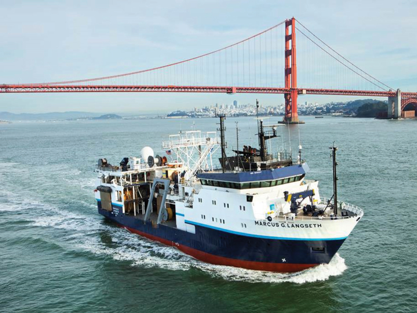
- Improve advertising of the spectacular data the ship collects, particularly in three dimensions (see Figure 1).
- Endorse training cruises and reserve sailing space for early career scientists.
A Vision for the Future
Participants agreed that future databases will need facilitated access to industry seismic information.
Meeting attendees envisioned future access to marine seismic data from various sources—national and international government agencies, academia, and industry—and that such data will be made more readily available by way of databases envisioned and developed in association with EarthCube.
Participants agreed that future databases will need facilitated access to industry seismic information, joint government-industry-academic collaborations to acquire new data, and a continuing commitment to collect high-quality seismic images in unexplored or poorly explored regions of the Earth (e.g., the Arctic). The Langseth currently provides such superb, crustal-scale 2-D and 3-D seismic images (Figure 1), serving a critical role for accessing such data by its user community.
—James A. Austin Jr. and Nathan Bangs, Institute for Geophysics, Jackson School of Geosciences, University of Texas at Austin, Austin; email: [email protected]; Dale S. Sawyer, The Weiss School of Natural Sciences, Rice University, Houston, Texas
Citation: Austin, J. A., Jr., N. Bangs, and D. S. Sawyer (2015), Better utilization of marine seismic data, Eos, 96, doi:10.1029/2015EO029867. Published on 20 May 2015.
Text © 2015. The authors. CC BY-NC 3.0
Except where otherwise noted, images are subject to copyright. Any reuse without express permission from the copyright owner is prohibited.