
A new study of the Seattle Fault Zone is revealing records of smaller, hidden earthquakes that could inform future hazard research.
seismology
Posted inResearch Spotlights
AI Improves Earthquake Detection
A new study shows the pros and cons of different model training methods.
Posted inEditors' Highlights
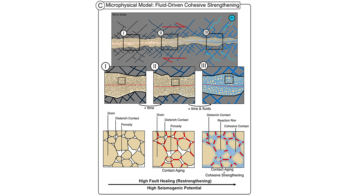
Fluid-Driven Reactions Restore Fault Strength Between Earthquakes
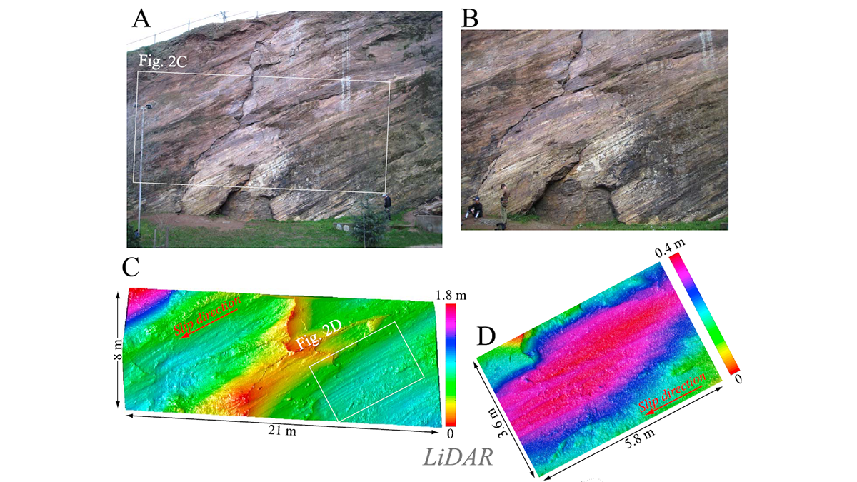
In fault gouge, fluids drive chemical healing by cementing grains, a mechanism for seismic slip in rocks frictionally expected to creep. This cohesion matters for fault stability.
Posted inFeatures
A Quiet Quantum Revolution in Earth’s Deep Interior
A subtle change in iron ions’ electronic configuration produces a measurable difference in seismic wave speeds through mantle rocks.
Posted inEditors' Highlights
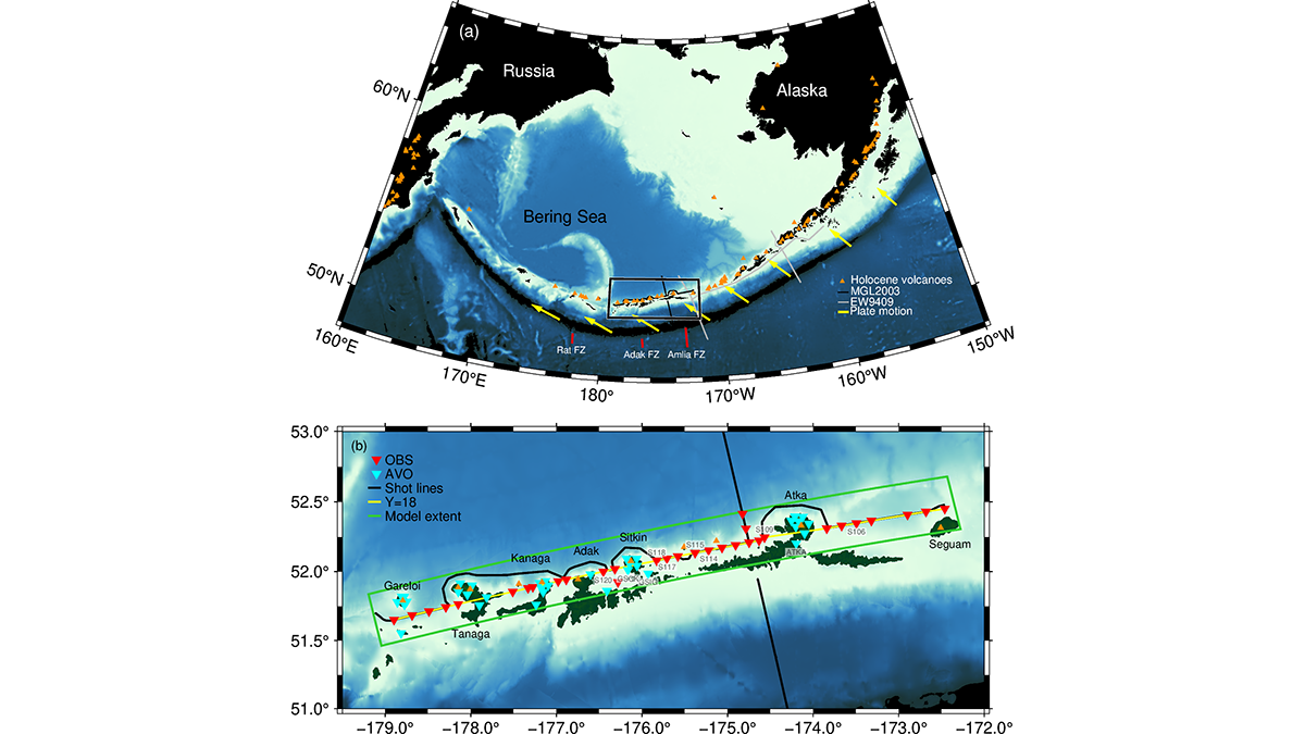
A Snapshot of Continental Crust in the Making
New seismic images from the Aleutian Arc show how active volcanic arcs may build new continental crust, highlighting the complex transition at multiple stages.
Posted inEditors' Highlights
Multi-Scale Fault Roughness Encapsulated in a Friction Law
A new rate- and roughness-dependent friction law incorporates multi-scale fault processes to reproduce earthquake fracture energy scaling.
Posted inEditors' Highlights
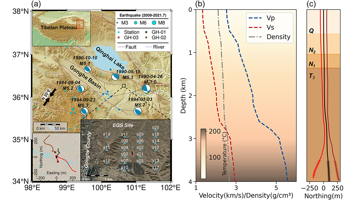
Pre-Existing Structure and Stress Shape Geothermal-Induced Seismicity
At China’s first Enhanced Geothermal System site, dense seismic observations, integrated with borehole data and stress modeling, reveal weak faults and scale-dependent control of stress and structure on induced seismicity.
Posted inNews
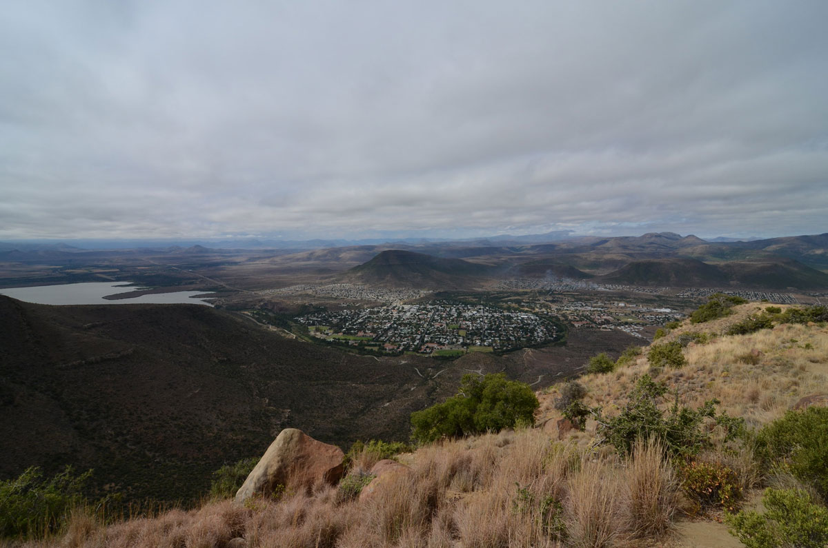
A Swarm of Earthquakes in South Africa’s Karoo Basin Poses Questions for Oil and Gas Development
A recent study cautions that the Karoo, a potential target for shale gas exploration, might not be as seismologically calm as it appears.
Posted inNews
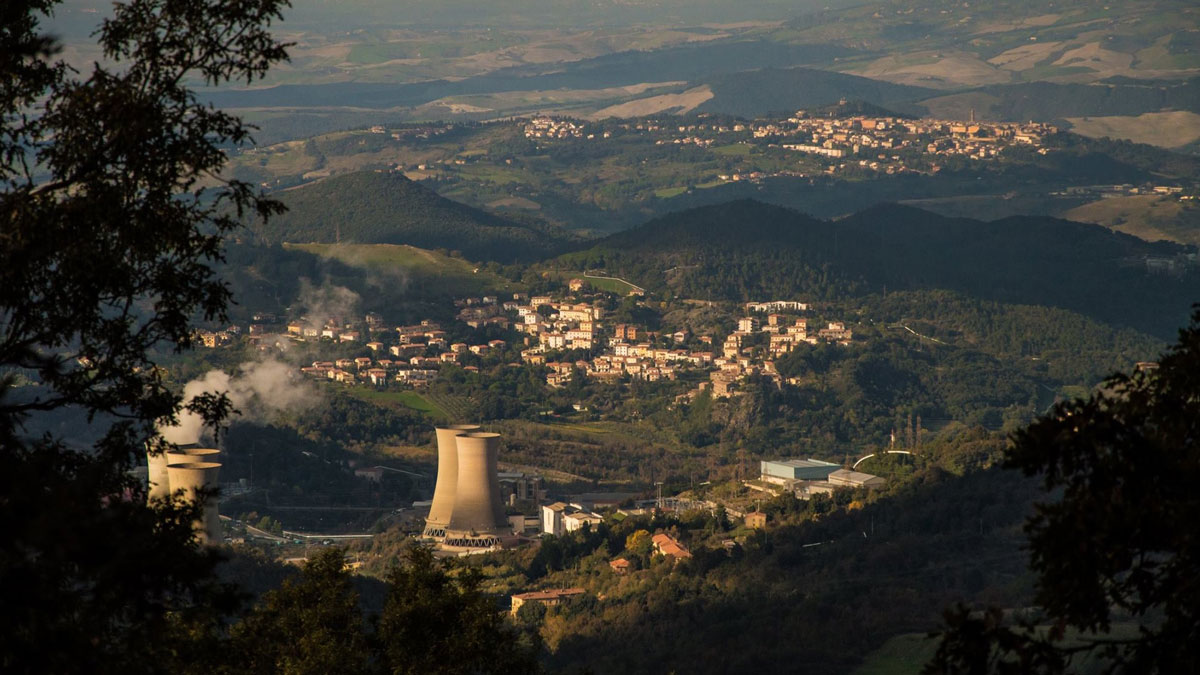
Scientists Find Thousands of Cubic Kilometers of Magma Hiding Beneath Tuscany
We already know what’s Under the Tuscan Sun. Now, a technique called ambient noise tomography has allowed researchers to see deep under the Tuscan crust.