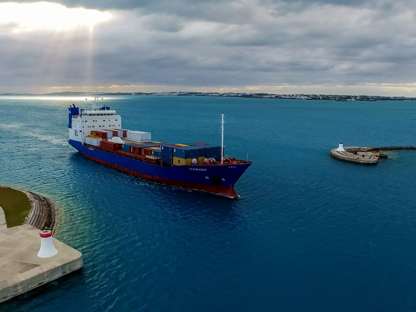
More than a flower, the Oleander is a container ship that provides weekly service between Hamilton, Bermuda, and Port Elizabeth, N.J. In so doing, the ship traverses water from three very widely separated domains: cold, fresh subpolar water from the Labrador Sea; hot, salty Gulf Stream water from the tropics via the Gulf of Mexico; and the large body of warm, salty subtropical water south of the Gulf Stream.
The Oleander added its career as an ocean-observing platform to its cargo transportation duties in 1971.
For decades, the Oleander and its forerunner of the same name have served as platforms for scientists to conduct sustained observation of the upper ocean across the continental shelf to the Gulf Stream and Sargasso Sea. In late October, all collaborators in this remarkable observational program came together for a comprehensive review of past, present, and future activities. The meeting wove together three interlocking themes—operations, science, and outreach—with a special focus on interdisciplinary opportunities.
The Oleander added its career as an ocean-observing platform to its cargo transportation duties in 1971. That year, once every month, the ship began towing a device known as the continuous plankton recorder (CPR), which collects phytoplankton and zooplankton for scientific study. That collection continues to this day. In 1977, the ship began a program to monitor upper ocean temperatures using expendable bathythermographs (XBT) on a monthly schedule. This program was first limited to the shelf, but it soon expanded to the Gulf Stream, and now it extends along the entire transit to Bermuda.
Starting in late 1992, autonomous instruments were installed aboard the Oleander to enable it to begin routine monitoring of upper ocean currents using a hull-mounted acoustic Doppler current profiler. The first profiles extended to depths of about 250 meters, and they have reached 700 to 800 meters since 2005.

At the meeting, attendees presented several major findings from the Oleander’s observational program. For example, plankton composition has shifted toward warmer-water species along the continental shelf. Consistent with these trends, the Oleander XBT measurements reveal a marked warming across the shelf, not only at the surface but also throughout the water column.
Following the Oleander’s example, several commercially operated vessels in the North Atlantic and Southern Ocean now conduct sustained operations that scan ocean currents.
Another reported finding, revealed by a multidecade record of direct Gulf Stream measurements from Oleander surveys, is that there is no long-term trend in upper ocean transport, contrary to suggestions recently reported by other studies using indirect and model assessments. These current measurements are also used to study the dynamic structure of fronts, coherent vortices, and smaller-scale mixing processes. Following the Oleander’s example, several commercially operated vessels in the North Atlantic and Southern Ocean now conduct sustained operations that scan ocean currents.
The meeting enabled the group to explore interdisciplinary topics. For example, participants discussed how a combination of acoustic backscatter information, satellite remote sensing, and in situ optical sensors is expected to become a powerful tool for understanding how the physical dynamics, primary productivity, and zooplankton distribution patterns interact. Thus, as speakers indicated, the National Oceanic and Atmospheric Administration (NOAA) has agreed to take the initiative for adding continuously recording digital sensors that record pressure, temperature, humidity, and wind, along with radiation sensors that monitor sunlight in the wavelengths relevant to photosynthesis, to the instruments aboard the Oleander.
We thank the owners and operators of the CMV Oleander for supporting these sustained ocean-observing activities and the National Science Foundation, NOAA, and the Office of Naval Research for the grants and contracts to operate and maintain these programs.
—T. Rossby (email: [email protected]), Graduate School of Oceanography, University of Rhode Island, Kingston; R. Curry, Bermuda Institute of Ocean Sciences, Ferry Reach, Saint George’s, Bermuda; and J. Palter, Graduate School of Oceanography, University of Rhode Island, Kingston
Citation:
Rossby, T.,Curry, R., and Palter, J. (2017), Packing science into a shipping vessel, Eos, , https://doi.org/10.1029/2017EO071319. Published on 28 April 2017.
Text © 2017. The authors. CC BY-NC-ND 3.0
Except where otherwise noted, images are subject to copyright. Any reuse without express permission from the copyright owner is prohibited.