
Source: Geophysical Research Letters
The mighty Gulf Stream current transports warm water out of the Gulf of Mexico and along the U.S. East Coast from Florida to North Carolina before it begins its arc across the deep Atlantic. After the Gulf Stream passes Cape Hatteras, N.C., it gradually forms distinctive patterns called meanders, wavelike crests and troughs that look like curves in a huge, winding river.
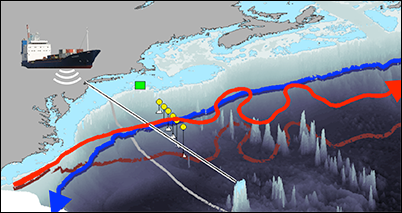
In a new study, Andres reports that the location where the Gulf Stream meanders begin to amplify has migrated westward over the past 2 decades. Satellite, mooring, and shipboard observations of the current’s flow from 1993 to 2014 show that this “destabilization point” has shifted west at a rate of about 25 kilometers per year.
Gulf Stream meanders can create underwater cyclones and other features that disrupt and stir nearby currents. The author’s analysis suggests that the migration of the destabilization point has boosted the frequency of deep stirring events since 2008. The westward movement may also be related to recent warming of shallower water above the continental shelf in the Mid-Atlantic Bight.
The author hypothesizes that the cause of the migration could be related to interactions between the Gulf Stream and the Deep Western Boundary Current, which flows toward the equator and crosses beneath the Gulf Stream near Cape Hatteras. Future research could determine why the destabilization point is on the move and what its full implications, such as potential effects on marine ecosystems, will be. (Geophysical Research Letters, doi:10.1002/2016GL069966, 2016)
—Sarah Stanley, Freelance Writer
Citation:
Stanley, S. (2016), Gulf stream destabilization point is on the move, Eos, 97, https://doi.org/10.1029/2016EO062455. Published on 08 November 2016.
Text © 2016. The authors. CC BY-NC-ND 3.0
Except where otherwise noted, images are subject to copyright. Any reuse without express permission from the copyright owner is prohibited.