Water resources managers are challenged with the characterization, understanding, and prediction of water and water management related to water demand, supply, and quality. The importance of having reliable observations of hydrological states and fluxes becomes evident when considering the broad impact of droughts, floods, agriculture, and climate effects on water resources.
Water resources management can benefit from the application of remote sensing and hydrologic models. Satellite and airborne remote sensing observations can provide valuable information and can be used to support the operational water resources community for management practices and decisions. However, several challenges to effectively applying these data remain, including identifying and categorizing near-term priority observations and finding opportunities to address near-term information gaps or limitations for improving access to data, information, and decision making.
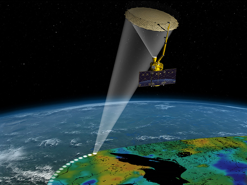
The meeting highlighted progress on projects that use airborne or satellite data to address water resource management challenges.
To address these challenges, 75 members of the science community convened in College Park, Md., in early March for a 2-day strategy meeting organized by the Water Resources Element of NASA’s Applied Sciences Program. The meeting, held at the U.S. National Oceanic and Atmospheric Administration’s Center for Weather and Climate Prediction, served to highlight progress on projects that use airborne or satellite data to address a range of water resource management challenges. Goals of the meeting included identifying priorities for the water resources community, facilitating stakeholder participation and collaboration, and soliciting feedback and guidance on management of water resources from experts.
Session organizers focused on various topics, including data needed to support decision making by water resource managers; agriculture, food security, and water quality applications; and drought forecasting and mitigation. Meeting participants shared progress on their projects and also discussed advancements in domestic and international collaborations among scientists and decision makers in the water resources community.
Participants also discussed and identified several key elements necessary for successful applied research and applications efforts, including early and consistent engagement of users and partners, demonstration of the value or value added of information products, promotion of innovators within organizations, high-impact training for users, and a robust transition strategy from research partners to operational users and stakeholders.
In addition to discussing stakeholder engagement successes and challenges, meeting attendees identified several key research variables, including soil moisture, soil water equivalent, evapotranspiration, relative humidity, and water vapor. The full summary can be found here.
Scientists assessed Earth observation and modeling priorities for water resources applications for the next generation of water cycle missions.
Over the course of the meeting, scientists sought to comprehensively assess the Earth observation and modeling priorities for water resources applications for the next generation of water cycle missions. These priorities will be sent to panelists who will work on the upcoming Earth Science Decadal Survey.
Breakout sessions that focused on prepping for the Earth Science Decadal Survey delivered some key recommendations. These include highlighting the need for integrated water cycle observation concepts with recently launched missions, such as the Global Precipitation Measurement (GPM) and the Soil Moisture Active Passive (SMAP) missions. Other recommendations underscore the importance of long-term measurement continuity, low-latency measurements with adequate repeat time, and measurements that help to close global and regional water balance, such as deep soil moisture and evapotranspiration.
Attendees discussed progress made during the Water Cycle Missions for the Next Decade Workshop held in April 2013 and identified applied science questions, data needs and capabilities, and priority topics of societal relevance that were not fully captured during that previous workshop. The conclusions can be found in the final workshop report from the Water Cycle Missions for the Next Decade Workshop. Thematic working groups also initiated a compilation of important applied science objectives and data needs, as described in “Future Satellite Missions in Support of NASA Water Resources Applications: Input to the NRC Decadal Survey.” Organizers from the workshop are seeking additional input to this report and welcome your suggestions and comments.
For more details on specific sessions and working groups and to download presentations, leave comments, and view a list of workshop organizers, visit the meeting’s website.
—John D. Bolten, Hydrological Sciences Branch, NASA Goddard Space Flight Center, Greenbelt, Md.; email: [email protected]; Christine Lee, Data Interaction and Science Applications Group, Jet Propulsion Lab, Pasadena, Calif.; and Paul Houser, Department of Geography and Geoinformation Science, George Mason University, Fairfax, Va.
Citation: Bolten, J. D., C. Lee, and P. Houser (2015), Satellite data for water resources management, Eos, 96, doi:10.1029/2015EO035971. Published on 28 September 2015.
Text not subject to copyright.
Except where otherwise noted, images are subject to copyright. Any reuse without express permission from the copyright owner is prohibited.
Text not subject to copyright.
Except where otherwise noted, images are subject to copyright. Any reuse without express permission from the copyright owner is prohibited.