The group’s overall goal was to broaden the science objectives for a mission proposal.
On 18 and 19 May 2018, Florida State University held a workshop at the Scripps Institution of Oceanography, with the goal of updating the community on strategies for measuring ocean surface vector currents coincident with ocean surface vector winds. The group’s overall goal was to broaden the science objectives for a mission proposal.
At the workshop, the group reviewed the need for such a mission as outlined in the recent National Academies’ decadal survey. This decadal survey recommended that observations of coincident surface winds and currents be among those competing for a new class of NASA missions known as Earth explorer missions.
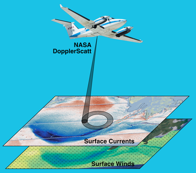
Workshop participants discussed examples of successful airborne observations from the Jet Propulsion Laboratory’s DopplerScatt instrument and progress on the European Space Agency’s Sea Surface Kinematics Multiscale monitoring mission (SKIM) to measure surface waves and currents. DopplerScatt is an airborne demonstration for a satellite mission concept. Both mission concepts use a Doppler approach to measuring surface currents responding to motions of capillary-gravity waves or specular points on the ocean surface. Consequently, the viewing angle in these two examples differs, as do the noncurrent observations; DopplerScatt measures winds, whereas SKIM measures wave characteristics at a viewing angle selected to minimize the wind signal.
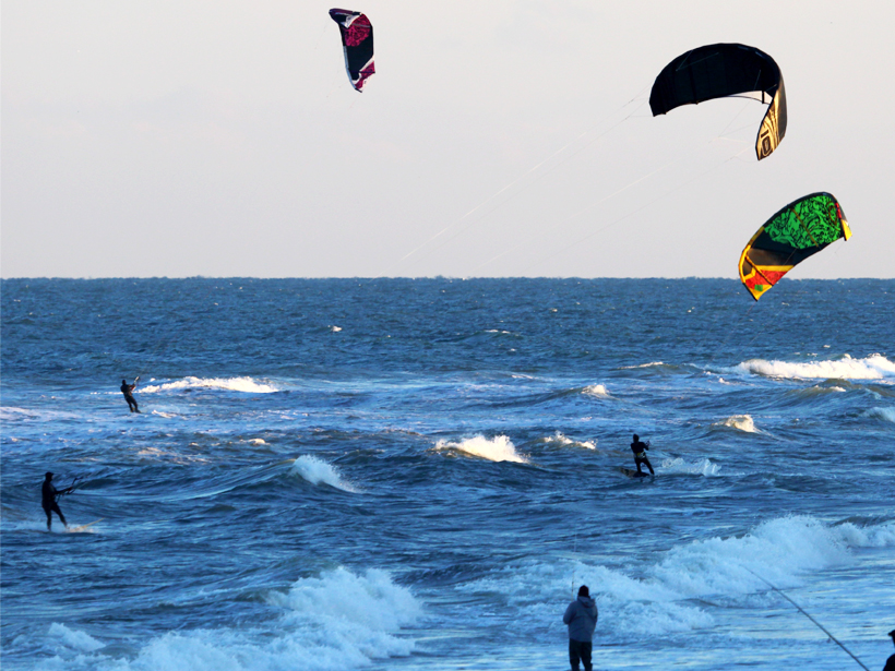
Attendees also discussed a study with surface drifters that found that sampling about every 18 hours was sufficient to capture the circulation around eddies.
Attendees found the preliminary DopplerScatt results were encouraging. They also found promising a study led by the Naval Research Laboratory that demonstrated that surface currents similar to those from DopplerScatt and SKIM can be effectively assimilated into ocean models, placing ocean eddies much more accurately than conventional altimetry. Attendees also discussed a study with surface drifters that found that sampling about every 18 hours was sufficient to maintain these eddies in the correct location and capture the circulation around eddies.
Participants also expanded scientific goals and presented preliminary examinations of potential problems related to sampling, rain, and orbits. Eventually, participants reached a consensus that these problems were likely to be minor for most cases, except for small ocean features.
Researchers also discussed preliminary estimates of the scales that the suggested satellites can image. They agreed that the vast majority of ocean eddies, down to 30 kilometers, can be resolved, in contrast to existing technology, which resolves only roughly 200-kilometer-scale features.
Through discussion, participants found that a great concern for making surface currents widely useful was a lack of understanding of how to translate surface currents to currents several meters below the ocean surface. The group conducted a field study this summer to help resolve the issue; results from that study are pending.
Workshop attendees strongly advocated that future mission science goals address three multidisciplinary issues. The first is associated with air-sea interaction, upwelling at the bottom of the ocean’s mixed layer, and entrainment. The second addresses gaps in our understanding of the tropical Pacific Ocean circulation, which is linked to heat budgets and the El Niño–Southern Oscillation. The third goal is related to transport in the Arctic Ocean and nearby seas. Although these are the proposed key topics for the mission, there are many other science questions that could be addressed, as well as a wide range of applications.
—Mark A. Bourassa (email: [email protected]), Department of Earth, Ocean and Atmospheric Science and Center for Ocean-Atmospheric Prediction Studies, Florida State University, Tallahassee; Ernesto Rodriguez, Jet Propulsion Laboratory, California Institute of Technology, Pasadena; and Sarah Gille, Scripps Institution of Oceanography, University of California, San Diego, La Jolla
Citation:
Bourassa, M. A.,Rodriguez, E., and Gille, S. (2018), Satellite observations of ocean surface winds and currents, Eos, 99, https://doi.org/10.1029/2018EO107799. Published on 06 November 2018.
Text © 2018. The authors. CC BY-NC-ND 3.0
Except where otherwise noted, images are subject to copyright. Any reuse without express permission from the copyright owner is prohibited.