
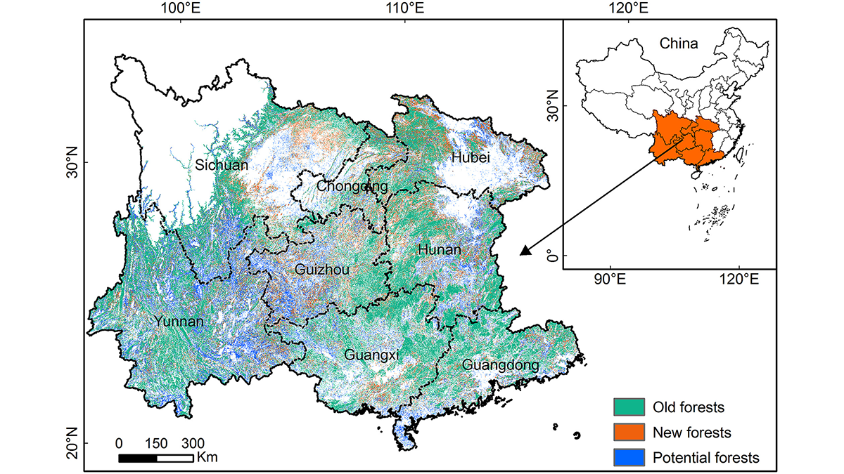
过去几十年,中国南方的造林项目在树木生物量中封存了大量的碳,但该地区的森林碳储存能力正接近饱和。
remote sensing
Posted inEditors' Highlights
Quantifying the Potential of Forestation for Carbon Storage
Forestation projects in southern China over the past few decades have sequestered large amounts of carbon in tree biomass, but the region is approaching saturation of forest carbon storage capacity.
Posted inNews
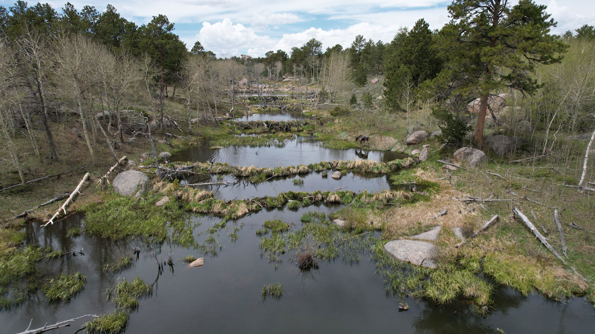
Scientists EEAGER-ly Track Beavers Across Western United States
Efficiently tracking nature’s engineers—beavers—at the scale of entire watersheds over time is now possible, thanks to a new artificial intelligence–trained model called EEAGER.

Posted inEditors' Highlights
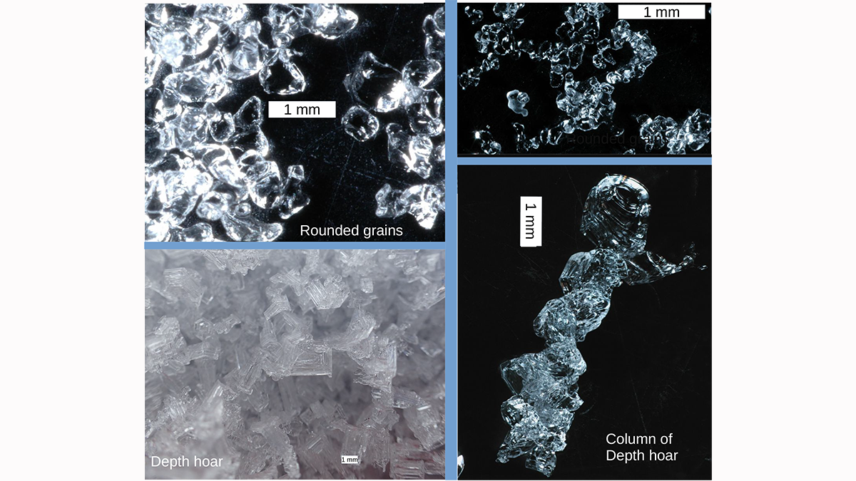
Measuring the Microstructure of Snow from Space
There is more to snow than flakes. Microwave measurements are shown to be capable of illuminating the microstructure of snow in ways that will improve our ability to monitor snow fields from space.

Posted inNews
Glacial Ice Offers Polar Bears a Precarious Climate Refuge
An isolated polar bear population in southeastern Greenland survives in fjords, despite spotty sea ice. But this pocket of bears is not a sign of how the species could be saved.

Posted inNews
Underwater Sounds Help Reveal Extent of Glacial Calving
If a glacier calves into the Arctic Ocean, does it make a sound? Some scientists say yes and have devised a clever way to use those sounds to calculate the size of the fallen ice chunks.

Posted inEditors' Highlights
Coseismic Displacement of 1987 Earthquake from Aerial Images
Differencing digital surface topography models constructed from historical aerial photographs reveal the coseismic surface displacement field of the 1987 earthquake in northern New Zealand.

Posted inResearch Spotlights
When the Aral Sea Dried Up, Central Asia Became Dustier
Winds kick up large amounts of dust from the desert that has formed as the world’s fourth largest lake has disappeared, spreading it around the region and raising concerns about public health.
Posted inEditors' Highlights
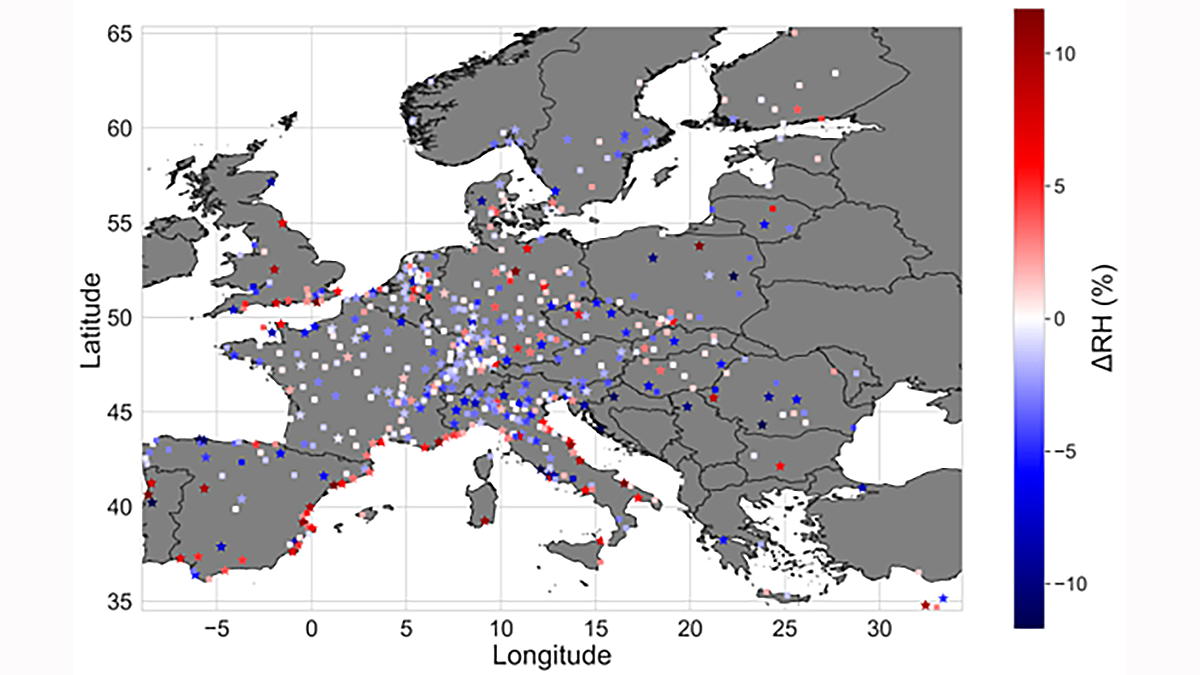
The Lower Humidity of Urban Areas Moderates Outdoor Heat Stress
Data scarcity of traditional observations cannot reveal whether surface temperature capture the potential for urban heat stress. This study improves the dataset with 40,000 citizen weather stations.